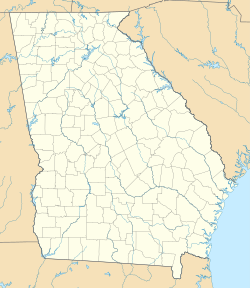
Smarr is an unincorporated community and census-designated place (CDP) in Monroe County, in the U.S. state of Georgia.[3] The 2020 census listed a population of 218.[4]
Smarr, Georgia | |
|---|---|
| Coordinates: 32°59′07″N 83°52′56″W / 32.98528°N 83.88222°W | |
| Country | United States |
| State | Georgia |
| County | Monroe |
| Area | |
| • Total | 1.70 sq mi (4.4 km2) |
| • Land | 1.70 sq mi (4.4 km2) |
| • Water | 0.0 sq mi (0 km2) |
| Elevation | 615 ft (187 m) |
| Population | |
| • Total | 218 |
| • Density | 130/sq mi (50/km2) |
| Time zone | UTC−5 (Eastern (EST)) |
| • Summer (DST) | UTC−4 (EDT) |
| ZIP Code | 31029 (Forsyth) |
| FIPS code | 13-71296 |
| GNIS feature ID | 333068 |
History
editSmarr was established in 1838 when the railroad was extended to that point, and named for the founder.[5]
Variant names were "Smarrs" and "Smarrs Station".[3] A post office called Smarr's Station was established in 1872, and the name was shortened to Smarrs in 1895.[6]
Geography
editSmarr is in central Monroe County on U.S. Route 41, which leads northwest 5 miles (8 km) to Forsyth, the county seat, and southeast 20 miles (32 km) to Macon.
According to the U.S. Census Bureau, the Smarr CDP has an area of 1.7 square miles (4.4 km2), all land.[1]
Demographics
edit| Census | Pop. | Note | %± |
|---|---|---|---|
| 2020 | 218 | — | |
| U.S. Decennial Census[7] 2020[8] | |||
Smarr was first listed as a census designated place in the 2020 U.S. Census.[8]
| Race / Ethnicity (NH = Non-Hispanic) | Pop 2020[8] | % 2020 |
|---|---|---|
| White alone (NH) | 198 | 90.83% |
| Black or African American alone (NH) | 2 | 0.92% |
| Native American or Alaska Native alone (NH) | 0 | 0.00% |
| Asian alone (NH) | 0 | 0.00% |
| Pacific Islander alone (NH) | 0 | 0.00% |
| Other Race alone (NH) | 1 | 0.46% |
| Mixed race or Multiracial (NH) | 9 | 4.13% |
| Hispanic or Latino (any race) | 8 | 3.67% |
| Total | 218 | 100.00% |
References
edit- ^ a b "2022 U.S. Gazetteer Files: Georgia". United States Census Bureau. Retrieved January 27, 2023.
- ^ "P1. Race – Smarr CDP, Georgia: 2020 DEC Redistricting Data (PL 94-171)". U.S. Census Bureau. Retrieved January 27, 2023.
- ^ a b U.S. Geological Survey Geographic Names Information System: Smarr
- ^ "Smarr CDP, Georgia". United States Census Bureau. Retrieved April 7, 2022.
- ^ Krakow, Kenneth K. (1975). Georgia Place-Names: Their History and Origins (PDF). Macon, GA: Winship Press. p. 207. ISBN 0-915430-00-2.
- ^ "Post Offices". Jim Forte Postal History. Retrieved 10 June 2019.
- ^ "Decennial Census of Population and Housing by Decades". US Census Bureau.
- ^ a b c "P2 HISPANIC OR LATINO, AND NOT HISPANIC OR LATINO BY RACE – 2020: DEC Redistricting Data (PL 94-171) – Smarr CDP, Georgia". United States Census Bureau.

