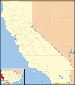
Rumsey is an unincorporated community and census-designated place (CDP)[1] in Yolo County, California. It is located 18 miles (29 km) northwest of Esparto,[3] in the Capay Valley, in the northwestern part of the county. Rumsey's ZIP Code is 95679 and its area code 530. It lies at an elevation of 420 feet (128 m).
Rumsey, California | |
|---|---|
| Coordinates: 38°53′24.74″N 122°14′25.62″W / 38.8902056°N 122.2404500°W | |
| Country | United States |
| State | California |
| County | Yolo County |
| Area | |
• Total | 2.532 sq mi (6.56 km2) |
| • Land | 2.447 sq mi (6.34 km2) |
| • Water | 0.085 sq mi (0.22 km2) |
| Elevation | 423 ft (129 m) |
| Population (2020) | |
• Total | 91 |
| • Density | 36/sq mi (14/km2) |
| Time zone | UTC-8 (Pacific) |
| • Summer (DST) | UTC-7 (PDT) |
| GNIS feature ID | 2805251[2] |
History
editA post office was erected in 1878 near the Rumsey community, but it was named "Rock". In 1888 it was moved two miles north to the terminus of the Vaca Valley and Clear Lake Railroad, and the name was changed to "Rumsey". The name "Rock" was after a rock landmark, and the name "Rumsey" was given after Captain D.C. Rumsey who owned the land at the time.[3]
Cache Creek was temporarily blocked north of Rumsey by a landslide caused by the 1906 San Francisco earthquake: "Our Rumsey correspondent mentions the fall of Cache Creek as a result of an earthquake shock Tuesday night. The water has continued to fall some since that date and in some places it is dry. Upon investigation by the officials of the Water Company it was found that a landslide had dammed the Creek near the Leonard ranch in Lake county...."[4] The creek subsequently broke through, causing severe flooding in Rumsey.[5][6]
Demographics
edit| Census | Pop. | Note | %± |
|---|---|---|---|
| 2020 | 91 | — | |
| U.S. Decennial Census[7] 1850–1870[8][9] 1880-1890[10] 1900[11] 1910[12] 1920[13] 1930[14] 1940[15] 1950[16] 1960[17] 1970[18] 1980[19] 1990[20] 2000[21] 2010[22] 2020[23] | |||
Rumsey first appeared as a census designated place in the 2020 U.S. Census.[24]
2020 Census
edit| Race / Ethnicity (NH = Non-Hispanic) | Pop 2020[23] | % 2020 |
|---|---|---|
| White alone (NH) | 68 | 74.73% |
| Black or African American alone (NH) | 0 | 0.00% |
| Native American or Alaska Native alone (NH) | 0 | 0.00% |
| Asian alone (NH) | 0 | 0.00% |
| Pacific Islander alone (NH) | 1 | 1.10% |
| Other race alone (NH) | 0 | 0.00% |
| Mixed race or Multiracial (NH) | 7 | 7.69% |
| Hispanic or Latino (any race) | 15 | 16.48% |
| Total | 91 | 100.00% |
References
edit- ^ a b "2020 U.S. Gazetteer Files - California". United States Census Bureau. Retrieved March 23, 2024.
- ^ a b "Rumsey Census Designated Place". Geographic Names Information System. United States Geological Survey, United States Department of the Interior.
- ^ a b Durham, David L. (1998). California's Geographic Names: A Gazetteer of Historic and Modern Names of the State. Clovis, Calif.: Word Dancer Press. p. 548. ISBN 1-884995-14-4.
- ^ http://web.gps.caltech.edu/~meltzner/1906/1906-OFR.pdf [bare URL PDF]
- ^ http://www.yolocountyhistory.com/items/show/2554 Damage caused at the Rumsey Depot Caused by 1906 earthquake and resulting flood. The earthquake created a rock slide which blocked cache creek. The resulting floodwaters washed out the Rumsey Depot. Several damaged buildings are visible in the picture.
- ^ http://www.yolocountyhistory.com/items/show/2555 .. Trees have been toppled over and are being pushed downstream by the floodwaters.
- ^ "Decennial Census by Decade". US Census Bureau.
- ^ "1870 Census of Population - Population of Civil Divisions less than Counties - California - Almeda County to Sutter County" (PDF). United States Census Bureau.
- ^ "1870 Census of Population - Population of Civil Divisions less than Counties - California - Tehama County to Yuba County" (PDF). United States Census Bureau.
- ^ "1890 Census of Population - Population of California by Minor Civil Divisions" (PDF). United States Census Bureau.
- ^ "1900 Census of Population - Population of California by Counties and Minor Civil Divisions" (PDF). United States Census Bureau.
- ^ "1910 Census of Population - Supplement for California" (PDF). United States Census Bureau.
- ^ "1920 Census of Population - Number of Inhabitants - California" (PDF). United States Census Bureau.
- ^ "1930 Census of Population - Number and Distribution of Inhabitants - California" (PDF). United States Census Bureau.
- ^ "1940 Census of Population - Number of Inhabitants - California" (PDF). United States Census Bureau.
- ^ "1950 Census of Population - Number of Inhabitants - California" (PDF). United States Census Bureau.
- ^ "1960 Census of Population - General population Characteristics - California" (PDF). United States Census Bureau.
- ^ "1970 Census of Population - Number of Inhabitants - California" (PDF). United States Census Bureau.
- ^ "1980 Census of Population - Number of Inhabitants - California" (PDF). United States Census Bureau.
- ^ "1990 Census of Population - Population and Housing Unit Counts - California" (PDF). United States Census Bureau.
- ^ "2000 Census of Population - Population and Housing Unit Counts - California" (PDF). United States Census Bureau.
- ^ "2010 Census of Population - Population and Housing Unit Counts - California" (PDF). United States Census Bureau.
- ^ a b "P2: Hispanic or Latino, and Not Hispanic or Latino by Race – 2020: DEC Redistricting Data (PL 94-171) – Rumsey CDP, California". United States Census Bureau.
- ^ "2020 Geography Changes". United States Census Bureau.
External links
edit

