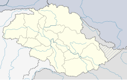
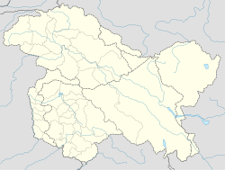
Olding, originally Olthingthang or Olthing Thang (Balti: ཨོལྡིང་ཐང།, romanized: Oldinga thanga),[1][2][a] is a village in the Dras River valley in the Kharmang District of Baltistan, Pakistan.[1] The village is 8,676 feet (2,644 m) above the sea level. It is close to the India-Pakistan border (LOC), and lies on the traditional trade route between Baltistan and Ladakh via Kargil.[5]
Olding
ཨོལྡིང་ཐང། | |
|---|---|
Village | |
| Coordinates: 34°44′28″N 76°10′12″E / 34.741°N 76.170°E | |
| Country | Pakistan |
| Adm. Unit | Gilgit-Baltistan |
| District | Kharmang District |
| Elevation | 2,644 m (8,676 ft) |
| Time zone | UTC+5:00 (PKT) |
 | |
Geography
editOlthingthang is in the valley of the Dras River (also called Shingo River or Suru River), shortly before its confluence with the Indus River near Marol. The Dras valley is quite narrow there, and the village is actually located on the slopes of a spur, about 800 to 1,000 ft above the river. It was described as a big village in 1912,[6] and often listed as a halting place on the route from Kargil to Skardu. It is 13 miles from Gangam, the first village in Baltistan to the north of the Line of Control.[7][b][original research?]
People
editThe village is predominantly inhabited by Tibetic peoples such as Baltis and Purigpas, Balti and Purgi are the main languages and Urdu serving as lingua franca. The dominant faith practiced by the people is Islam.[9]
Economy
editThe village is known for many varieties of fruit such as apricot, apple, grapes, mulberry, cherry and peach etc. Peoples of the village sell the fruits and earn thousands of rupees. Varieties of apricots include margholum, halmand, khochuli, sitachuli, khositar and Situnchuli.
Maps
editSee also
editNotes
editReferences
edit- ^ a b Albinia, Alice (2008), Empires of the Indus, John Murray, p. 252
- ^ Dani 2001, p. 394.
- ^ Gazetteer of Kashmir and Ladak 1890, p. 637.
- ^ Gazetteer of Kashmir and Ladak 1890, p. 838.
- ^ Joldan, Sonam (Autumn 2006), "Relationship between Ladakh and Buddhist Tibet: Pilgrimage and trade", The Tibet Journal, 31 (3): 43–76, JSTOR 43300982
- ^ Filippi 1912, p. 85.
- ^ Mason, Kenneth (1929), Routes in the Western Himalaya, Kashmir Etc., Vol. I, Calcutta: Government of India Press, p. 92 – via archive.org
- ^ Kharal to Olding, OpenStreetMap, 5 January 2023.
- ^ Purig, Rinchan. "Purig Migration History - 1947". International Association for Ladakh Studies.
Bibliography
edit- Gazetteer of Kashmir and Ladak, Calcutta: Superintendent of Government Printing, 1890 – via archive.org
- Dani, Ahmad Hasan (2001), History of Northern Areas of Pakistan: Upto 2000 A.D., Sang-e-Meel Publications, ISBN 978-969-35-1231-1 – via archive.org
- Filippi, Filippo de (1912), Karakoram and Western Himalaya 1909, New York: E. P. Dutton and Company – via archive.org


