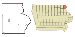
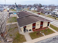
New Albin is a city in Iowa Township, Allamakee County, Iowa, United States. It is the northeasternmost town in Iowa, located on the Mississippi River and the Minnesota border. The population was 432 at the time of the 2020 census.[2]
New Albin, Iowa | |
|---|---|
 | |
 Location of New Albin, Iowa | |
| Coordinates: 43°29′49″N 91°17′14″W / 43.49694°N 91.28722°W | |
| Country | |
| State | |
| County | Allamakee |
| Township | Iowa |
| Government | |
| • Mayor | Alberto Whitlatch |
| Area | |
• Total | 0.25 sq mi (0.65 km2) |
| • Land | 0.25 sq mi (0.65 km2) |
| • Water | 0.00 sq mi (0.00 km2) |
| Elevation | 650 ft (198 m) |
| Population (2020) | |
• Total | 432 |
| • Density | 1,714.29/sq mi (661.07/km2) |
| Time zone | UTC-6 (Central (CST)) |
| • Summer (DST) | UTC-5 (CDT) |
| ZIP code | 52160 |
| Area code | 563 |
| FIPS code | 19-55785 |
| GNIS feature ID | 0459464 |

History
editNew Albin was platted in 1872 shortly after the Chicago, Dubuque and Minnesota Railroad had been built through that territory.[3][4] It was named for the son of a railroad official,[5] who tragically died from burns after falling into a bonfire.[6] Highway 26 (originally Highway 182) was constructed through New Albin in 1936.[7]
Geography
editAccording to the United States Census Bureau, the city has a total area of 0.24 square miles (0.62 km2), all land.[8]
In the north part of town, there is an iron post marking the border between Iowa and Minnesota. [9]
Demographics
edit| Year | Pop. | ±% |
|---|---|---|
| 1880 | 423 | — |
| 1890 | 411 | −2.8% |
| 1900 | 543 | +32.1% |
| 1910 | 588 | +8.3% |
| 1920 | 683 | +16.2% |
| 1930 | 556 | −18.6% |
| 1940 | 602 | +8.3% |
| 1950 | 568 | −5.6% |
| 1960 | 643 | +13.2% |
| 1970 | 644 | +0.2% |
| 1980 | 609 | −5.4% |
| 1990 | 534 | −12.3% |
| 2000 | 527 | −1.3% |
| 2010 | 522 | −0.9% |
| 2020 | 432 | −17.2% |
| Source:"U.S. Census website". United States Census Bureau. Retrieved March 29, 2020. and Iowa Data Center Source: | ||
2020 census
editAs of the census of 2020,[11] there were 432 people, 206 households, and 114 families residing in the city. The population density was 1,712.2 inhabitants per square mile (661.1/km2). There were 239 housing units at an average density of 947.2 per square mile (365.7/km2). The racial makeup of the city was 97.2% White, 0.0% Black or African American, 0.5% Native American, 0.0% Asian, 0.0% Pacific Islander, 0.2% from other races and 2.1% from two or more races. Hispanic or Latino persons of any race comprised 0.5% of the population.
Of the 206 households, 21.8% of which had children under the age of 18 living with them, 41.3% were married couples living together, 10.7% were cohabitating couples, 23.3% had a female householder with no spouse or partner present and 24.8% had a male householder with no spouse or partner present. 44.7% of all households were non-families. 34.0% of all households were made up of individuals, 18.0% had someone living alone who was 65 years old or older.
The median age in the city was 45.6 years. 21.1% of the residents were under the age of 20; 5.3% were between the ages of 20 and 24; 22.9% were from 25 and 44; 26.6% were from 45 and 64; and 24.1% were 65 years of age or older. The gender makeup of the city was 51.9% male and 48.1% female.
2010 census
editAs of the census[12] of 2010, there were 522 people, 222 households, and 138 families living in the city. The population density was 2,175.0 inhabitants per square mile (839.8/km2). There were 257 housing units at an average density of 1,070.8 per square mile (413.4/km2). The racial makeup of the city was 97.1% White, 0.4% African American, 1.5% Native American, 0.4% Asian, 0.2% from other races, and 0.4% from two or more races. Hispanic or Latino of any race were 0.4% of the population.
There were 222 households, of which 27.9% had children under the age of 18 living with them, 50.5% were married couples living together, 7.7% had a female householder with no husband present, 4.1% had a male householder with no wife present, and 37.8% were non-families. 32.9% of all households were made up of individuals, and 17.6% had someone living alone who was 65 years of age or older. The average household size was 2.35 and the average family size was 3.01.
The median age in the city was 43.5 years. 25.3% of residents were under the age of 18; 5.6% were between the ages of 18 and 24; 21.1% were from 25 to 44; 25.7% were from 45 to 64; and 22.2% were 65 years of age or older. The gender makeup of the city was 49.6% male and 50.4% female.
2000 census
editAs of the census[13] of 2000, there were 527 people, 226 households, and 139 families living in the city. The population density was 2,390.8 inhabitants per square mile (923.1/km2). There were 247 housing units at an average density of 1,120.5 per square mile (432.6/km2). The racial makeup of the city was 97.15% White, 1.14% Native American, 0.19% from other races, and 1.52% from two or more races. Hispanic or Latino of any race were 0.57% of the population.
There were 226 households, out of which 29.2% had children under the age of 18 living with them, 50.0% were married couples living together, 8.0% had a female householder with no husband present, and 38.1% were non-families. 34.1% of all households were made up of individuals, and 15.9% had someone living alone who was 65 years of age or older. The average household size was 2.33 and the average family size was 2.99.
Age spread: 26.9% under the age of 18, 7.6% from 18 to 24, 25.8% from 25 to 44, 19.4% from 45 to 64, and 20.3% who were 65 years of age or older. The median age was 38 years. For every 100 females, there were 95.2 males. For every 100 females age 18 and over, there were 96.4 males.
The median income for a household in the city was $32,981, and the median income for a family was $36,667. Males had a median income of $26,625 versus $19,375 for females. The per capita income for the city was $14,049. About 4.5% of families and 6.6% of the population were below the poverty line, including 6.3% of those under age 18 and 8.5% of those age 65 or over.
Notable person
edit- Milt Gantenbein, NFL player for the Green Bay Packers and three-time NFL champion, was born in New Albin
References
edit- ^ "2020 U.S. Gazetteer Files". United States Census Bureau. Retrieved March 16, 2022.
- ^ a b "2020 Census State Redistricting Data". census.gov. United states Census Bureau. Retrieved August 12, 2021.
- ^ Hancock, Ellery M. (1913). Past and Present of Allamakee County, Iowa: A Record of Settlement, Organization, Progress and Achievement, Volume 1. S. J. Clarke publishing Company. p. 252.
- ^ Alexander, W. E. (1882). History of Winneshiek and Allamakee Counties, Iowa. Western Publishing Company. pp. 400.
- ^ "Profile for New Albin, Iowa". ePodunk. Retrieved August 6, 2014.
- ^ "How New Albin got its name". Iowa Gen Web Project. Retrieved March 22, 2024.
- ^ "Misc. New Albin History Articles". Iowa Gen Web Project. Retrieved April 25, 2024.
- ^ "US Gazetteer files 2010". United States Census Bureau. Archived from the original on January 25, 2012. Retrieved May 11, 2012.
- ^ "About the community of New Albin".
- ^ "Census of Population and Housing". Census.gov. Retrieved June 4, 2015.
- ^ "2020 Census". United States Census Bureau.
- ^ "U.S. Census website". United States Census Bureau. Retrieved May 11, 2012.
- ^ "U.S. Census website". United States Census Bureau. Retrieved January 31, 2008.

