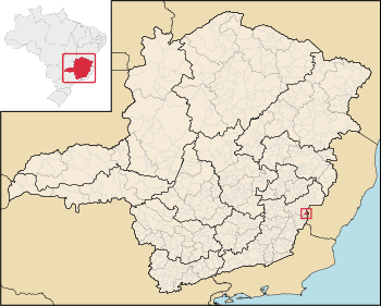
Alto Caparaó is a Brazilian municipality in the state of Minas Gerais. The city belongs to the mesoregion of Zona da Mata and to the microregion of Manhuaçu. As of 2020[update] its population is estimated to be 5,894.[1]

Geography
editClimate
edit| Climate data for Alto Caparaó (1981–2010) | |||||||||||||
|---|---|---|---|---|---|---|---|---|---|---|---|---|---|
| Month | Jan | Feb | Mar | Apr | May | Jun | Jul | Aug | Sep | Oct | Nov | Dec | Year |
| Mean daily maximum °C (°F) | 28.4 (83.1) |
29.2 (84.6) |
28.5 (83.3) |
27.3 (81.1) |
25.0 (77.0) |
24.3 (75.7) |
24.0 (75.2) |
25.1 (77.2) |
26.0 (78.8) |
26.8 (80.2) |
27.2 (81.0) |
27.5 (81.5) |
26.6 (79.9) |
| Daily mean °C (°F) | 22.0 (71.6) |
22.4 (72.3) |
21.8 (71.2) |
20.4 (68.7) |
17.5 (63.5) |
16.1 (61.0) |
15.8 (60.4) |
16.8 (62.2) |
18.7 (65.7) |
20.3 (68.5) |
21.2 (70.2) |
21.6 (70.9) |
19.6 (67.3) |
| Mean daily minimum °C (°F) | 18.0 (64.4) |
17.7 (63.9) |
17.6 (63.7) |
15.5 (59.9) |
12.4 (54.3) |
10.2 (50.4) |
10.0 (50.0) |
10.7 (51.3) |
13.5 (56.3) |
15.8 (60.4) |
17.4 (63.3) |
17.9 (64.2) |
14.7 (58.5) |
| Average precipitation mm (inches) | 248.7 (9.79) |
131.3 (5.17) |
165.8 (6.53) |
65.2 (2.57) |
29.6 (1.17) |
14.8 (0.58) |
12.1 (0.48) |
25.3 (1.00) |
39.3 (1.55) |
100.5 (3.96) |
208.6 (8.21) |
281.5 (11.08) |
1,322.7 (52.07) |
| Average precipitation days (≥ 1.0 mm) | 16 | 10 | 12 | 7 | 5 | 2 | 2 | 3 | 4 | 8 | 14 | 16 | 99 |
| Average relative humidity (%) | 78.8 | 78.0 | 80.6 | 80.8 | 81.5 | 81.4 | 78.9 | 75.9 | 74.5 | 75.9 | 78.7 | 79.8 | 78.7 |
| Mean monthly sunshine hours | 170.5 | 202.8 | 190.9 | 195.7 | 195.0 | 196.5 | 205.9 | 219.5 | 189.0 | 173.9 | 154.3 | 162.1 | 2,256.1 |
| Source: Instituto Nacional de Meteorologia[2] | |||||||||||||
See also
editReferences
edit- ^ IBGE 2020
- ^ "Normais Climatológicas Do Brasil 1981–2010" (in Portuguese). Instituto Nacional de Meteorologia. Retrieved 21 May 2024.
20°31′S 41°54′W / 20.517°S 41.900°W