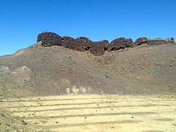
Zibad Rural District (Persian: دهستان زيبد) is in Kakhk District of Gonabad County, Razavi Khorasan province, Iran.[3] Its capital is the village of Zibad.[4]
Zibad Rural District
Persian: دهستان زيبَد | |
|---|---|
 Shelter of the last emperor of Persia, Yazdegerd III | |
| Coordinates: 34°18′31″N 58°26′14″E / 34.30861°N 58.43722°E[1] | |
| Country | Iran |
| Province | Razavi Khorasan |
| County | Gonabad |
| District | Kakhk |
| Founded by | Kay Khosrow |
| Capital | Zibad |
| Population (2016)[2] | |
• Total | 4,892 |
| Time zone | UTC+3:30 (IRST) |
| Website | www |
Demographics
editPopulation
editAt the time of the 2006 National Census, the rural district's population was 4,747 in 1,721 households.[5] There were 4,243 inhabitants in 1,701 households at the following census of 2011.[6] The 2016 census measured the population of the rural district as 4,892 in 1,941 households. The most populous of its 36 villages was Zibad, with 1,058 people.[2]
Overview
editThe village of Zibad was ratified as the center of Zibad Rural District in 1945. In the past 50 years due to severe drought, the population has migrated to the cities. Zibad, meaning beautiful, was a famous ancient place in Shahnameh. According to Shahnameh Ferdowsi (around 1000 AD), it was the place of a famous war called Davazdah Rokh (12 Hero) between Iran and Turan. Zibad also has an ancient qanat that may be more than 1,600 years old.
Gallery
editSee also
editReferences
edit- ^ OpenStreetMap contributors (31 October 2024). "Zibad Rural District (Gonabad County)" (Map). OpenStreetMap (in Persian). Retrieved 31 October 2024.
- ^ a b Census of the Islamic Republic of Iran, 1395 (2016): Razavi Khorasan Province. amar.org.ir (Report) (in Persian). The Statistical Center of Iran. Archived from the original (Excel) on 2 April 2022. Retrieved 19 December 2022.
- ^ Habibi, Hassan (1 June 2017) [Approved 15 July 1375]. Reforms of national divisions in Khorasan province. rc.majlis.ir (Report) (in Persian). Ministry of the Interior, Political-Defense Commission of the Government Board. Proposal 1.4.42.7504; Notification 127903/T17245K. Archived from the original on 22 May 2018. Retrieved 4 January 2024 – via Islamic Parliament Research Center of the Islamic Republic of Iran.
- ^ Mousavi, Mirhossein (c. 2024) [Approved 4 October 1366]. Creation and formation of seven rural districts including villages, farms and places in Gonabad County under Khorasan province. lamtakam.com (Report) (in Persian). Ministry of the Interior, Council of Ministers. Archived from the original on 7 January 2024. Retrieved 7 January 2024 – via Lam ta Kam.
- ^ Census of the Islamic Republic of Iran, 1385 (2006): Razavi Khorasan Province. amar.org.ir (Report) (in Persian). The Statistical Center of Iran. Archived from the original (Excel) on 20 September 2011. Retrieved 25 September 2022.
- ^ Census of the Islamic Republic of Iran, 1390 (2011): Razavi Khorasan Province. irandataportal.syr.edu (Report) (in Persian). The Statistical Center of Iran. Archived from the original (Excel) on 20 January 2023. Retrieved 19 December 2022 – via Iran Data Portal, Syracuse University.
External links
edit- "قنات میراث فرهنگی و علمی ایرانیان". Aftabir.com. Retrieved 11 February 2019.
- "مرکز پژوهشها - ایجاد و تشکیل تعداد 7 دهستان شامل روستاها، مزارع و مکانها در شهرستان گناباد تابع استان خراسان". Rc.majlis.ir. Retrieved 11 February 2019.
