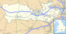
Wraysbury and Hythe End Gravel Pits is a 117.2-hectare (290-acre) biological Site of Special Scientific Interest in Wraysbury in Berkshire.[1][2] It is part of South West London Waterbodies Ramsar site[3] and Special Protection Area.[4]
| Site of Special Scientific Interest | |
 | |
| Location | Berkshire |
|---|---|
| Grid reference | TQ 012 735[1] |
| Coordinates | 51°27′04″N 0°32′42″W / 51.451°N 0.545°W |
| Interest | Biological |
| Area | 117.2 hectares (290 acres)[1] |
| Notification | 1992[1] |
| Location map | Magic Map |
The site features four former gravel pits and is within the floodplains of the River Thames and the Colne Brook.[5] It is important for the number of bird species it features.[6]
Fauna
editThe following species have been recorded on the reserve.[7][5][6]
Birds
edit- Tufted duck
- Gadwall
- Goosander
- Common goldeneye
- Smew
- Common pochard
- Eurasian Wigeon
- Mandarin duck
- Common Shelduck
- Common kingfisher
- Common grasshopper warbler
- Eurasian reed warbler
- Common redshank
- Eurasian coot
- Grey heron
- Little egret
- Common buzzard
- Water rail
- Ring-necked parakeet
- Grey wagtail
- Common reed bunting
- Common swift
- Common chiffchaff
- Garganey
- Hobby
- Eurasian collared dove
- Common nightingale
- Northern wheatear
- Whinchat
- Slavonian grebe
- Red-necked grebe
- Black-necked grebe
- Long-tailed duck (rare)
- Red-breasted merganser
- Common sandpiper
- Green sandpiper
- Little ringed plover
- Common ringed plover
- Common snipe
- Jack snipe
- Lesser redpoll
- Lesser scaup (rare)
- Ortolan bunting (rare)
Invertebrates
edit- White-legged damselfly
- The beetle, Oulimnius major
- The caddisfly, Leptocerus lusitanius
Flora
editThe following plants have been recorded at the site:[7]
Trees
editPlants
editReferences
edit- ^ a b c d "Designated Sites View: Wraysbury and Hythe End Gravel Pits". Sites of Special Scientific Interest. Natural England. Retrieved 24 October 2019.
- ^ "Map of Wraysbury and Hythe End Gravel Pits". Sites of Special Scientific Interest. Natural England. Retrieved 24 October 2019.
- ^ "Designated Sites View: South West London Waterbodies". Ramsar Site. Natural England. Retrieved 24 October 2019.
- ^ "Designated Sites View: South West London Waterbodies". Special Protection Areas. Natural England. Retrieved 24 October 2019.
- ^ a b Carl Hughes (3 July 1992). "SSSI". Wraysbury.net. Retrieved 15 March 2017.
- ^ a b "Wraysbury and Horton Gravel Pits". Berksoc.org.uk. 20 June 2014. Retrieved 15 March 2017.
- ^ a b "Wraysbury and Hythe End Gravel Pits citation" (PDF). Sites of Special Scientific Interest. Natural England. Retrieved 24 October 2019.
