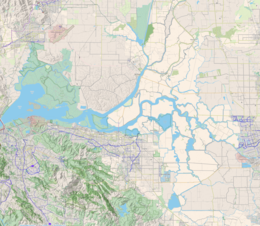
Winter Island (also known as Ruckels Island)[1] is a 453-acre (183 ha) island in Suisun Bay, in the western Sacramento-San Joaquin River Delta.[2][3] It is north of Pittsburg,[2][3] separated from Browns Island to the west by a slough. It was private property,[3] and contained one house.[2] It is used as a duck hunting area, a wetland, and a dredging disposal area.[3] In 2016 Winter Island was purchased by the California Department of Water Resources in order to restore the island as a tidal marsh.[4] Winter Island is part of Contra Costa County, and managed by Reclamation District 2122.[5] It is shown, labeled "Ruckels Island", on an 1850 survey map of the San Francisco Bay area made by Cadwalader Ringgold[6] and an 1854 map of the area by Henry Lange.[7]
 An aerial photo of Winter Island (on the right). Browns Island is on the left of the image, and Antioch is on the bottom. | |
| Geography | |
|---|---|
| Location | Suisun Bay |
| Coordinates | 38°02′35″N 121°50′56″W / 38.043°N 121.849°W |
| Area | 453 acres (183 ha) |
| Highest elevation | 0 m (0 ft) |
| Administration | |
United States | |
| U.S. state | California |
| County | Contra Costa County |
In 2009, Brusco Tug and Barge, a tugboat company, pled guilty to illegal dredge dumping near the island between 2003 and 2007.[3] In 2014, a large wildfire broke out on the island.[2]
See also
editReferences
edit- ^ "Winter Island". Geographic Names Information System. United States Geological Survey, United States Department of the Interior.
- ^ a b c d "Crews responding to brush fire on Winter Island in delta". KGO-TV. 2014-01-22. Retrieved 2016-10-12.
- ^ a b c d e Costa, Hilary (2009-09-11). "Tug company settles Delta pollution charges". East Bay Times. Retrieved 2016-10-12.
- ^ Department of Water Resources’ (DWR) Fish Restoration Program (FRP) acquired approximately 589 acres on Winter Island in 2016 for tidal wetland restoration
- ^ "Countywide Reclamation Services: Municipal Service Review/Sphere of Influence Update (2nd Round) – FINAL" (PDF). Contra Costa Local Agency Formation Commission. 18 November 2015. Retrieved 23 February 2021.
- ^ Ringgold, Cadwalader; Stuart, Fred D.; Everett, Chas.; Harrison (1850). "General Chart embracing Surveys of the Farallones Entrance to the Bay of San Francisco, Bays of San Francisco and San Pablo, Straits of Carquines and Suisun Bay, and the Sacramento and San Joaquin Rivers, to the Cities of Sacramento and San Joaquin, California". David Rumsey Map Collection. San Francisco Common Council. Retrieved 25 February 2021.
- ^ Lange, Henry (1854). "Bai San Francisco und Vereinigung des Sacramento mit dem San Joaquin". David Rumsey Map Collection. George Westermann. Retrieved 25 February 2021.


