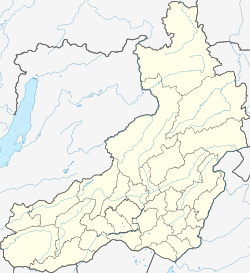
Ust-Karsk (Russian: Усть-карск), formerly known as Ust-Kara (Russian: Усть-кара) is an urban-type settlement in the Sretensky District of Zabaykalsky Krai, Russia. The settlement is located on the northern bank of the Shilka River, near the mouth of its left tributary, the Kara River.
Ust-Karsk
Усть-карск | |
|---|---|
| Coordinates: 52°42′43″N 118°49′10″E / 52.7120°N 118.8194°E | |
| Country | Russia |
| Federal subject | Zabaykalsky Krai |
| Administrative district | Sretensky District |
| Population | |
• Total | 1,899 |
• Estimate (2018)[2] | 1,688 (−11.1%) |
| Time zone | UTC+9 (MSK+6 |
| Postal code(s)[4] | |
| OKTMO ID | 76640156051 |


Population: 1,899 (2010 Census);[1] 2,035 (2002 Census);[5] 2,541 (1989 Soviet census).[6]
The name of the town means "Kara mouth".[7]
Climate
editUst-Karsk has a pure continental climate and it is the hottest place in Siberia. On July 12, 2010, Ust-Karsk set the high temperature record for Asian Russia,42.7 °C (108.9 °F). This took place during a massive heatwave felt throughout Russia and China.[8] In the coldest winters, it can be as cold as −50 °C (−58 °F).
History
editThe history of Ust-Kara is closely connected to that of the Kara katorga, a network of prison settlements that existed in the area in 1838–1893. Prisoners were used to work gold mines. In the early 1850s, the annual gold production on the Kara was around 70 pood (1100 kg).[9]
In the 1850s, during the preparations for the Amur Annexation, Ust-Kara was one of the sites (along with the Shilkinsky Zavod and Bolshaya Kularka) where barges were built for the Russian military expeditions down the Amur.[10]
See also
editSources
edit- ^ a b Russian Federal State Statistics Service (2011). Всероссийская перепись населения 2010 года. Том 1 [2010 All-Russian Population Census, vol. 1]. Всероссийская перепись населения 2010 года [2010 All-Russia Population Census] (in Russian). Federal State Statistics Service.
- ^ "26. Численность постоянного населения Российской Федерации по муниципальным образованиям на 1 января 2018 года". Federal State Statistics Service. Retrieved 23 January 2019.
- ^ "Об исчислении времени". Официальный интернет-портал правовой информации (in Russian). 3 June 2011. Retrieved 19 January 2019.
- ^ Почта России. Информационно-вычислительный центр ОАСУ РПО. (Russian Post). Поиск объектов почтовой связи (Postal Objects Search) (in Russian)
- ^ Federal State Statistics Service (21 May 2004). Численность населения России, субъектов Российской Федерации в составе федеральных округов, районов, городских поселений, сельских населённых пунктов – районных центров и сельских населённых пунктов с населением 3 тысячи и более человек [Population of Russia, Its Federal Districts, Federal Subjects, Districts, Urban Localities, Rural Localities—Administrative Centers, and Rural Localities with Population of Over 3,000] (XLS). Всероссийская перепись населения 2002 года [All-Russia Population Census of 2002] (in Russian).
- ^ Всесоюзная перепись населения 1989 г. Численность наличного населения союзных и автономных республик, автономных областей и округов, краёв, областей, районов, городских поселений и сёл-райцентров [All Union Population Census of 1989: Present Population of Union and Autonomous Republics, Autonomous Oblasts and Okrugs, Krais, Oblasts, Districts, Urban Settlements, and Villages Serving as District Administrative Centers]. Всесоюзная перепись населения 1989 года [All-Union Population Census of 1989] (in Russian). Институт демографии Национального исследовательского университета: Высшая школа экономики [Institute of Demography at the National Research University: Higher School of Economics]. 1989 – via Demoscope Weekly.
- ^ Kennan, George (1891). Siberia and the Exile System. London: James R. Osgood, McIlvaine & Co. p. 138.
- ^ Masters, Jeff (15 October 2010). "Paula dying; Zambia records its hottest temperature in history". Weather Underground. Retrieved 21 August 2018.
- ^ Maack, Richard Karlovich (Ричард Карлович Маак) (1859), Путешествие на Амур, совершенное по распоряжению Сибирскаго Отдѣла Императорскаго Русскаго Географическаго Общества, в 1855 году: Один том, с портретом графа Муравьева-Амурскаго и с отдѣлельным собранием рисунков, карт и планов (The travel to the Amur, carried out on orders of the Siberian Division of the Russian Imperial Geographic Society in 1855...), Изд. члена-соревнователя Сибирскаго отдѣла С. Ф. Соловьева, p. 37
- ^ Maack 1859, p. 39


