User:Dalelwala | |
|---|---|
village | |
| Coordinates: 29°49′19″N 75°26′55″E / 29.822°N 75.4486°E | |
| Country | |
| State | Punjab |
| District | Mansa |
| Talukas | budhlada |
| Population (2001) | |
• Total | 3,500 |
| Languages | |
| • Official | Punjabi (Gurmukhi) |
| • Regional | Punjabi |
| Time zone | UTC+5:30 (IST) |
| PIN | 151503[1] |
| Telephone code | 01659-24***** |
| Vehicle registration | PB31 |
| Nearest city | Mansa |
| Sex ratio | 1000/883 ♂/♀ |
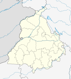
dalelwala, sometimes spelled dalelwala, is a town in the dalelwala tehsil of Mansa district in East Punjab, India. It is also a block of the district.
Geography
editDalelwala is located at [2] side on State Highway boha to jhunir, in the Mansa district of Indian Punjab. Mansa is the nearest railway station, lying 20 kilometres (12 mi) to its north, Sardulgarh (25 km) to the southwest, the city and district of Bathinda to the northeast and the city and district of Sangrur to the northeast.[2] The block has the total area of 34,488 square kilometres (13,316 sq mi).[3]
GURPAL SINGH DALELWALA
editSIMERJEET SINGH MAAN
editCulture
editdalelwala has a village and town. Punjabi is the mother tongue as well as the official language here.
Education and others
editIt has good educational options, having many schools[4] and for higher education, students goes to the near by cities. Maan|url=http://www.tribuneindia.com/2011/20111118/bathinda.htm%7Cnewspaper=The Tribune, Chandigarh|date=17 November, 2011|accessdate=22 January 2012}}</ref>
- School
- Government School dalelwala
- Baba Farid Public School
- Colleges near by
Guru Teg Bahadur College of Education, Dalelwala, Punjab Nangal Road Dalelwala (District Mansa) Punjab, India #Govt. College, Mansa
- National Post Graduate College, Bhikhi
- S. D. Kanya Mahavidyala
dalelwala info
editDalel Wala is a Village in Jhunir Mandal in Mansa District in Punjab State in India . Dalel Wala is 16.65 km distance from its District Main City Mansa . And 164 km distance from its State Main City Chandigarh . .
Bajewala , Bana Wala , Beerae Wala Jattan , Behniwal , Bhalike , Bhamme Kalan , Bhamme Khurd , Buraj Bhalike , Chachuhar , Chaine Wala , Chappian Wali , ... . are the villages along with this village in the same Jhunir Mandal
Near By Villages of this Village with distance are Danewala ( 3.3 km ) , Nandgarh ( 3.9 km ) , Lakhmirwala ( 3.9 km ) , Malko ( 4.3 km ) , Alampur Mandran ( 4.7 km ) , Tahlian ( 5.9 km ) , Deluana ( 6.5 km ) ,
DALELWALA DERA
editDERA SIDH BABA CHETAN DAS JI
References
edit- ^ "dalelwala - PIN code and Post office details". www.pincodes.net.in. Retrieved 26 January, 2012.
{{cite web}}: Check|url=value (help); Check date values in:|accessdate=(help) - ^ a b Google maps
- ^ "Mansa District area details". www.mansa.nic.in. Retrieved 26 January, 2012.
{{cite web}}: Check date values in:|accessdate=(help) - ^ "dalelwala city, Punjab". www.onefivenine.com. Retrieved 26 January, 2012.
{{cite web}}: Check date values in:|accessdate=(help)
