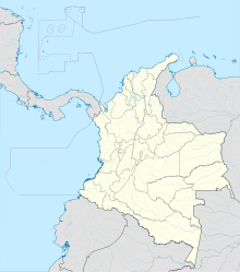
Uribe Airport (IATA: URI, ICAO: SKUB) is an airport serving the town of La Uribe, in the Meta Department of Colombia. The runway and town are on the northern bank of the small Duda River, a tributary of the Guayabero River. High terrain exists north and west.
Uribe Airport | |||||||||||
|---|---|---|---|---|---|---|---|---|---|---|---|
| Summary | |||||||||||
| Airport type | Public | ||||||||||
| Serves | La Uribe, Colombia | ||||||||||
| Elevation AMSL | 2,750 ft / 838 m | ||||||||||
| Coordinates | 3°14′15″N 74°20′50″W / 3.23750°N 74.34722°W | ||||||||||
| Map | |||||||||||
 | |||||||||||
| Runways | |||||||||||
| |||||||||||
See also
editReferences
edit- ^ Airport information for URI at Great Circle Mapper.
- ^ Google Maps - Uribe
External links
edit
