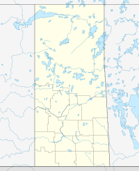
Torquay (2016 population: 255) is a village in the Canadian province of Saskatchewan within the Rural Municipality of Cambria No. 6 and Census Division No. 2. It was named after Torquay in Devon, England.[1]

Torquay is at the junction of Highway 350 and 18.
History
editTorquay was established in 1912 when the land was sold to the Canadian Pacific Railway for $2,400.[2] At the suggestion of a railroad superintendent's wife, the area was named after the English town of Torquay as like its namesake, it had an abundant water supply.[2] The Ambrose-Torquay Border Crossing that connects Torquay with the North Dakota village of Ambrose opened in 1915 and remains in daily use today.
Politician Elmer Knutson, founder of the Confederations of Regions Party, was born on his family's farm in Torquay in 1914.
Torquay incorporated as a village on December 11, 1923.[3] The first council meeting as the Village of Torquay was held on January 9, 1924.[2]
In May 2018 the Canadian government announced plans to construct the country's first geothermal power plant in the area, with the eventual aim of using renewable energy to power hundreds of thousands of homes in Saskatchewan.[4]
Demographics
editIn the 2021 Census of Population conducted by Statistics Canada, Torquay had a population of 215 living in 91 of its 103 total private dwellings, a change of -15.7% from its 2016 population of 255. With a land area of 1.35 km2 (0.52 sq mi), it had a population density of 159.3/km2 (412.5/sq mi) in 2021.[7]
In the 2016 Census of Population, the Village of Torquay recorded a population of 255 living in 99 of its 116 total private dwellings, a 7.5% change from its 2011 population of 236. With a land area of 1.35 km2 (0.52 sq mi), it had a population density of 188.9/km2 (489.2/sq mi) in 2016.[8]
See also
editReferences
edit- ^ Barry, Bill (September 2005). Geographic Names of Saskatchewan. Regina, Saskatchewan: People Places Publishing, Ltd. p. 424. ISBN 1-897010-19-2.
- ^ a b c "History - The Village of Torquay". Archived from the original on August 26, 2018. Retrieved February 26, 2019.
- ^ "Urban Municipality Incorporations". Saskatchewan Ministry of Government Relations. Archived from the original on October 15, 2014. Retrieved June 1, 2020.
- ^ Canada's first-ever geothermal power plant in the words for Torquay Regina Leader-Post. 18 May 2018. Retrieved 26 February 2019.
- ^ "Saskatchewan Census Population" (PDF). Saskatchewan Bureau of Statistics. Archived from the original (PDF) on September 24, 2015. Retrieved May 31, 2020.
- ^ "Saskatchewan Census Population". Saskatchewan Bureau of Statistics. Retrieved May 31, 2020.
- ^ "Population and dwelling counts: Canada, provinces and territories, census divisions and census subdivisions (municipalities), Saskatchewan". Statistics Canada. February 9, 2022. Retrieved April 1, 2022.
- ^ "Population and dwelling counts, for Canada, provinces and territories, and census subdivisions (municipalities), 2016 and 2011 censuses – 100% data (Saskatchewan)". Statistics Canada. February 8, 2017. Retrieved May 30, 2020.
External links
edit- Media related to Torquay, Saskatchewan at Wikimedia Commons
