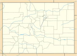
The Tonahutu Creek Trail, in the general area of Grand Lake, Colorado, in both Grand and Larimer counties, was listed on the National Register of Historic Places in 2008.[1]
Tonahutu Creek Trail | |
 | |
| Nearest city | Grand Lake, Colorado |
|---|---|
| Coordinates | 40°19′10″N 105°46′32″W / 40.319444°N 105.775556°W[2] |
| Area | 31.5 acres (12.7 ha) |
| Built | 1918 |
| Architect | Architects of the National Park Service |
| Architectural style | Late 19th and Early 20th Century American Movements, Rustic |
| MPS | Rocky Mountain National Park MPS |
| NRHP reference No. | 08000130[1] |
| Added to NRHP | March 5, 2008 |
It is also known as Little North Inlet Trail and as Tonahutu Trail.
The trail runs from very close to Grand Lake roughly along Tonahutu Creek to Flattop Mountain, in the west side of Rocky Mountain National Park.
The general route was established in 1880; the trail was improved in 1924. Its main trail is about 13 miles (21 km) long. Its significant built features (paraphrasing the NRHP document) include dry rock walls, log footbridge/ford combinations, bogwalks, log and rock water bars and drains, the Harbison Ditch, and abandoned cabins in Big Meadows.[3]
The listing includes one contributing structure. The trail reflects landscape architecture design by National Park Service architects.[3]
See also
editReferences
edit- ^ a b "National Register Information System". National Register of Historic Places. National Park Service. November 2, 2013.
- ^ Coordinates are those of the Grand Lake end of the trail as provided by its GNIS record
- ^ a b Sierra Standish (November 10, 2006). "National Register of Historic Places Inventory/Nomination: Tonahutu Creek Trail / Little North Inlet Trail; Tonahutu Trail; 5GA.3823; SLR. 11897". National Park Service. Retrieved June 5, 2018. With accompanying 10 photos
