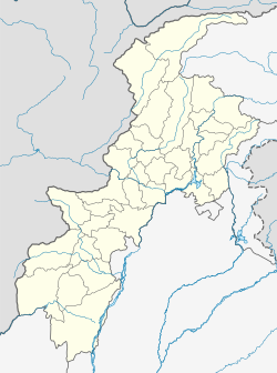
Thandiani (literally meaning "very cold") is a hill station in the Galyat area of the Khyber Pakhtunkhwa Province of Pakistan. Thandiani is located in the northeast of Abbottabad District and is about 37.5 kilometres (23.3 mi) from Abbottabad in the foothills of the Himalayas.[1][2] To the east beyond the Kunhar River lies the snow-covered Pir Panjal mountain range of Kashmir. Visible to the north and northeast are the mountains of Kohistan and Kaghan. To the northwest are the snowy ranges of Swat and Chitral. The hills of Thandiani are about 2,750 metres (9,020 ft) above sea level.
Thandiani | |
|---|---|
 Thandiani, Galyat | |
| Coordinates: 34°14′N 73°21′E / 34.233°N 73.350°E | |
| Country | |
| Province | Khyber-Pakhtunkhwa |
| District | Abbottabad District |
| Time zone | UTC+5 (PST) |
History
editThandiani was originally granted as a lease to some members of the Battye family[3] in British India, who were Christian missionaries and also found in civil and military service, and who produced scions such as Wigram Battye and Quintin Battye.[4][5] The Battyes subsequently gifted the location to the church authorities, where a sanatorium and various other facilities were set up during the British rule, mostly for the convenience of missionaries, Anglican church personnel and officers stationed at the neighbouring cantonment of Abbottabad. It also contained some private European houses, a camping ground, a small bazaar, and the small seasonal church of St. Xavier in the Wilderness which were occupied only during the summer months.[6][7]
Tourism
editThandiani is characterized by excellent weather and lush greenery in the summer months, and snow-covered vistas and hills in the winter. Many tourists from Khyber Pakhtunkhwa and all over Pakistan visit here, especially in the summer season. Being at a high altitude, with attractive scenery and several hiking trails into the forests and other nearby locations, it is a very attractive prospect.
A beautiful trek leads to Thandiani from Abbottabad that passes through Dagri Naka.[8]
It has famous villages namely, Sialkot, Chamiyali, Kotla, Basali and Pattan Kallan. Sialkot is the nearest village in fact Thandiyani lies in the boundaries of Sialkot village.
Forests and Wildlife
editThe mountains around Thandiani are quite thickly forested compared to most other hill stations in the locality, which have suffered some degree of deforestation over time. The local wildlife includes leopards, monkeys, several kinds of pheasants and the increasingly rare flying squirrel and pine marten, to name only a few.[9]
2005 earthquake
editThe area and its surrounding villages were damaged by the 2005 Kashmir earthquake. Now, it is very developed spot for tourists.
References
edit- ^ "Thandiani - Hill Station in Galyat". Thenews.com.pk. Retrieved 19 June 2018.
- ^ "Distance from Abbottabad". Google Maps. Retrieved 19 June 2018.
- ^ See 'Early Leases in the Hazara' in Major Wace's Full and Permanent Settlement Report of the Hazara District 1868-1874, Annex 1. pub. 1874, pp.379-380
- ^ Of the Corps of Guides (British India)
- ^ For a history of the members of this unique family, see Evelyn Desiree Battye, The Fighting Ten, London: British Association for Cemeteries in South Asia publications, 1984. It is also worth noting here that one of the Battye brothers, who died in a military campaign in the Black Mountain (Kala Dhaka) area in 1888, Major Leigh Richmond Battye, is buried in the Old Christian Cemetery, Abbottabad
- ^ Under the overall jurisdiction and management of St. Luke's Church, Abbottabad
- ^ Thandiani - Imperial Gazetteer of India, v. 23, p. 304
- ^ "Attractions : Galyat". Archived from the original on 16 July 2010.
- ^ "Forests and Wildlife". www.pakistantoday.com.pk. Retrieved 19 June 2018.
External links
edit- Murree travel guide from Wikivoyage

