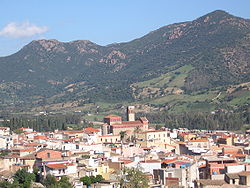
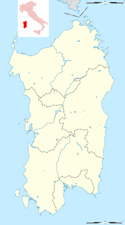
Tertenia is a comune (municipality) in the Province of Nuoro in the Italian region Sardinia, located about 70 kilometres (43 mi) northeast of Cagliari and about 25 kilometres (16 mi) south of Tortolì.
Tertenia
Dardania | |
|---|---|
| Comune di Tertenia | |
 | |
| Coordinates: 39°42′N 9°35′E / 39.700°N 9.583°E | |
| Country | Italy |
| Region | Sardinia |
| Province | Province of Nuoro (NU) |
| Government | |
| • Mayor | Giulio Murgia |
| Area | |
• Total | 117.77 km2 (45.47 sq mi) |
| Elevation | 129 m (423 ft) |
| Population (31 December 2015)[1] | |
• Total | 3,888 |
| • Density | 33/km2 (86/sq mi) |
| Demonym | Terteniesi |
| Time zone | UTC+1 (CET) |
| • Summer (DST) | UTC+2 (CEST) |
| Postal code | 08047 |
| Dialing code | 0782 |
| Patron saint | St. Sophia |
| Saint day | September 1 |
Tertenia borders the following municipalities: Cardedu, Gairo, Jerzu, Lanusei, Loceri, Osini, Ulassai.
It is located in a high valley at the base of Mt. Arbu and Mt. Ferru, along the Rio Quirra river.[2]
References
editWikimedia Commons has media related to Tertenia.
- ^ All demographics and other statistics: Italian statistical institute Istat.
- ^ "Tertenia". 🏖️Sardinian Beaches. Retrieved 2023-01-12.


