Subbox use instead of child
edit
{{Testcase table
| type = highway
| state = qld
| state2 = nsw
| road_name = Pacific Highway
| route_image =
| route_image2 =
| location = Location Pacific Hwy.svg
| length = 960
| split = yes
| section1 = Brunswick Heads to Mayfield West
| direction_a1 = North
| end_a1 = Pacific Motorway Brunswick Heads
| exits1 =
| direction_b1 = South
| end_b1 = Tuggerah then Ourimbah to Wyoming
| direction_a2 = NE
| end_a2 = Hunter Street
| exits2 =
| direction_b2 = SW
| end_b2 = Kariong to North Sydney
| direction_a3 = North
| end_a3 = Pacific Motorway Central Coast Highway
| exits3 =
| direction_b3 = South
| end_b3 = Warringah Freeway North Sydney, Sydney
| est =
| through =
| route =
| former = Only former and current NSW sections included[ 2]
}}
| show_links = yes
}}
Side by side comparison {{Infobox Australian road }} {{Infobox Australian road/sandbox }}
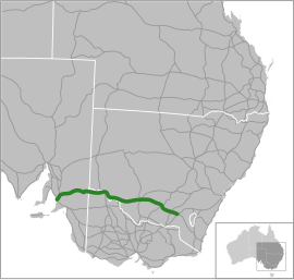
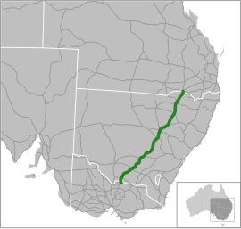
Sturt Highway
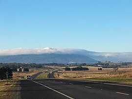
–New South Wales B-double truck on the Sturt HighwayType Highway Length 947 km (588 mi) Route number(s)
Gawler – SA/Vic. Border SA/Vic. Border – Vic./NSW Border Vic./NSW Border – Hume Motorway Former
National Route 20 (1955-1992) West end Max Fatchen Expressway Gawler, South Australia Barrier Highway (A32)Barossa Valley Way (B19)Calder Highway (A79)Silver City Highway (B79)Murray Valley Highway Mid-Western Highway (B64) via Cobb Highway (B75)Kidman Way (B87)Newell Highway (A39)Olympic Highway (A41)East end Hume Motorway Tarcutta, New South Wales Major settlements Nuriootpa , Renmark , Mildura , Balranald , Hay , Narrandera , Wagga Wagga
Sturt Highway
–New South Wales Type Highway Length 947 km (588 mi) Route number(s)
Gawler – SA/Vic. Border SA/Vic. Border – Vic./NSW Border Vic./NSW Border – Hume Motorway Former
National Route 20 (1955-1992) West end Max Fatchen Expressway Gawler, South Australia Barrier Highway (A32)Barossa Valley Way (B19)Calder Highway (A79)Silver City Highway (B79)Murray Valley Highway Mid-Western Highway (B64) via Cobb Highway (B75)Kidman Way (B87)Newell Highway (A39)Olympic Highway (A41)East end Hume Motorway Tarcutta, New South Wales Major settlements Nuriootpa , Renmark , Mildura , Balranald , Hay , Narrandera , Wagga Wagga
Side by side comparison {{Infobox Australian road }} {{Infobox Australian road/sandbox }}
Great Northern Highway
Map of Western Australia with Great Northern Highway highlighted in red
Type Highway Length 3,194.66 km (1,985 mi)[ 8] Gazetted 10 March 1944[ 9] Route number(s)
Tourist routes
Southwest end Morrison Road , (National Routes 1), Midland, Perth
Northeast end Harbour Road, Wyndham Major settlements Bullsbrook , New Norcia , Dalwallinu , Mount Magnet Meekatharra , Newman , Port Hedland , Broome Fitzroy Crossing , Halls Creek
Side by side comparison {{Infobox Australian road }} {{Infobox Australian road/sandbox }}
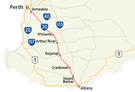
Albany Highway
Map of the south-west of Western Australia, with Albany Highway highlighted in red
Type Highway Length 405.47 km (252 mi)[ 8] Opened 1863 Route number(s) Northwest end The Causeway (State Route 5), Victoria Park (Perth) Southeast end York Street, Albany Major settlements Armadale , North Bannister , Williams , Arthur River Kojonup , Cranbrook , Mount Barker , Albany
edit
The following are from Wikipedia:WikiProject Australian Roads/Infobox testcases
Side by side comparison {{Infobox Australian road }} {{Infobox Australian road/sandbox }}
Great Eastern Highway
Great Eastern Highway at The Lakes (a rural locality east of Perth), heading east Type Highway Length 595 km (370 mi) Opened 1890s Route number(s) National Highway 94 Victoria Park – Redcliffe & Midland – Coolgardie National Route 1 Victoria Park – Woodbridge State Route 51 Guildford – Midland Coolgardie – Kalgoorlie West end Canning Highway Victoria Park Albany Highway /The Causeway , Graham Farmer Freeway /Orrong Road , Tonkin Highway , Great Eastern Highway Bypass , Roe Highway , Great Southern Highway , Northam-Toodyay Road, Coolgardie–Esperance Highway
see alsoMajor Perth junctions East end Goldfields Highway via Hannan Street , Kalgoorlie Major settlements Northam , Merredin , Southern Cross , Coolgardie
Great Eastern Highway
Great Eastern Highway at
The Lakes (a rural locality east of Perth), heading east
Type Highway Length 595 km (370 mi) Opened 1890s Route number(s) National Highway 94 Victoria Park – Redcliffe & Midland – Coolgardie National Route 1 Victoria Park – Woodbridge State Route 51 Guildford – Midland Coolgardie – Kalgoorlie West end Canning Highway Victoria Park Albany Highway /The Causeway , Graham Farmer Freeway /Orrong Road , Tonkin Highway , Great Eastern Highway Bypass , Roe Highway , Great Southern Highway , Northam-Toodyay Road, Coolgardie–Esperance Highway
see alsoMajor Perth junctions East end Goldfields Highway via Hannan Street , Kalgoorlie Major settlements Northam , Merredin , Southern Cross , Coolgardie
Side by side comparison {{Infobox Australian road }} {{Infobox Australian road/sandbox }}
Great Northern Highway
Great Northern Highway near Paynes Find Type Highway Length 3,204 km (1,991 mi) Route number(s) SW end Morrison Road , Midland, Perth NE end Harbour Road, Wyndham Major settlements Bullsbrook , Muchea , Bindoon , New Norcia Pithara , Dalwallinu , Wubin , Paynes Find Mount Magnet , Cue , Meekatharra , Newman Hamersley Range National Park , South Hedland , Broome , Derby , Fitzroy Crossing Halls Creek
Great Northern Highway
Type Highway Length 3,204 km (1,991 mi) Route number(s) SW end Morrison Road , Midland, Perth NE end Harbour Road, Wyndham Major settlements Bullsbrook , Muchea , Bindoon , New Norcia Pithara , Dalwallinu , Wubin , Paynes Find Mount Magnet , Cue , Meekatharra , Newman Hamersley Range National Park , South Hedland , Broome , Derby , Fitzroy Crossing Halls Creek
Side by side comparison {{Infobox Australian road }} {{Infobox Australian road/sandbox }}
Albany Highway
Albany Highway at Cannington Type Highway Length 410 km (255 mi) Route number(s) State Route 30 NW end The Causeway Victoria Park Shepperton Road , Leach Highway , Manning Road , Nicholson Road , Roe Highway , Tonkin Highway , Brookton Highway , Armadale Road /South Western Highway , Coalfields Highway , Great Southern Highway , Muirs Highway , South Coast Highway
for full list seeMajor Intersections SE end Middleton Road ,Albany, Western Australia Major settlements East Victoria Park , Cannington , Gosnells , Kelmscott , Armadale , North Bannister , Williams , Arthur River , Kojonup , Cranbrook , Mount Barker , Narrikup , Orana
Albany Highway
Type Highway Length 410 km (255 mi) Route number(s) State Route 30 NW end The Causeway Victoria Park Shepperton Road , Leach Highway , Manning Road , Nicholson Road , Roe Highway , Tonkin Highway , Brookton Highway , Armadale Road /South Western Highway , Coalfields Highway , Great Southern Highway , Muirs Highway , South Coast Highway
for full list seeMajor Intersections SE end Middleton Road ,Albany, Western Australia Major settlements East Victoria Park , Cannington , Gosnells , Kelmscott , Armadale , North Bannister , Williams , Arthur River , Kojonup , Cranbrook , Mount Barker , Narrikup , Orana
Side by side comparison {{Infobox Australian road }} {{Infobox Australian road/sandbox }}
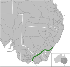
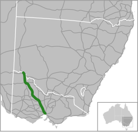
Calder Highway
–Victoria Calder Freeway facing Mount Macedon Type Highway Length 561 km (349 mi) Route number(s)
Silver City Highway - NSW/Vic. Border NSW/Vic. Border - Calder Freeway south of Ravenswood South Duplexes: Bendigo - Harcourt Former NW end SE end Major settlements Mildura , Ouyen , Charlton , Bendigo , Harcourt , Malmsbury , Kyneton , Woodend , Macedon , Gisborne , Diggers Rest , Sunbury
Calder Highway
–Victoria Calder Freeway facing Mount Macedon
Type Highway Length 561 km (349 mi) Route number(s)
Silver City Highway - NSW/Vic. Border NSW/Vic. Border - Calder Freeway south of Ravenswood South Duplexes: Bendigo - Harcourt Former NW end SE end Major settlements Mildura , Ouyen , Charlton , Bendigo , Harcourt , Malmsbury , Kyneton , Woodend , Macedon , Gisborne , Diggers Rest , Sunbury
^ "NEW SOUTH WALES GOVERNMENT GAZETTE No. 57" (PDF) . Parliament of New South Wales . 10 May 2013.^ Highway One – NSW Section , Ozroads Website . Retrieved on 15 May 2013[self-published source ^ NSW State Route 111 , Ozroads , Retrieved on 1 June 2013.[self-published source ^ NSW State Route 83 , Ozroads , Retrieved on 1 June 2013.[self-published source ^ Metroad 1 , Ozroads , Retrieved on 1 June 2013.[self-published source ^ NSW State Route 14 , Ozroads , Retrieved on 3 June 2013.[self-published source ^ Metroad 10 , Ozroads , Retrieved on 1 June 2013.[self-published source ^ a b Main Roads Western Australia. "Road Information Mapping System" . Government of Western Australia. Retrieved 20 June 2013 . ^ "The Land Act, 1933–1937: Naming of Highway (per 1944/11)" (PDF) . Western Australia Government Gazette . 10 March 1944. p. 1944:165.^ "Hume Highway; 71 Parramatta Rd, Haberfield NSW 2045, Australia to Camden Valley Way, Prestons NSW 2170, Australia" . Google Maps . 2017. Retrieved 9 January 2017 .^ "Hume Motorway; -33.9554640, 150.8771110 to Hume Motorway & Hume Hwy & Old Hume Hwy & M31, New South Wales 2577, Australia" . Google Maps . 2017. Retrieved 7 January 2017 .^ "Hume Highway; Old Hume Hwy & M31, New South Wales 2577, Australia to Bandiana Link Rd & Hume Hwy & Hume Fwy & National Highway M31, Wodonga VIC 3690, Australia" . Google Maps . 2017. Retrieved 9 January 2017 .^ "Hume Freeway; Hume Hwy, Wodonga VIC 3690, Australia to M80, Thomastown VIC 3074, Australia" . Google Maps . 2017. Retrieved 9 January 2017 .^ "Draft Newell Highway Corridor Strategy" (PDF) (PDF). Roads & Maritime Services , Government of New South Wales. April 2014. pp. 8– 9, 11. Retrieved 23 March 2015 .^ National Routes , Main Roads Victoria . Retrieved on 26 August 2013.[self-published source ^ Freeway Route Numbering System , Main Roads Victoria . Retrieved on 26 August 2013.[self-published source
![]() Pacific Motorway, Brunswick Heads
Pacific Motorway, Brunswick Heads
![]() Industrial Drive
| section2 = Newcastle West to Tuggerah then Ourimbah to Wyoming
| direction_a2 = NE
| end_a2 =
Industrial Drive
| section2 = Newcastle West to Tuggerah then Ourimbah to Wyoming
| direction_a2 = NE
| end_a2 = ![]() Stewart Avenue/Hunter Street
Stewart Avenue/Hunter Street
 Parry Street
 Northcott Drive
 Charlestown Road
 Newcastle Inner City Bypass
 Macquarie Street
 Central Coast Highway
 Motorway Link
 Sparks Road
 Wyong Road
 Pacific Motorway
![]() Mann Street
| section3 = Kariong to North Sydney
| direction_a3 = North
| end_a3 =
Mann Street
| section3 = Kariong to North Sydney
| direction_a3 = North
| end_a3 = ![]() Pacific Motorway
Pacific Motorway![]() Central Coast Highway
Central Coast Highway
![]() Warringah Freeway, North Sydney, Sydney
| est =
Warringah Freeway, North Sydney, Sydney
| est =
 M1[citation needed]
 A1
A1 A43
A43 No shield
 B83
B83 A1
A1
 A1/A38
 No shield
 National Route 1 (1955–2013)
 National Route 1 (1955–88)
 State Route 111 (1988–2013)[3]
 National Route 1 (1955–79)
 State Route 83 (1979–2013)[4]
 National Route 1 (1955–93)
 Metroad 1 (1993–2013)[5]
 National Route 1 (1955–92)
 State Route 14 (1992–98)[6]
 Metroad 10 (1998–2007)[7]
 National Route 1 (1955–93)

