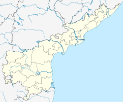
Tanuku mandal is one of the 48 mandals in West Godavari district of the Indian state of Andhra Pradesh. It is under the administration of Tadepalligudem revenue division and the headquarters are located at Tanuku.[3] The mandal is bounded by Iragavaram, Nallajerla, Devarapalle, Nidadavolu, Unguturu, Pentapadu, Tanuku and Undrajavaram mandals.[4]
Tanuku mandal | |
|---|---|
| Coordinates: 16°45′N 81°42′E / 16.75°N 81.7°E | |
| Country | India |
| State | Andhra Pradesh |
| District | West Godavari |
| Headquarters | Tanuku |
| Government | |
| • Body | Mandal Parishad |
| Area | |
• Total | 16.78 km2 (6.48 sq mi) |
| Population (2011)[1] | |
• Total | 77,962 [1] |
| Languages | |
| • Official | Telugu |
| Time zone | UTC+5:30 (IST) |
Towns and villages
editAs of 2011[update] census of India, the mandal has 9 settlements, which includes 1 town, an out growth and 8 villages. Tanuku (M) is the only town in the mandal.[1][3]
The settlements in the mandal are listed below:
- Notes
- (M) denotes a Municipality
- (OG) denotes an Out Growth[5]
See also
editReferences
edit- ^ a b c d "District Census Handbook – West Godavari" (PDF). Census of India. pp. 22–23, 54. Retrieved 18 January 2015.
- ^ "District Census Handbook - West Godavari" (PDF). Census of India. pp. 22, 314. Retrieved 21 January 2016.
- ^ a b "West Godavari District Mandals" (PDF). Census of India. p. 445. Retrieved 21 January 2016.
- ^ "Mandals in West Godavari district". aponline.gov.in. Archived from the original on 29 April 2015. Retrieved 21 January 2016.
- ^ "Abbreviations used". censusindia.gov.in. Retrieved 21 January 2016.

