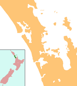
Tāpapakanga Regional Park is a regional park situated in the Auckland Region of New Zealand's North Island. It is located in Franklin, east of Kawakawa Bay, and is owned and operated by Auckland Council.[2]
| Tāpapakanga Regional Park | |
|---|---|
 | |
| Location | Franklin, Auckland, New Zealand |
| Coordinates | 36°58′45″S 175°15′30″E / 36.9791°S 175.2582°E |
| Area | 120 ha (300 acres)[1] |
| Operated by | Auckland Council |
Geography and biodiversity
editThe park is a mix of farmland, coastal bush and beach, overlooking the Firth of Thames. The native bush remnants include taraire, tānekaha, tawa and rewarewa trees.[1]
History
editThe land was an important place for the Marutūāhu iwi of the Hauraki Gulf, in particular Ngāti Whanaunga, and it was a traditional area for stonefield gardening.[3] In 1899, settler James Ashby settled on the land, building a kauri homestead with his wife Rebecca in 1900.[3] Ashby developed a lifelong friendship with Ngāti Whanaunga chief Tukumana Te Taniwha.[3] Two pou are found in the regional park, one of which features a carving of James Ashby.[3]
The regional park opened in 1995.[3]
Gallery
edit-
Ashby Homestead
-
The stonefields at Tāpapakanga
-
The Tāpapakanga Stream
References
edit- ^ a b Janssen, Peter (January 2021). Greater Auckland Walks. New Holland Publishers. p. 162. ISBN 978-1-86966-516-6. Wikidata Q118136068.
- ^ "Council profile". aucklandcouncil.govt.nz. Auckland Council.
- ^ a b c d e Cameron, Ewen; Hayward, Bruce; Murdoch, Graeme (2008). A Field Guide to Auckland: Exploring the Region's Natural and Historical Heritage (Revised ed.). Random House New Zealand. p. 255. ISBN 978-1-86962-1513.
