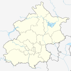
Sunhe Area (Chinese: 孙河地区; pinyin: Sūnhé Dìqū) is an area and township located in the northwest of Chaoyang District, Beijing, China. It borders Konggang Subdistrict and Houshayu Township to the north, Tianzhu Township to the east, Cuigezhuang and Jinzhan Townships to the south, Laiguangying Township and Beiqijia Town to the west. As of the 2020 census, the area had a total population of 31,288.[1]
Sunhe Area
孙河地区 | |
|---|---|
 Entrance of Cultural Town on the north of the township, 2022 | |
| Coordinates: 40°02′29″N 116°31′08″E / 40.04139°N 116.51889°E | |
| Country | China |
| Municipality | Beijing |
| District | Chaoyang |
| Village-level Divisions | 6 communities 13 villages |
| Area | |
• Total | 35.26 km2 (13.61 sq mi) |
| Population (2020) | |
• Total | 31,288 |
| • Density | 890/km2 (2,300/sq mi) |
| Time zone | UTC+8 (China Standard) |
| Postal code | 100102 |
| Area code | 010 |
This region used to be called Sunduitun, and was changed to Sunhecun (Chinese: 孙河村; lit. 'Sun River Village') in 1808, which later became the name of the whole township.[2]
History
edit| Time | Status |
|---|---|
| 1912 | Part of Daxing County, Hebei |
| 1948 | Part of Changping County of Hebei and the 13th District of Beijing |
| 1956 | Part of Dongjiao District, Beijing |
| 1958 | Divided among people's communes of Heping, Chaoyang, Xingfu and Hongguang |
| 1959 | Formed its own commune, later changed to a production team |
| 1984 | Converted to Sunhe Township |
| 2004 | Incorporated Huanggang Township |
Administrative Divisions
editAs of 2021, Sunhe Township encompasses 19 subdivisions, in which 6 are communities and 13 are villages:[3]
| Administrative Division Code | Community Name in English | Community Name in Simplified Chinese | Type |
|---|---|---|---|
| 110105037001 | Kangying Jiayuanyi | 康营家园一 | Community |
| 110105037002 | Kangying Jiayuan'er | 康营家园二 | Community |
| 110105037003 | Kangying Jiayuansan | 康营家园三 | Community |
| 110105037004 | Kangying Jiayuansi | 康营家园四 | Community |
| 110105037005 | Xiaxinbao | 下辛堡 | Community |
| 110105037006 | Jingrunyuan | 景润苑 | Community |
| 110105037200 | Sunhe | 孙河 | Village |
| 110105037203 | Kangying | 康营 | Village |
| 110105037204 | Beidiandong | 北甸东 | Village |
| 110105037205 | Beidianxi | 北甸西 | Village |
| 110105037206 | Xidian | 西甸 | Village |
| 110105037207 | Xiaxinbao | 下辛堡 | Village |
| 110105037208 | Shangxinbao | 上辛堡 | Village |
| 110105037209 | Huanggang | 黄港 | Village |
| 110105037210 | Lixianfen | 李县坟 | Village |
| 110105037211 | Leiqiao | 雷桥 | Village |
| 110105037212 | Shenjiafen | 沈家坟 | Village |
| 110105037213 | Shaziying | 沙子营 | Village |
| 110105037214 | Lugou | 苇沟 | Village |
See also
editReferences
edit- ^ 国家统计局, ed. (2020). 中国统计年鉴 [China statistical yearbook]. Vol. 39 (1st ed.). Beijing: 中国统计出版社. ISBN 978-7-5037-9225-0. OCLC 1262741013.
- ^ a b 李立国; 李万钧; 吴世民, eds. (2013). 中华人民共和国政区大典, 北京市卷. Beijing: 中国社会出版社. ISBN 978-7-5087-4058-4. OCLC 910451741.
- ^ "2021年统计用区划代码和城乡划分代码". www.stats.gov.cn. Retrieved 2022-09-28.

