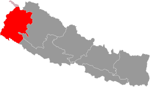
Sudurpashchim Province (Nepali: सुदूरपश्चिम प्रदेश, Sudūrapaścima prāntaharū; transl. Far-West Province) is one of the seven provinces established by the new constitution of Nepal which was adopted on 20 September 2015.[1] It borders the Tibet Autonomous Region of China to the north, Karnali Province and Lumbini Province to the east, and India's states of Uttarakhand and Uttar Pradesh to the west and south, respectively. The province covers an area of 19,999.28 km2, or about 13.55% of the country's total area.
Initially known as Province No. 7, the newly elected Provincial Assembly adopted Sudurpashchim Province as the permanent name for the province in September 2018. As per a 28 September 2018 Assembly voting, the city of Godawari was declared the capital of the province, but Dhangadhi serves as the temporary capital.[2][3] The province is coterminous with the former Far-Western Development Region, Nepal. The three major cities in terms of population and economy are Dhangadhi, Bhimdutta (Mahendranagar), and Tikapur.[4]
Etymology
editPreviously, Sudurpashchim Province was a development region of Nepal with the same territory. Far-Western Development Region was official name of this region. It is located at the western end of the country. Sudurpashchim was Nepali term of Far-Western region.
History
editDoti was an ancient kingdom in the far western region of Kumaon which was formed after the disintegration of the Katyuri Kingdom of Kumaon around the 13th century.[5] Doti was one of eight different princely states the Katyuri Kingdom was divided into eight for their eight prince's and became different independent kingdoms; Baijnath-Katyuri, Dwarahat, Doti, Baramandal, Askot, Sira, Sora, Sui (Kali Kumaon). Later on, the whole land between Ramganga on the west (Uttarakhand) and the Karnali on the east (which divides the far western region from other parts of Nepal), came under the Raikas after the origin of Raikas of Katyuris in Doti.[6] "Brahma Dev Mandi" at Kanchanpur District of Mahakali Zone was established by Katyuri king Brahma Dev.[7] Before the announcement of new provinces in Nepal, the area of this province was known as Far-Western development region of Nepal. When created there were no changes made in the province.[citation needed]
Raikas of Doti
editNiranjan Malla Dev was the founder of Doti Kingdom around the 13th century after the fall of the Katyuri Kingdom. He was the son of Last Katyuris of united Katyuris kingdom.[8]
Kings of Doti were called Raikas (also Rainka Maharaj).[9] Later on Raikas, after defeating the Khas Malla of Karnali Zone, were able to establish the strong Raikas Kingdom in Far Western Region and Kumaon which was Doti.
Mughal invasion
editDuring the period of Akbar's rule in the 16th century, the Mughals had attacked the Raikas of Doti. They invaded Ajemeru, the capital of the Raika Kingdom. Ajemeru is now in Dadeldhura District of the far western region of Nepal. Hussain Khan, army chief of Akbar residing in Lucknow had led the attack. According to `Abd al-Qadir Badayuni (c. 1540 - 1615), Indo-Persian historian during Mughal Empire, Mughal Army chief of Lucknow, Hussian Khan, lured by the wealth and treasures of the kingdom of the Raikas, wanted to plunder the region, this being the motive behind the assault, but they did not succeed.[10]
Conflict with Gorkha
editThe historic place of war between the Khas Doti Kingdom and Nepal (Khas Gorkha kingdom) during the period of Gorkha/Khas Expansion in 1790, according to the history of Nepal, is Nari-Dang, on the bank of the Seti River. The Dumrakot was the base of the Khas Doti Kingdom for fighting against the Own Khas Gorkhalis.[citation needed]
Khairgarh-Singhai State
editRaja Deep Shahi was expelled from Nepal in 1790 A.D and on arriving at Terai of Oudh (now Lakhimpur Kheri District of Uttar Pradesh of India) he established Khairgarh-Singhai State in Khairigarh under British India.[11] Kanchanpur Praganna (present Kanchanpur and Kailali districts) was also the parts of his State or Zamindari. He succeeded in defeating the Banjaras rural of Khairigarh and establishing himself in that Pargana and in parts of Bhur. His state was merged with India In 1947 after Indian Independence.
Geography
editSudurpashchim Province covers 19,539 km2 i.e. 13.27% of the total area of the country. In the total area of the province, the mountainous terrain is 7,932.834 square km. (40.60%), hilly terrain 6,748.7706 km2. (34.54%) and Terai area is 4,857.3954 km2. (24.86%) belongs to This province has more mountainous and mountainous terrain. This province is located in the far western part of the state of Nepal. Two districts of this province (Kailali and Kanchanpur) are located in Terai region, four (Doti, Dadeldhura, Achham, and Baitadi) are in hilly region and three (Darchula, Bajhang, and Bajura) are in the Himalayan region.[12] Karnali River flows in the east, Seti River in the mid and Mahakali River flows to the west of this province.
Mountains
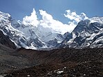
editMt. Api (7132 m.), Mt. Saipal (7025m), Bobaye(6,808m), Nampa (6755m), Om Parvat (5590m) and Jethi Bahurani (6850m) are the major mountain peaks of this province.
| Mountains | Elevation
(meters) |
District | Range | Additional information |
|---|---|---|---|---|
| Api | 7,132 | Darchula District | Yoka Pahar Gurans Himal | First ascent in 1960 AD |
| Saipal | 7,031 | Bajhang District | Western Nepal Himalaya | First ascent in 1960 AD |
| Jethi Bahurani | 6,850 | Darchula/Bajhang | Himalayas | First ascent in 1978 AD[13] |
| Bobaye | 6,808 | Darchula/Bajhang | Byas Rishi Himal | First ascent in 1996 AD |
| Nampa | 6,755 | Darchula | Gurans | First ascent in 1972 AD[13] |
| Om Parvat | 5,590 | Darchula | Himalayas | First ascent in 2004 AD |
Government and administration
editThe Governor acts as the head of the province while the Chief Minister is the head of the provincial government. The Chief Judge of the Dipayal High Court is the head of the judiciary.[14] The present Governor, Chief Minister and Chief Judge are Ganga Prasad Yadav (governor), Kamal Bahadur Shah (chief minister) and Yagya Prasad Basyal.[15][16] The province has 53 provincial assembly constituencies and 16 House of Representative constituencies.[17]
Sudurpashchim Province has a unicameral legislature, like all of the other provinces in Nepal. The term length of the provincial assembly is five years. The Provincial Assembly of Sudurpashchim Province is temporarily housed at the District Coordination Committee Hall in Dhangadhi.[18]
Administrative subdivisions
editThe province is divided into nine districts, which are listed below. A district is administrated by the head of the District Coordination Committee and the District Administration Officer. The districts are further divided into municipalities or rural municipalities. The municipalities include one sub-metropolitan city and 33 municipalities. There are 54 rural municipalities in the province.[19]
Tourism
editThe Sudurpaschim province, is one of Nepal's best-kept secrets. It is raw, untouched and extremely beautiful. This place has it all – from mountains to meadows, from wildlife to wilderness. It is a region that is so underrated that it hardly sees any tourists.[20]
Ghodaghodi Lake
editThe Ghodaghodi Tal is in the southern region of the Sudurpaschim province and is the largest lake in the province. It is home to around 140 bird species including the crested serpent eagle, grey-headed eagle, pochard and darter. Nearby are 13 other shallow lakes and ponds that create a unique landscape. Other wild animals here include the otter, gharial and the Bengal tiger.
Shuklaphanta National Park
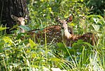
editWest of the Ghodaghodi lake is the Shuklaphanta National Park, which is probably the largest grassland in Sudurpaschim. Home to swamp deer, this national park is one of the prettiest national parks in the country. Like the lake, the national park also sees a lot of migratory birds and is also home to elephants, tigers and gharials. Back in the 1970s, the area was a hunting ground for the royals of Nepal, but things have changed as it is a protected zone now. The jungle and the park are not fully explored. The place is also home to Rana Tharus, one of the earliest inhabitants of the Terai.
Khaptad National Park
editThis is the heart and soul of the Sudurpaschaim province. This hilly plateau is the most popular place in the region. The air here is fresh and the terrain is lush green. There is a lot of flora and fauna in the Khaptad area, including musk deer, wild boar, and birds like the chyakhura, kalij and danphe.
-
Khaptad Triveni
-
Khaptad Lake at Khaptad National Park
-
Khaptad during snow fall
-
Mountains from Khaptad National Park
-
Meadows of Khaptad National Park
Ramaroshan area
editOut of all the places in the Sudurpaschim province, this is arguably the most underrated area. Located in the Achham District there are 12 lakes in the conservation area along with 18 meadows that give the place a unique landscape. From here, mountains like Saipal and Api can also be seen along with the Budhigankadi river basin. It is also home to tall cliffs that the locals climb to harvest honey.
Badimalika
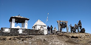
editThere is something ancient about Badimalika. Maybe it is the landscape or maybe it is just the fact that it is a holy site, Badimalika is a must-visit place. The scenery changes every season.
-
Trails to Triveni from Badimalika
-
View from Badimalika Temple
-
Bells seen at Badimalika
During the spring and monsoon, it is lush green while during the autumn, the green grass turns brown. In the winter, the place becomes even pretty with patches of snow all over the hills and meadows. There are a few lakes. The place is ideal for trekkers.
Api Nampa Conservation Area
editApi Nampa is the youngest conservation area in the country and one of the most preserved. Nestled in the northwest side of the country, it is untouched. The valley between Mount Api and Mount Nampa is one of the best parts of the conservation area as it is full of meadows, oak trees and coniferous forests. Animals like the snow leopard are quite common in the area.
Mount Saipal
editMount Saipal in Sudurpaschim is popular among a niche group of climbers and trekkers. Getting to the Saipal base camp is not easy, but it is worth it. Walking on empty trails with a small group of people and sleeping on tents enjoying the night sky is what should expect from this trek. It takes past the Bajhang District, past dense forests and a few local settlements. The best time to trek this region is between mid-October to the end of November, the festive months of Nepal, as the harvest has cleared fields to camp. The trek is quite challenging because it is less popular among tourists, is raw and unexplored. There are no facilities for lodging, and the trekkers have to be self-sufficient with tents and other logistics.
Surma Sarovar
editSurma Sarovar is one of the hidden gems in the Sudurpaschim region. Located at an altitude of 4,300 metres, the trail to get there is not easy. walk past high ridges that get to by crossing passes and also get to walk past small lakes and ponds along with meadows with mountains like Jethi Bahurani. The lake is said to be holy, as people consider it an option to the holy Mansarovar lake in Tibet.
Budhinanda Tal
editAn isolated lake in the middle of nowhere is another trek that is not for the faint-hearted. It takes around 13 days to complete. Walking steep cliffs and the base of hills of Sudurpaschim, this tough trek will test both body and mind. Every year people get lost here so do not venture out alone and take a local along. That way, can enjoy the views that the place offers. The best time to go here is during Janai Purnima when a large group of pilgrims from the district go there. But, locals say that visiting the place during autumn is also good given you take a local along.[20]
Garva Durbar
editIt was constructed around 100 years ago by Khadga Shumsher Jung Bahadur Rana on 13 ropanis of land. It was used by the Ranas as a resting spot for when they travelled from the plains to the hills. Built in 1927 AD, the three-storey palace has 83 windows and 53 doors.
Ugratara Temple
editThe Ugratara temple is a famous religious and tourist temple in the far western province. It is located about four kilometers west of Dadeldhura at Amargadhi Municipality-7. This temple is considered to be one of the nine Bhagwati temples in the far west of Nepal. It is built in pagoda style. It is the religiously important temple of Hinduism and is also rich in its art and architecture. The idol of Goddess Parvati is the main idol of the temple.The temple was later renovated by Naga Malla, the King of Doti, and King Birendra also assisted in the further renovation.
Rupaligad Waterfall
editRupaligad Waterfall is located in Rupal, Dadeldhura, Sudurpashchim Province.
Malikarjun Temple
edit- Situated 46 km (29 mi) from Khalanga in Malikarjun VDC, the Malikarjun Temple[21] contains idols of Lord Shiva and Goddess Parvati.[citation needed] Malika is worshipped as Parbati while Arjun represents Shiva. Devotees throng this temple every year during the months of Ashadh and Kartik by Nepali calendar. Gaura Festival is also celebrated here with highly population of Darchula in this temple. This temple is also famous for a journey which is done by walking a long and ending it in this temple.[22] It is very famous in Darchula District.[23]
Nateshwori Temple
editThe major festivals of the temple are Janai Purnima and Chaite Dashain on the very day devotees form all over Nepal and also from India come to visit.
Though situated on the lap of Badimalika, this temple (नाटेश्वरी) is considered as the belongings (elder sister) of Malika Devi. Rituals of Nateshwori are carried out by two sets of priests; one being the Thakuri priests and other the Bhramin Joshi. Shahi Thakuri of Khirpata and Joshi Bhramin of Belkatte are the ones who performs the ritual and can touch the deity. This temple is opened only during big festivals and on other few special days, the daily rituals of the temple are performed in the Bhandarghar (भण्डारघर) in Thakuribada (ठकुरीवाडा) by Shahi Thakuri priests.
The temple of Goddess Shaileshwari is situated at Silgadhi in Doti district. It is one of the most famous shrines in the mid-western and far-western hills of Nepal.
There is mention of the place in the Skanda Purana. The deities in the temple complex include a Shiva lingam, Chaturbhuj Narayan, Ganesh, Bhairab and Masta. Special pujas are offered here during the Dashain festival.
Baidyanath Dham
editBaidyanath Dham, one of the four shrines of Nepal,[24] is a shrine of Lord Shiva located in Achham District in the confluence of the Budhi Ganga and Saraswati rivers in Achham district.[25] The shrine has a school to teach Ved called Ved Bidyashram.[26] In 2020, the government allocated NPR 2 million for Baidyanath Dham to upgrade Ved Bidyashram.[27]
In Shivaratri pilgrims from Nepal and India visit this place.
Tripura Sundari Temple
editTripura Sundari is a religious Hindu temple located in Dasrathchand municipality of Baitadi district Nepal about 10 km west (about 20 minutes drive from headquarter) from headquarters of Baitadi. It is one among the seven Bhagwati temples of Nepal. This beautiful temple is located in the middle of the village Tripura in the uphills. Tripura Sundari is dedicated to the goddess Durga. The temple is painted with red which is also considered to be the symbol of the goddess Durga also identified as Adi Parashakti, goddess of war, a symbol of positivity (Divine forces), a hope. According to Hindu mythology, she is a warrior form of goddess Parvati wife of Shiva. She is usually depicted riding a lion and with 10 arms, each arm holding the special type of weapon given by other gods to her for her battle against the buffalo demon. The temples borrow a long story behind its creation and evolution in it. There are altogether seven Bhagwati Temples (Temples of Goddess Durga) in Baitadi. It is believed that these temples seven are devoted to the seven sisters of goddess Durga. This temple is dedicated to Ransaini (one sister among seven) so the temple is also known as Ransaini Temple.
Many festivals such as Dashain, Gaura, Sankranti, and Jaat are occasionally celebrated in the Temple. Many people from Nepal and India come here for the occasions to celebrate festivals and to worship goddess Bhagwati for their better and happy life and to get blessed by the goddess Durga.
Bedkot Lake
editLingaa Temple
editLingaa Temple is situated in kanchanpur district daije area.
Education
editAccording to the census of 2021, Sudurpashchim's literacy rate is 76.2%. 83.6% of males and 69.4% of females are literate.[28]
University 1. Sudurpaschim University is a university in Nepal, located in Mahendranagar, Kanchanpur. It was established in August 2010 (2067 BS) by the Act of the Constituent Assembly by the Government of Nepal. It came into operation in 2011, after the appointment of the university officials. Prime Minister of Nepal serves as the Chancellor of the university.
2. SHAHEED DASHRATH CHAND NATIONAL UNIVERSITY OF HEALTH SCIENCES Geta Medical College, which is located in Dhangadhi, Kailali district of Nepal, is set to be promoted as Nepal’s first national health science university. The university will be named after Shaheed Dasharath Chand, a martyr in Nepal’s struggle for democracy. Prime Minister Pushpa Kamal Dahal, also known as Prachanda, announced this during a program organized by Geta Medical College. By Ashadh 2080, 12 structures’ construction projects are expected to be finished. The college’s construction has cost a total of Rs 5.4 billion so far. [29]
Kailali Multiple Campus
- Kailali Multiple Campus (Nepali: कैलाली बहुमुखी क्याम्पस) is one of the constituent campuses of Far-western University located in Dhangadi of western Nepal.[30] The campus was established in 1980 as a constituent campuses of Tribhuvan University, however the affiliation was changed in 2021 based on government decision.[31][32] The campus is recognized by University Grants Commission since 2075 BS (2018-2019).[33]
Sports
edit- The Dhangadhi city has its own cricket league, Dhangadhi Premier League. Dhangadhi Rangsala with a capacity of 10,000+ spectators is the football stadium in the city. The Khaptad Gold Cup is held in the stadium. DPL is held on Fapla International Cricket Ground. Sudurpashchim Royals will be franchise based team of Nepal Premier League.
Roadways
editHighways connects all nine districts of Sudurpaschim Province. Mahakali Highway and Seti Highway are major highways of this province. Mahakali Highway connects seven hilly districts to Terai region. The highway connects major trade routes Dhangadhi and Attariya.
The Karnali bridge lies in Mahendra Highway at Chisapani at the border of Kailali and Bardiya district & connects Sudurpashchim Province with Lumbini Province and Karnali Province. The bridge site is 500 km from the capital city of Kathmandu, and 86 km from the closest airport facilities in Dhangadhi. The design of the bridge and its location have made it a tourist attraction for domestic and international visitors. The nearest city to the Karnali Bridge is the town of Chisapani in Far-Western Region, Nepal.[34] Postal Highway, Seti Highway, Mahendra Highway and Mahakali Highway are the major highways of Sudurpashchim Province, Nepal. Mahakali Corridor is a North-South Corridor project which connects India on South and China on North is an ongoing highway project which will be alternative to Mahakali highway which connects Brahmdev-Jogbuda-Dadeldhura-Julaghat, Baitadi-Darchula-Chhangru-Tinker.
Demographics
editThe province has a population of 2,552,517 which is 9.63% of the total population of Nepal. The population density is about 130 persons per square kilometer. The province has a population growth rate of 1.53%. The sex ratio is 912 males for 1000 females, with a total of 1,217,887 males and 1,334,630 females recorded in 2011. The urban population of the region is 1,504,279 (58.9%) and the rural population is 1,048,238 (41.1%).[35]
Ethnic groups
editThe Khas/Chhetri are the largest Indigenous group, making up 44.09% of the population. The Tharu are the second largest, making up 17.15%. Other Khas groups including Hill Brahmin, Kami, Thakuri, Damai, Sarki, Lohar and Sanyasi make up 11.90%, 7.22%, 4.40%, 2.56%, 1.67%, 1.17% and 1.01% of the population. There are some Magars (2.18%) as well.[36]
Languages
editThe vast majority of the population speaks language varieties closely related to Nepali, if not mutually intelligible. Eastern dialects such as Bajauri and Achhami are closer to the Khas Bhasha spoken in Karnali province. The main dialect in the province is Doteli, spoken in the central part of the province, which gradually gets closer to Kumaoni spoken on the Indian side of the border. Nearly the entire Terai population spoke Tharu until the 1950s, when many Doteli and Nepali speakers from the hills migrated to the Terai. The local Tharu variant has influence from Nepali and the Hindi dialects spoken in the plains to the south across the border. The largest Sino-Tibetan language is Magar, although there are still some speakers of Byangsi in the higher mountain regions near Tibet.
The Language Commission of Nepal has recommended Dotyali and Tharu as official language in the province. The commission has also recommended Baitadeli, Achhami, and Bajhangi to be additional official languages, for specific regions and purposes in the province.[37]
Religion
editReligion in Sudurpashchim Province
Hinduism is followed by most of the people of this province, with 97.23%. Among entire population 1.09% of people follows Christianity, 1.07% of people follows Buddhism and 0.23% of population follows Islam in this province.[38]
| Rank | District | Pop. | Rank | District | Pop. | ||||
|---|---|---|---|---|---|---|---|---|---|
| Dhangadhi Mahendranagar |
1 | Dhangadhi | Kailali | 147,741 | 11 | Bhajani | Kailali | 51,845 | Godawari Tikapur |
| 2 | Mahendranagar | Kanchanpur | 104,599 | 12 | Bedkot | Kanchanpur | 49,479 | ||
| 3 | Godawari | Kailali | 78,018 | 13 | Shuklaphanta | Kanchanpur | 46,834 | ||
| 4 | Tikapur | Kailali | 76,984 | 14 | Mahakali | Kanchanpur | 39,253 | ||
| 5 | Ghodaghodi | Kailali | 75,586 | 15 | Purchaudi | Baitadi | 39,174 | ||
| 6 | Lamki Chuha | Kailali | 75,425 | 16 | Parshuram | Dadeldhura | 34,983 | ||
| 7 | Krishnapur | Kanchanpur | 56,643 | 17 | Dasharath Chand | Baitadi | 34,575 | ||
| 8 | Gauriganga | Kailali | 55,314 | 18 | Sanphebagar | Achham | 33,788 | ||
| 9 | Punarbas | Kanchanpur | 53,633 | 19 | Bungal | Bajhang | 33,224 | ||
| 10 | Belauri | Kanchanpur | 53,544 | 20 | Dipayal Silgadhi | Doti | 32,941 | ||
See also
editReferences
edit- ^ "Nepal Provinces". statoids.com. Retrieved 21 March 2016.
- ^ "Prov 7 named Sudurpashchim amid objection from NC, RJP". The Himalayan Times. 28 September 2018. Archived from the original on 22 November 2022. Retrieved 1 October 2018.
- ^ "Province 7 named Sudurpashchim, Godawari capital". The Kathmandu Post. 28 September 2018. Retrieved 1 October 2018.
- ^ "Nepal Provinces". www.statoids.com.
- ^ Dr.Y.S Kathoch, A New History of Uttarakhand; On Katyuri Dynasty "Around,13th Century Katyuri Dynasty established in Ranachulihat was broken into many sections" Doti was among them
- ^ Advin T. Atkinson; Gazetteer Hindi Edition (2003); He wrote (Page 274) Whole territory to the east of Ram gang was belongs to Raikas during the late 16th century.
- ^ Dr. Madam Chandra Bhatt; A New History of Uttarakhand (2006): " Champawat ke Chand Raja.
- ^ Dr. Y. S. Kathoch; A New History of Uttarakhand (2006). Founder of Doti was Niranjan Mall Dev.
- ^ Badri Datt Pandey; History of Kumaun (1937)
- ^ "Kumaon History". Thekumaonhills.com. 29 March 1947. Archived from the original on 19 February 2020. Retrieved 4 June 2015.
- ^ [1][dead link]
- ^ "प्रदेश परिचय | प्रदेश प्रमुखको कार्यालय". oph.sudurpashchim.gov.np. Retrieved 31 July 2023.
- ^ a b Annapurna, Kris (25 February 2022). "Gurans Himal: Stories From the Far Western Himalaya » Explorersweb". Explorersweb. Retrieved 4 August 2023.
- ^ "High Courts get their chief judges". Retrieved 27 April 2018.
- ^ "Trilochan Bhatta becomes Province 7 chief minister". The Himalayan Times. 16 February 2018. Retrieved 28 April 2018.
- ^ "President of Nepal administers oath to Chiefs of seven provinces | DD News". ddnews.gov.in. Retrieved 27 April 2018.
- ^ "CDC creates 495 constituencies". The Himalayan Times. 31 August 2017. Retrieved 27 April 2018.
- ^ "Preparations underway for assembly meeting". The Himalayan Times. 31 January 2018. Retrieved 28 April 2018.
- ^ "स्थानिय तह". 103.69.124.141. Retrieved 27 April 2018.
- ^ a b diwakar (23 November 2021). "9 hidden gems in Nepal's Sudurpaschim that should be on your next bucket list - OnlineKhabar English News". Retrieved 26 September 2023.
- ^ "Shree Shailya Shikhar Malikarjun Temple".
- ^ "Malikarjun Jatra Darchula: मालिकार्जुन जात्राः मडकि जातः the Journey ।। यात्रा — MyVideo".
- ^ "Pilgrimage Sites".
- ^ "अगाडि बढ्दै अत्तरिया". Retrieved 15 August 2020.
- ^ Khatri, Khamma. "Achham celebrates Makar Sakranti performing cultural dances". My Republica. Retrieved 15 August 2020.
- ^ "अछामको वैद्यनाथमा दर्शनार्थी बढ्दै". Radio Nepal. Retrieved 15 August 2020.
- ^ Setopati, Setopati. "Oli govt doles out Rs 13.9m in three months". Setopati. Retrieved 15 August 2020.
- ^ "literacy | national_population and housing_census_year results". censusnepal.cbs.gov.np. Retrieved 3 August 2023.
- ^ "All 16 Universities in Nepal". 7 April 2023.
- ^ "कैलाली बहुमुखी क्याम्पस बन्यो सुप विश्वविद्यालयको आङ्गिक". देशसञ्चार. 18 January 2021. Retrieved 8 April 2021.
- ^ Collegenp. "Dhankuta Multiple Campus, Dhankuta". Retrieved 13 March 2021.
- ^ Sen, Sandeep (10 December 2020). "Students padlock exam controller's office in Kailali". The Himalayan Times. Retrieved 8 April 2021.
- ^ "Kailali Multiple Campus". Retrieved 8 April 2021.
- ^ "Chisapani: Nepal's untamed far west - OnlineKhabar English News". 28 September 2018. Retrieved 18 July 2022.
- ^ "Nepal Census 2011" (PDF). UN Stats.
- ^ "National Data Portal-Nepal". nationaldata.gov.np. Retrieved 26 May 2021.
- ^ a b "सरकारी कामकाजको भाषाका आधारहरूको निर्धारण तथा भाषासम्बन्धी सिफारिसहरू (पञ्चवर्षीय प्रतिवेदन- साराांश) २०७८" (PDF). Language Commission (in Nepali). Language Commission of Nepal. Archived from the original (PDF) on 6 September 2021. Retrieved 28 October 2021.
- ^ "National Data Portal-Nepal". nationaldata.gov.np. Retrieved 31 July 2023.

