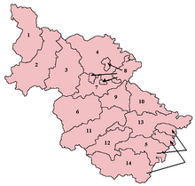
Strafforth and Tickhill /ˈstræfərð/, originally known as Strafforth, was the southernmost wapentake in the West Riding of Yorkshire, England. The west of the district, plus a detached area in the east, constituted the Upper Division, while the central area and a detached part in the extreme east constituted the Lower Division.

Parishes in the Upper Division included Aston, Barnby Dun, Braithwell, Conisbrough, Dinnington, Ecclesfield, Firbeck, Handsworth, Harthill, Hatfield, Hooton Roberts, Laughton-en-le-Morthen, Maltby, Ravenfield, Rawmarsh, Rotherham, Sheffield, Slade Hooton, South Anston, Sprotborough, Stone, Thorpe Salvin, Thrybergh, Todwick, Treeton, Wales, Wath-upon-Dearne, Whiston, Wickersley and parts of Finningley.
The Lower Division included the parishes of Adwick-le-Street, Adwick-upon-Dearne, Arksey, Armthorpe, Bolton-upon-Dearne, Brodsworth, Darfield, Doncaster, Fishlake, High Melton, Hooton Pagnell, Kirk Sandall, Mexborough, Rossington, Thorne, Thurnscoe, Tickhill, Wadworth, Warmsworth, parts of Blyth, Nottinghamshire and the extra-parochial area of Hampole.
The original meeting place of the wapentake is unknown, but may have been the future site of Conisbrough Castle.[1]
The Earldom of Strafford takes its name from a variant of this district name, wherein the first incumbent Thomas Wentworth, 1st Earl of Strafford originated.
See also
editReferences
edit53°25′55″N 1°06′32″W / 53.432°N 1.109°W