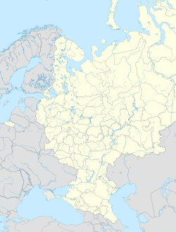
Slavskoye (Russian: Сла́вское; German: Kreuzburg in Ostpreußen; Polish: Krzyżbork; Lithuanian: Kryžbarkas) is a settlement in the Bagrationovsky District, Kaliningrad Oblast, Russia, located 20 kilometers (12 mi) south of Kaliningrad.
Slavskoye
Сла́вское | |
|---|---|
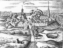
 A 1684 depiction of the town | |
| Coordinates: 54°30′N 20°26′E / 54.500°N 20.433°E | |
| Country | Russia |
| Federal subject | Kaliningrad Oblast |
| Administrative district | Bagrationovsky District |
| Founded | 1240 (Julian) |
| Elevation | 47 m (154 ft) |
| Population | |
• Total | 248 |
| Time zone | UTC+2 (MSK–1 |
| Postal code(s)[3] | 238420 |
| OKTMO ID | 27703000336 |
History
editIn 1240, the Teutonic Knights founded a castle (Creutzburg or Kreuzburg, meaning 'cross castle') in the region of Natangia at the location of an Old Prussian settlement. In 1315 Kreuzburg received its town privileges. Throughout the Hunger War in 1414, 71 houses were destroyed and five citizens were killed by the Polish troops. In 1440 the town joined the anti-Teutonic Prussian Confederation, at the request of which Polish King Casimir IV Jagiellon signed the act of incorporation of the region to the Kingdom of Poland in 1454.[4] During the subsequent Thirteen Years' War the town suffered heavy damages, and after the war, per the peace treaty signed in Toruń in 1466, it became a part of Poland as a fief held by the Teutonic Knights.[5] The town suffered damages in the Polish-Teutonic War of 1519–1521, which broke out after the Grand Master of the Teutonic Order refused to pledge allegiance to Poland. The war resulted in the secularization of the Teutonic Knights in 1525, and the establishment of the Duchy of Prussia, which remained a fief of Poland.
In 1701, the town became part of the Kingdom of Prussia. It was badly affected by the Napoleonic Battle of Eylau in February 1807 and almost totally destroyed by a fire catastrophe on May 10, 1818, when 152 buildings burned down. Only the church, the vicarage, and the schoolhouse were not affected. Due to that disaster the regional administration was transferred to Preußisch Eylau. In 1871, the town became part of Germany.
Kreuzburg was connected to the railway system in 1908.
Throughout the Soviet East Prussian Offensive in February 1945 Kreuzburg was again largely destroyed and transferred from Germany to the Soviet Union according to the 1945 Potsdam Conference. Its German population was expelled, and the name was changed from Kreuzburg to Slavskoye.
Population
edit- 1740: 986
- 1816: 1,700
- 1823: 1,352
- 1843: 1,809
- 1875: 2,004
- 1885: 1,976, including 17 Catholics, 11 Jews
- 1910: 1,726
- 1939: 2,005
Notable residents
edit- Hermann von Boyen (1771–1848), Prussian fieldmarshal
- Michael Kongehl (1646–1710), baroque poet
- Michel Tolkien (1620-?), earliest known paternal ancestor of J. R. R. Tolkien, the English author
References
edit- ^ Russian Federal State Statistics Service (2011). Всероссийская перепись населения 2010 года. Том 1 [2010 All-Russian Population Census, vol. 1]. Всероссийская перепись населения 2010 года [2010 All-Russia Population Census] (in Russian). Federal State Statistics Service.
- ^ "Об исчислении времени". Официальный интернет-портал правовой информации (in Russian). 3 June 2011. Retrieved 19 January 2019.
- ^ Почта России. Информационно-вычислительный центр ОАСУ РПО. (Russian Post). Поиск объектов почтовой связи (Postal Objects Search) (in Russian)
- ^ Górski, Karol (1949). Związek Pruski i poddanie się Prus Polsce: zbiór tekstów źródłowych (in Polish). Poznań: Instytut Zachodni. pp. XXXVIII, 54.
- ^ Górski, pp. 96-97, 214-215
Bibliography
edit- Horst Schulz, Der Kreis Pr. Eylau, Verden/Aller 1983


