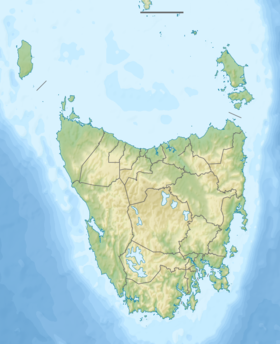
The Serpentine River is a major perennial river located in the south-west and western regions of Tasmania, Australia.
| Serpentine | |
|---|---|
| Location | |
| Country | Australia |
| State | Tasmania |
| Region | South-west, Western |
| Physical characteristics | |
| Source | Wilmont Range |
| • location | Lake Pedder |
| • coordinates | 42°56′S 146°7′E / 42.933°S 146.117°E |
| • elevation | 313 m (1,027 ft) |
| Mouth | Gordon River |
• location | Gordon Splits |
• coordinates | 42°44′53″S 145°57′39″E / 42.74806°S 145.96083°E |
• elevation | 122 m (400 ft) |
| Length | 26 km (16 mi) |
| Basin features | |
| River system | Gordon-Franklin catchment |
| Reservoir | Lake Pedder |
| [1] | |
Course and features
editThe Serpentine River is almost entirely inundated by the current Lake Pedder. Before its flooding the river rose at the northwestern corner of the original Lake Pedder and drained the eastern slopes of the Frankland and Wilmot ranges. It flows generally north by northwest, joined by one minor tributary. The river is impounded by the Serpentine Dam, one of three dams that create Lake Pedder, and then flows towards the Gordon Splits where it reaches its confluence with the Gordon River.[2]
See also
editReferences
edit- ^ "Map of Serpentine River, TAS". Bonzle Digital Atlas of Australia. 2015. Retrieved 30 June 2015.
- ^ Flanagan, Richard (1985). A terrible beauty: history of the Gordon River country. Richmond, Vic.: Greenhouse. ISBN 0-86436-001-0.
Further reading
edit- Gee, H.; Fenton, J., eds. (1978). The South West Book - A Tasmanian Wilderness. Melbourne: Australian Conservation Foundation. ISBN 0-85802-054-8.
- Kerr, Garry; McDermott, Hary (2000). The Huon Pine Story (The History of Harvest and Use of a unique Timber. Portland, Victoria: Mainsail Books. ISBN 0-9577917-0-4.
- Lines, William J. (2006). Patriots : defending Australia's natural heritage. St. Lucia, Qld.: University of Queensland Press. ISBN 0-7022-3554-7.
- Neilson, D. (1975). South West Tasmania - A land of the Wild. Adelaide: Rigby. ISBN 0-85179-874-8.
