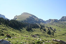
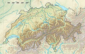
The Selun is one of the peaks of the Churfirsten range, located in the Appenzell Alps. It lies between the valley of Toggenburg and Lake Walenstadt in the canton of St. Gallen. The summit is easily accessible by a trail on the northern side.
| Selun | |
|---|---|
 Selun peak in the background, with Vorderselun (Vorder Selunalp) in the foreground | |
| Highest point | |
| Elevation | 2,205 m (7,234 ft) |
| Prominence | 158 m (518 ft)[1] |
| Parent peak | Frümsel |
| Coordinates | 47°9′10″N 9°15′20″E / 47.15278°N 9.25556°E |
| Geography | |
| Location | St. Gallen, Switzerland |
| Parent range | Churfirsten, Appenzell Alps |
The peak is named for the extended alpine pasture Selunalp to the peak's north-west, situated above c. 1700 m.[2] The name's etymology is uncertain, possibly from a *sellonem (Latin sella) "saddle".[3] Named for Selunalp is Johannes Seluner (c. 1828–1898) who was found in 1844 as a feral child living in Wildenmannlisloch cave.
References
edit- ^ Retrieved from the Swisstopo topographic maps. The key col is the Rappenloch (2,047).
- ^ Selunalp in Geographisches Lexikon der Schweiz (1902). Indicated as Vordere Selunalp and Hintere Selunalp on the Siegfried Map (map.geo.admin.ch); note also Selunwald between 1100 and 1500 m, separating Selunalp from the lower Hofstattalp.
- ^ Wilhelm Götzinger, Die romanischen Ortsnamen des Kantons St. Gallen (1891), p. 78. Paul Zinsli, Sprachleben der Schweiz: Sprachwissenschaft, Namenforschung, Volkskunde (1963), p. 297.
External links
edit- Media related to Selun at Wikimedia Commons
- Selun on Hikr
