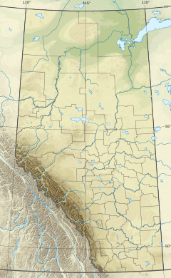
Rat Creek is a tributary to the North Saskatchewan River. Rat Creek was once part of a much larger system which formerly almost connected to the Sturgeon River. However, Rat Creek is now defined as a lost creek, due to the city of Edmonton's encroachment on the surrounding area for urban use. Rat Creek was fed by sloughs that occurred north of Edmonton.
| Rat Creek | |
|---|---|
| Location | |
| Country | Canada |
| Province | Alberta |
| Basin features | |
| River system | North Saskatchewan River |
History of Rat Creek
editRat Creek was once a large water system, which brought water downstream into the North Saskatchewan River. The creek's name refers to muskrats, rather than to any member of the genus Rattus, which were plentiful along the creek when the region was an active part of the North American fur trade.[1]
Rat Creek lies on the northern side of Edmonton's river valley, and its original full route is comparable to the south side's Mill Creek and Whitemud Creek as one of the longest creeks in the city. A section of the North-West Mounted Police camped near Rat Creek on their way to establish themselves at Edmonton in 1874, moving to Fort Saskatchewan the following year. They complained that their horses and wagons were constantly mired in the thick mud and the many sloughs that were present in this area.
Almost 20 years later, the NWMP contingent at Fort Saskatchewan were rushed into Edmonton to suppress the so-called "Rat Creek Rebellion." Militant Edmontonians stopped the force at the bridge crossing Rat Creek, hence the uprising's name. To settle the situation, the government backed down to the extent of maintaining a land titles office in Edmonton - but starting another one at the end-of-steel in southside Old Strathcona.[2][3]
Post-1904 Edmonton development
editIn the early years following Edmonton's 1904 incorporation as a city, Rat Creek was an area used extensively as a city dump, which filled part of the Kinnaird Ravine. Later, the city decided to fill the creek in and pave it over, gaining more land for development and avoiding the cost of building bridges over it. This affected the creek greatly as it had no longer a way of flowing - progressively draining in the last hundred years, leading to the lost creek designation.[4]
The original route of Rat Creek was in the present neighbourhood of Norwood. The lower reaches of Rat Creek are still visible in Kinnaird Ravine, and it is now fed by storm drain culverts.
Possible city restoration efforts
editRat Creek is a place of interest for many environmentalists, who believe in preserving the natural habitat that the creek provides and re-introducing a natural flow to the creek. Since 1975, the City of Edmonton has developed an extensive North Saskatchewan River valley parks system, which includes stretches up creeks and ravines branching away from the main valley.[5] Over the course of 2016 and 2017, its Planning Department has worked with the community to develop the "Dawson Park & Kinnaird Ravine Master Plan", which reached its penultimate Phase 4 in November 2017.[6] The Phase 4 plan includes restoration and expansion of the creek's native flora, as well as restoration of the natural flow of the lower portion of Rat Creek, from a point near the light rail transit's Stadium Station through to its connection with the North Saskatchewan River.[6] As of November 2018[update], the Design and Build Phases have not yet been funded, and the city's Open Space Planning and Design branch has taken the plan to Edmonton City Council for consideration in the 2019-2022 budget cycle.[7]
References
edit- ^ "Rat Creek". Alberta Avenue Oral History Project. Retrieved 2018-11-15.
- ^ Edmonton Bulletin, June 20, 1892
- ^ Monto, Old Strathcona Edmonton's Southside Roots
- ^ Hughes, Katherine; Dammeyer, Henry (2001). "Lost Creeks and Wetlands of Edmonton". Environmental Research and Studies Centre. University of Alberta. Retrieved 2018-11-15.
- ^ Bergman, Cadence (September 2014). "Plans for Stadium LRT station area" (PDF). Rat Creek Press. Archived from the original on 2016-03-04. Retrieved 2018-11-15.
{{cite news}}: CS1 maint: bot: original URL status unknown (link) - ^ a b "Dawson Park & Kinnaird Ravine Master Plan Phase 4: Final Concept Plan" (PDF). City of Edmonton. 2017-11-21. Retrieved 2018-11-15.
- ^ "Dawson Park and Kinnaird Ravine Master Plan". Open Space Planning and Design, City of Edmonton. 2018-11-15. Retrieved 2018-11-15.
