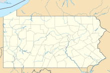
Quakertown Airport (IATA: UKT, ICAO: KUKT, FAA LID: UKT) is a public airport in Bucks County, Pennsylvania, owned by the Bucks County Airport Authority.[1] It is two miles west of Quakertown, Pennsylvania[1] and was dedicated on 22 January 1965.[2] It is home to the Civil Air Patrol Squadron 904.
Quakertown Airport | |||||||||||
|---|---|---|---|---|---|---|---|---|---|---|---|
| Summary | |||||||||||
| Airport type | Public | ||||||||||
| Owner/Operator | Bucks County Airport Authority | ||||||||||
| Serves | Quakertown, Pennsylvania | ||||||||||
| Elevation AMSL | 526 ft / 160 m | ||||||||||
| Coordinates | 40°26′11″N 75°22′49″W / 40.43639°N 75.38028°W | ||||||||||
| Map | |||||||||||
 | |||||||||||
| Runways | |||||||||||
| |||||||||||
| Statistics (2008) | |||||||||||
| |||||||||||
Facilities
editQuakertown Airport covers 122 acres (49 ha) at an elevation of 526 feet (160 m). Its one runway, 11/29, is 3,201 by 50 feet (976 x 15 m) asphalt.[1]
In the year ending 4 September 2008 the airport had 29,642 aircraft operations, average 81 per day: 99% general aviation and 1% air taxi. 88 aircraft were then based at the airport: 89% single-engine, 6% multi-engine, 2% jet, 1% helicopter and 2% ultralight.[1]
See also
editReferences
edit- ^ a b c d e FAA Airport Form 5010 for UKT PDF, effective 2009-07-02.
- ^ "Pennsylvania Aviation History". PennDOT Aviation Bureau. Archived from the original on June 7, 2011. Retrieved 2007-07-23.
External links
edit- Quakertown Airport at Bucks County Airport Authority website
- Civil Air Patrol Squadron 904
- Aerial photo as of 13 April 1999 from USGS The National Map via MSR Maps
- Quakertown Airport (UKT) at PennDOT Bureau of Aviation
- FAA Terminal Procedures for UKT, effective December 26, 2024
- Resources for this airport:
- FAA airport information for UKT
- AirNav airport information for KUKT
- ASN accident history for UKT
- FlightAware airport information and live flight tracker
- NOAA/NWS weather observations: current, past three days
- SkyVector aeronautical chart, Terminal Procedures

