Selected article 1
Portal:Islands/Selected article/1
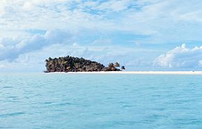
An uninhabited island, desert island, or deserted island, is an island, islet or atoll which lacks permanent human population. Uninhabited islands are often depicted in films or stories about shipwrecked people, and are also used as stereotypes for the idea of "paradise". Some uninhabited islands are protected as nature reserves, and some are privately owned. Devon Island in Canada's far north is the largest uninhabited island in the world.
Small coral atolls or islands usually have no source of fresh water, but occasionally a freshwater lens can be reached with a well. (Full article...)
Selected article 2
Portal:Islands/Selected article/2
Key Biscayne (Spanish: Cayo Vizcaíno) is an island located in Miami-Dade County, Florida, located between the Atlantic Ocean and Biscayne Bay. It is the southernmost of the barrier islands along the Atlantic coast of Florida, and lies south of Miami Beach and southeast of Miami. The key is connected to Miami via the Rickenbacker Causeway, originally built in 1947.
The northern portion of Key Biscayne is home to Crandon Park, a county park. The middle section of the island consists of the incorporated Village of Key Biscayne. The southern part of the island is now protected as Bill Baggs Cape Florida State Park, adjacent to Biscayne National Park, one of the two national parks in Miami-Dade County. (Full article...)
Selected article 3
Portal:Islands/Selected article/3
Japan is an island country in East Asia. Located in the Pacific Ocean off the northeast coast of the Asian mainland, it is bordered on the west by the Sea of Japan and extends from the Sea of Okhotsk in the north to the East China Sea in the south. The Japanese archipelago consists of four major islands—Hokkaido, Honshu, Shikoku, and Kyushu—and thousands of smaller islands, covering 377,975 square kilometres (145,937 sq mi). Japan has a population of nearly 124 million as of 2024, making it the eleventh-most populous country.
The capital of Japan and its largest city is Tokyo; the Greater Tokyo Area is the largest metropolitan area in the world, with more than 37 million inhabitants as of 2024. Japan is divided into 47 administrative prefectures and eight traditional regions. About three-quarters of the country's terrain is mountainous and heavily forested, concentrating its agriculture and highly urbanized population along its eastern coastal plains. The country sits on the Pacific Ring of Fire, making its islands prone to destructive earthquakes and tsunamis. (Full article...)
Selected article 4
Portal:Islands/Selected article/4
Mersea Island /ˈmɜːrzi/ is an island in Essex, England, in the Blackwater and Colne estuaries to the south-east of Colchester. Its name comes from the Old English word meresig, meaning "island of the pool" and thus is tautological. The island is split into two main areas, West Mersea and East Mersea, and connected to the mainland by the Strood, a causeway that can flood at high tide.
The island has been inhabited since pre-Roman times. It was used as a holiday destination in Roman Britain for occupants of Camulodunum (Colchester). Fishing has been a key industry on the island since then, particularly oysters, and along with tourism makes up a significant part of the island's economy. The Church of St Peter & St Paul in West Mersea is thought to have existed since the 7th century, while the Church of St Edmund in East Mersea dates from around the 12th or 13th century. The island became popular with smugglers from the 16th to the 19th century. It became a focal point for troops in both world wars, and a number of observation posts can still be found on the island. Tourism remains popular, and there are a number of beach huts and holiday parks on the island. A week-long festival of boat racing, Mersea Week, takes place every summer. (Full article...)
Selected article 5
Portal:Islands/Selected article/5
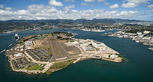
Ford Island (Hawaiian: Poka ʻAilana) is an islet in the center of Pearl Harbor, Oahu, in the U.S. state of Hawaii. It has been known as Rabbit Island, Marín's Island, and Little Goats Island; its native Hawaiian name is Mokuʻumeʻume. The island had an area of 334 acres (135 ha) when it was surveyed in 1825, which was increased during the 1930s to 441 acres (178 ha) with fill dredged out of Pearl Harbor by the United States Navy to deepen the harbor.
The island was the site of an ancient Hawaiian fertility ritual, which was stopped by Christian missionaries during the 1830s. The island was given by Kamehameha I to Spanish deserter Francisco de Paula Marín, and later returned to the monarchy. After the island was bought at auction by James Isaac Dowsett and sold to Caroline Jackson, it became the property of Dr. Seth Porter Ford by marriage and was renamed Ford Island. After Ford's death, his son sold the island to the John Papa ʻĪʻī estate and it was converted into a sugarcane plantation. (Full article...)
Selected article 6
Portal:Islands/Selected article/6

A private island is a disconnected body of land wholly owned by a private citizen or corporation. Although this exclusivity gives the owner substantial control over the property, private islands remain under the jurisdiction of national and sometimes local governments. Their size can vary widely, from that of a typical suburban yard to several hundred square kilometers. (Full article...)
Selected article 7
Portal:Islands/Selected article/7
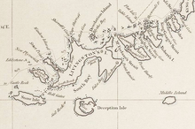
A phantom island is a purported island which was included on maps for a period of time, but was later found not to exist. They usually originate from the reports of early sailors exploring new regions, and are commonly the result of navigational errors, mistaken observations, unverified misinformation, or deliberate fabrication. Some have remained on maps for centuries before being "un-discovered".
Unlike lost lands, which are claimed (or known) to have once existed but to have been swallowed by the sea or otherwise destroyed, a phantom island is one that is claimed to exist contemporaneously, but later found not to have existed in the first place (or found not to be an island, as with the Island of California). (Full article...)
Selected article 8
Portal:Islands/Selected article/8
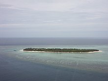
A cay (/ˈkiː, ˈkeɪ/ KEE, KAY), also spelled caye or key, is a small, low-elevation, sandy island on the surface of a coral reef. Cays occur in tropical environments throughout the Pacific, Atlantic, and Indian oceans, including in the Caribbean and on the Great Barrier Reef and Belize Barrier Reef. (Full article...)
Selected article 9
Portal:Islands/Selected article/9
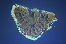
Geologically, a volcanic island is an island of volcanic origin. The term high island can be used to distinguish such islands from low islands, which are formed from sedimentation or the uplifting of coral reefs (which have often formed on sunken volcanos). (Full article...)
Selected article 10
Portal:Islands/Selected article/10

The first island chain refers to the first chain of major Pacific archipelagos out from the East Asian continental mainland coast. It is principally composed of the Kuril Islands, the Japanese archipelago, the Ryukyu Islands, Taiwan (Formosa), the northern Philippines, and Borneo, hence extending all the way from the Kamchatka Peninsula in the northeast to the Malay Peninsula in the southwest. The first island chain forms one of three island chain doctrines within the island chain strategy in the U.S. foreign policy.
Much of the first island chain is roughly situated in waters claimed by China. These include the South China Sea, within the nine-dash line, as well as the East China Sea west of the Okinawa Trough. (Full article...)
Selected article 11
Portal:Islands/Selected article/11

A floating island is a mass of floating aquatic plants, mud, and peat ranging in thickness from several centimeters to a few meters. Sometimes referred to as tussocks, floatons, or suds, floating islands are found in many parts of the world. They exist less commonly as an artificial island. Floating islands are generally found on marshlands, lakes, and similar wetland locations, and can be many hectares in size. (Full article...)
Selected article 12
Portal:Islands/Selected article/12
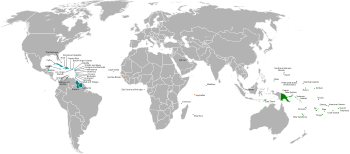
The Small Island Developing States (SIDS) are a grouping of developing countries which are small island countries and small states that tend to share similar sustainable development challenges. These include small but growing populations, limited resources, remoteness, susceptibility to natural disasters, vulnerability to external shocks, excessive dependence on international trade, and fragile environments. Their growth and development are also held back by high communication, energy and transportation costs, irregular international transport volumes, disproportionately expensive public administration and infrastructure due to their small size, and little to no opportunity to create economies of scale. They consist of some of the most vulnerable countries to anthropogenic climate change.
The SIDS were first recognized as a distinct group of developing countries at the United Nations Conference on Environment and Development in June 1992. The Barbados Programme of Action was produced in 1994 to assist the SIDS in their sustainable development efforts. The United Nations Office of the High Representative for the Least Developed Countries, Landlocked Developing Countries and Small Island Developing States (UN-OHRLLS) represents the group of states. (Full article...)
Selected article 13
Portal:Islands/Selected article/13

A river island is any exposed landmass surrounded by river water. Properly defined, it excludes shoals between seasonally varying flows and may exclude semi-coastal islands in river deltas such as Marajó.
These islands result from changes in the course of a river. Such changes may be caused by interactions with a tributary, or by the opposing fluvial actions of deposition and/or erosion that form a natural cut and meander. Nascent vegetation-free shoals and mudflats may dissipate and shift or build up into such islands through deposition; the process may be assisted through artificial reinforcement or natural factors, such as reeds, palms, evergreen trees or willows, that act as obstacles or erosion barriers, so that water flows around them. Islands may be small or large, covering many square kilometers, examples of which are given below. (Full article...)
Selected article 14
Portal:Islands/Selected article/14

An artificial island or man-made island is an island that has been constructed by humans rather than formed through natural processes. Other definitions may suggest that artificial islands are lands with the characteristics of human intervention in their formation process, while others argue that artificial islands are created by expanding existing islets, constructing on existing reefs, or amalgamating several islets together. Although constructing artificial islands is not a modern phenomenon, there is no definite legal definition of it. Artificial islands may vary in size from small islets reclaimed solely to support a single pillar of a building or structure to those that support entire communities and cities. Archaeologists argue that such islands were created as far back as the Neolithic era. Early artificial islands included floating structures in still waters or wooden or megalithic structures erected in shallow waters (e.g. crannógs and Nan Madol discussed below).
In modern times, artificial islands are usually formed by land reclamation, but some are formed by flooding of valleys resulting in the tops of former knolls getting isolated by water (e.g., Barro Colorado Island). There are several reasons for the construction of these islands, which include residential, industrial, commercial, structural (for bridge pylons) or strategic purposes. One of the world's largest artificial islands, René-Levasseur Island, was formed by the flooding of two adjacent reservoirs. Technological advancements have made it feasible to build artificial islands in waters as deep as 75 meters. The size of the waves and the structural integrity of the island play a crucial role in determining the maximum depth. (Full article...)
Selected article 15
Portal:Islands/Selected article/15 Island ecology is the study of island organisms and their interactions with each other and the environment. Islands account for nearly 1/6 of earth’s total land area, yet the ecology of island ecosystems is vastly different from that of mainland communities. Their isolation and high availability of empty niches lead to increased speciation. As a result, island ecosystems comprise 30% of the world’s biodiversity hotspots, 50% of marine tropical diversity, and some of the most unusual and rare species. Many species still remain unknown.
The diversity of species on islands is highly impacted by human activities such as deforestation and introduction of the exotic species. In response, ecologists and managers are directing attention towards conservation and restoration of island species. Because they are simple systems, islands provide an opportunity to study processes of extinction that can be extrapolated to larger ecosystems. (Full article...)
Selected article 16
Portal:Islands/Selected article/16 Falkner Island Light, also known as the Faulkner Island Lighthouse, is a lighthouse in Connecticut, United States, on Falkner Island which is off Guilford Harbor on Long Island Sound. The lighthouse was constructed in 1802 and commissioned by President Thomas Jefferson. The lighthouse has had three keeper's houses: the original house of 1802 was rebuilt in 1851 and then again in 1871. The 1871 keeper's house survived to 1976, when it was destroyed by fire; the Coast Guard repaired and automated the lighthouse two years later. A volunteer group, the Faulkner's Light Brigade, has undertaken the restoration and preservation of the lighthouse since 1991, completing the last major restoration work in March 2011. Access to Falkner Island and the light is restricted during the nesting season of the roseate terns from May to August yearly. The Falkner Island Lighthouse, as the second oldest extant lighthouse in Connecticut, is listed on the National Register of Historic Places. (Full article...)
Selected article 17
Portal:Islands/Selected article/17
Wolfe Island is the largest of the Thousand Islands, and is located at the entrance to the St. Lawrence River in Lake Ontario. It is a piece of land situated between Kingston, Ontario and Cape Vincent, New York. Wolfe Island is included in Frontenac County and the Township of Frontenac Islands. The largest settlement on the island is the village of Marysville.
The island is about 29 kilometres (18 miles) long, with its width varying from around 9 kilometres (6 miles) to a few hundred metres at some points; its area is about 124 square kilometres (48 square miles). To put this into perspective, Wolfe Island is twice the size of the island of Manhattan which is 59.1 square kilometres (22.8 square miles). (Full article...)
Selected article 18
Portal:Islands/Selected article/18
Manitoulin Island (/ˌmænəˈtuːlɪn/ MAN-ə-TOO-lin) is an island in Lake Huron, located within the borders of the Canadian province of Ontario, in the bioregion known as Laurentia. With an area of 2,766 km2 (1,068 sq mi), it is the largest lake island in the world, large enough that it has over 100 lakes itself. In addition to the historic Anishinaabe and European settlement of the island, archaeological discoveries at Sheguiandah have demonstrated Paleo-Indian and Archaic cultures dating from 10,000 BC to 2,000 BC.
The current name of the island is the English version, via French, of the Ottawa or Ojibwe name Manidoowaaling (ᒪᓂᑝᐙᓕᓐᒃ), which means "cave of the spirit". It was named for an underwater cave where a powerful spirit is said to live. By the 19th century, the Odawa "l" was pronounced as "n". The same word with a newer pronunciation is used for the town Manitowaning (19th-century Odawa "Manidoowaaning"), which is located on Manitoulin Island near the underwater cave where legend has it that the spirit dwells. The modern Odawa name for Manitoulin Island is Mnidoo Mnis, meaning "Spirit Island". (Full article...)
Selected article 19
Portal:Islands/Selected article/19
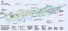
Isle Royale (/ˈrɔɪəl/, ROY-əl) is an island of the Great Lakes located in the northwest of Lake Superior and part of the U.S. state of Michigan. The island and the 450 surrounding smaller islands and waters make up Isle Royale National Park.
Isle Royale is 45 miles (72 km) long and 9 miles (14 km) wide, with an area of 206.73 square miles (535.4 km2), making it the fourth-largest lake island in the world. In addition, it is the largest natural island in Lake Superior, the second-largest island in the Great Lakes (after Manitoulin Island), the third-largest in the contiguous United States (after Long Island and Padre Island), the largest in the contiguous US with no road link to the mainland, and the 33rd-largest island in the United States. (Full article...)
Selected article 20
Portal:Islands/Selected article/20
Olkhon (Russian: Ольхо́н, also transliterated as Olchon; Buryat: Ойхон, Oikhon) is the third-largest lake island in the world. It is by far the largest island in Lake Baikal in eastern Siberia, with an area of 730 km2 (280 sq mi). Structurally, it constitutes the southwestern margin of the Academician Ridge. The island measures 71.5 km (44.4 mi) in length and 20.8 km (12.9 mi) in width.
There are two versions regarding the origin of the name of the island and both are derived from the language of the Buryats, the indigenous people of Olkhon. The first is that the island's name comes from the word oyhon – “woody”, and the second is that it comes from olhan – “dry”. It is still debated which of the two is the actual origin of the name Olkhon as both words describe the island perfectly. Much of the island is still covered by forests and the amount of precipitation is extremely low – about 240 mm (9.4 in) per year. (Full article...)
Selected article 21
Portal:Islands/Selected article/21 Island Conservation is a non-profit organization with the mission to "restore islands for nature and people worldwide" and has therefore focused its efforts on islands with species categorized as Critically Endangered and Endangered on the IUCN's Red List. Working in partnership with local communities, government management agencies, and conservation organizations, Island Conservation develops plans and implements the removal of invasive alien species, and conducts field research to document the benefits of the work and to inform future projects.
Island Conservation's approach is now being shown to have a wider beneficial effect on the marine systems surrounding its project areas. In addition, invasive vertebrate eradication has now been shown to have many benefits besides conservation of species. Specifically, the approach has been found to align with 13 UN Sustainable Development Goals and 42 associated targets encompassing marine and terrestrial biodiversity conservation, promotion of local and global partnerships, economic development, climate change mitigation, human health and sanitation and sustainable production and consumption. (Full article...)
Selected article 22
Portal:Islands/Selected article/22
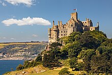
St Michael's Mount (Cornish: Karrek Loos yn Koos, meaning "hoar rock in woodland") is a tidal island in Mount's Bay near Penzance, Cornwall, England (United Kingdom). The island is a civil parish and is linked to the town of Marazion by a causeway of granite setts, passable (as is the beach) between mid-tide and low water. It is managed by the National Trust, and the castle and chapel have been the home of the St Aubyn family since around 1650.
Historically, St Michael's Mount was an English counterpart of Mont-Saint-Michel in Normandy, France, which is also a tidal island, and has a similar conical shape, though Mont-Saint-Michel is much taller. (Full article...)
Selected article 23
Portal:Islands/Selected article/23
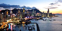
Hong Kong Island (Chinese: 香港島; Jyutping: Hoeng1 gong2 dou2; Cantonese Yale: Hēunggóng dóu) is an island in the southern part of Hong Kong. The island, known originally and on road signs simply as "Hong Kong", had a population of 1,289,500 and a population density of 16,390 per square kilometre (42,400/sq mi), as of 2023[update]. It is the second largest island in Hong Kong, with the largest being Lantau Island. Hong Kong Island forms one of the three areas of Hong Kong, with the other two being Kowloon and the New Territories.
In 1842, following the Qing dynasty's defeat at the First Opium War (1839–1842), Hong Kong Island was formally ceded in perpetuity to the United Kingdom under the Treaty of Nanking. The City of Victoria was then established on the island by British forces in honour of Queen Victoria. At the time, the island had a population of about 3,000 inhabitants scattered in a dozen fishing villages. (Full article...)
Selected article 24
Portal:Islands/Selected article/24
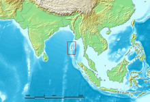
The Andaman Islands (/ˈændəmən/) are an archipelago, made up of 200 islands, in the northeastern Indian Ocean about 130 km (81 mi) southwest off the coasts of Myanmar's Ayeyarwady Region. Together with the Nicobar Islands to their south, the Andamans serve as a maritime boundary between the Bay of Bengal to the west and the Andaman Sea to the east. Most of the islands are part of the Andaman and Nicobar Islands, a Union Territory of India, while the Coco Islands and Preparis Island are part of the Yangon Region of Myanmar.
The Andaman Islands are home to the Andamanese, a group of indigenous people made up of a number of tribes, including the Jarawa and Sentinelese. While some of the islands can be visited with permits, entry to others, including North Sentinel Island, is banned by law. The Sentinelese are generally hostile to visitors and have had little contact with any other people. The Indian government and coast guard protect their right to privacy. (Full article...)
Selected article 25
Portal:Islands/Selected article/25

The Andaman and Nicobar Islands is a union territory of India comprising 572 islands, of which only 38 are inhabited. The islands are grouped into two main clusters: the northern Andaman Islands and the southern Nicobar Islands, separated by a 150 km (93 mi) wide channel. The capital and largest city of the territory, Port Blair (officially Sri Vijaya Puram), is located approximately 1,190 km (740 mi) from Chennai and 1,255 km (780 mi) from Kolkata in mainland India. The islands are situated between the Bay of Bengal to the west and the Andaman Sea to the east. The northernmost point is 901 km (560 mi) from the mouth of the Hooghly River. Indira Point, located at 6°45'10″N and 93°49'36″E on the southern tip of Great Nicobar, is the southernmost point of India.
The territory shares maritime borders with Indonesia located about 165 km (103 mi) to the south, Myanmar located 280 km (170 mi) to the north-east and Thailand located 650 km (400 mi) to the south-east. The islands occupy a total land area of approximately 8,249 km2 (3,185 sq mi) with a population of 380,581 as per the 2011 census. The territory is divided into three districts: Nicobar, South Andaman, and North and Middle Andaman with the capitals at Car Nicobar, Port Blair and Mayabunder respectively. (Full article...)
Selected article 26
Portal:Islands/Selected article/26

The Pitcairn Islands (/ˈpɪtkɛərn/ PIT-kairn; Pitkern: Pitkern Ailen), officially Pitcairn, Henderson, Ducie and Oeno Islands, are a group of four volcanic islands in the southern Pacific Ocean that form the sole British Overseas Territory in the Pacific Ocean. The four islands—Pitcairn, Henderson, Ducie and Oeno—are scattered across several hundred kilometres of ocean and have a combined land area of about 47 square kilometres (18 square miles). Henderson Island accounts for 86% of the land area, but only Pitcairn Island is inhabited. The inhabited islands nearest to the Pitcairn Islands are Mangareva (of French Polynesia), 688 km to the west, as well as Easter Island, 1,929 km to the east.
The Pitcairn Islanders are a biracial ethnic group descended mostly from nine Bounty mutineers and a handful of Tahitian consorts. As of 2023, the territory had only 35 permanent inhabitants. (Full article...)
Selected article 27
Portal:Islands/Selected article/27
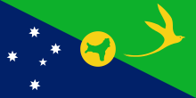
The Territory of Christmas Island is an Australian external territory in the Indian Ocean comprising the island of the same name. It is located approximately 350 kilometres (190 nautical miles) south of Java and Sumatra and about 1,550 km (840 nmi) north-west of the closest point on the Australian mainland. With an area of 135 square kilometres (52 sq mi), Christmas Island's geographic isolation and history of minimal human disturbance has led to a high level of endemism among its flora and fauna, which is of interest to scientists and naturalists. The territory derives its name from its discovery on Christmas Day 1643 by Captain William Mynors.
The first European to sight Christmas Island was Richard Rowe of the Thomas in 1615. Captain William Mynors named it on Christmas Day, 25 December 1643. It was first settled in the late 19th century, after abundant phosphate deposits were found, originally deposited as guano, leading Britain to annex the island in 1888, and begin commercial mining in 1899. Christmas Island was invaded by the Japanese in 1942 to secure its phosphate deposits, and transferred from Singapore to Australia, where it remains, in 1958. (Full article...)
Selected article 28
Portal:Islands/Selected article/28
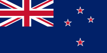
New Zealand is an island country in the southwestern Pacific Ocean. It consists of two main landmasses—the North Island (Te Ika-a-Māui) and the South Island (Te Waipounamu)—and over 600 smaller islands. It is the sixth-largest island country by area and lies east of Australia across the Tasman Sea and south of the islands of New Caledonia, Fiji, and Tonga. The country's varied topography and sharp mountain peaks, including the Southern Alps, owe much to tectonic uplift and volcanic eruptions. New Zealand's capital city is Wellington, and its most populous city is Auckland. (Full article...)
Selected article 29
Portal:Islands/Selected article/29
Coron is the third-largest island in the Calamian Islands in northern Palawan in the Philippines. The island is part of the larger municipality of the same name. It is about 170 nautical miles (310 km) southwest of Manila and is known for several Japanese shipwrecks of World War II vintage. Because of its unique ecological features, the entire area is protected by several legal proclamations. (Full article...)
Selected article 30
Portal:Islands/Selected article/30
Hilton Head Island, often referred to as simply Hilton Head, is a Lowcountry resort town and barrier island in Beaufort County, South Carolina, United States. It is 20 miles (32 km) northeast of Savannah, Georgia (as the crow flies), and 95 miles (153 km) southwest of Charleston. The year-round population was 37,661 at the 2020 census, although during the peak of summer vacation season the population can swell to 150,000. It is the principal city of the Hilton Head Island–Bluffton–Port Royal metropolitan area, which had an estimated population of 232,523 in 2023. (Full article...)
Selected article 31
Portal:Islands/Selected article/31
| Part of a series on |
| Evolutionary biology |
|---|
 |
Selected article 32
Portal:Islands/Selected article/32
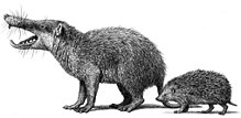
Island gigantism, or insular gigantism, is a biological phenomenon in which the size of an animal species isolated on an island increases dramatically in comparison to its mainland relatives. Island gigantism is one aspect of the more general "island effect" or "Foster's rule", which posits that when mainland animals colonize islands, small species tend to evolve larger bodies, and large species tend to evolve smaller bodies (insular dwarfism). This is itself one aspect of the more general phenomenon of island syndrome which describes the differences in morphology, ecology, physiology and behaviour of insular species compared to their continental counterparts. Following the arrival of humans and associated introduced predators (dogs, cats, rats, pigs), many giant as well as other island endemics have become extinct (e.g. the dodo and Rodrigues solitaire, giant flightless pigeons related to the Nicobar pigeon). A similar size increase, as well as increased woodiness, has been observed in some insular plants such as the Mapou tree (Cyphostemma mappia) in Mauritius which is also known as the "Mauritian baobab" although it is member of the grape family (Vitaceae). (Full article...)
Selected article 33
Portal:Islands/Selected article/33
Long Island is a densely populated continental island in southeastern New York state, extending into the Atlantic Ocean. It constitutes a significant share of the New York metropolitan area in both population and land area. The island extends from New York Harbor 118 miles (190 km) eastward into the ocean with a maximum north–south width of 23 miles (37 km). With a land area of 1,401 square miles (3,630 km2), it is the largest island in the contiguous United States. (Full article...)
Selected article 34
Portal:Islands/Selected article/34
The Farallon Islands /færəlɔːn/ FA-ra-lon, or Farallones (from Spanish farallón 'pillar, sea cliff'), are a group of islands and sea stacks in the Gulf of the Farallones, off the coast of San Francisco, California, United States. The islands are also sometimes referred to by mariners as the Devil's Teeth Islands, in reference to the many treacherous underwater shoals in their vicinity. The islands lie 30 miles (48 km) outside the Golden Gate and 20 miles (32 km) south of Point Reyes, and are visible from the mainland on clear days. The islands are part of the City and County of San Francisco. The only inhabited portion of the islands is on Southeast Farallon Island (SEFI), where researchers from Point Blue Conservation Science and the U.S. Fish and Wildlife Service stay. The islands are closed to the public. (Full article...)
Selected article 35
Portal:Islands/Selected article/35
Alcatraz Island (/ˈælkəˌtræz/) is a small island 1.25 miles (2.01 km) offshore from San Francisco, California, United States. The island was developed in the mid-19th century with facilities for a lighthouse, a military fortification, and a military prison. In 1934, the island was converted into a federal prison, Alcatraz Federal Penitentiary. The strong currents around the island and cold water temperatures made escape nearly impossible, and the prison became one of the most notorious in American history. The prison closed in 1963, and the island is now a major tourist attraction. (Full article...)
Selected article 36
Portal:Islands/Selected article/36
The Toronto Islands are a chain of 15 small islands in Lake Ontario, south of mainland Toronto, Ontario, Canada. (Full article...)
Selected article 37
Portal:Islands/Selected article/37
The Hawaiian Islands (Hawaiian: Mokupuni Hawaiʻi) are an archipelago of eight major volcanic islands, several atolls, and numerous smaller islets in the North Pacific Ocean, extending some 1,500 miles (2,400 kilometers) from the island of Hawaiʻi in the south to northernmost Kure Atoll. Formerly called the Sandwich Islands by Europeans, the present name for the archipelago is derived from the name of its largest island, Hawaiʻi. (Full article...)
Selected article 38
Portal:Islands/Selected article/38
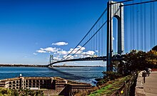
Staten Island (/ˈstætən/ STAT-ən) is the southernmost borough of New York City, coextensive with Richmond County and situated at the southernmost point of New York. The borough is separated from the adjacent state of New Jersey by the Arthur Kill and the Kill Van Kull and from the rest of New York by New York Bay. With a population of 495,747 in the 2020 Census, Staten Island is the least populated New York City borough but the third largest in land area at 58.5 sq mi (152 km2); it is also the least densely populated and most suburban borough in the city. (Full article...)
Selected article 39
Portal:Islands/Selected article/39

Prince Edward Island is an island province of Canada. While it is the smallest province in terms of land area and population, it is the most densely populated. The island has several nicknames: "Garden of the Gulf", "Birthplace of Confederation" and "Cradle of Confederation". Its capital and largest city is Charlottetown. It is one of the three Maritime provinces and one of the four Atlantic provinces.
Part of the traditional lands of the Mi'kmaq, it was colonized by the French in 1604 as part of the colony of Acadia. The island, known as Isle St-Jean (St. John's Island), was ceded to the British at the conclusion of the Seven Years' War in 1763 and became part of the colony of Nova Scotia. In 1769, St. John's island became its own British colony and its name was changed to Prince Edward Island (PEI) in 1798. PEI hosted the Charlottetown Conference in 1864 to discuss a union of the Maritime provinces; however, the conference became the first in a series of meetings which led to Canadian Confederation on July 1, 1867. Prince Edward Island initially balked at Confederation but, facing bankruptcy from the Land Question and construction of a railroad, joined as Canada's seventh province on July 1, 1873. (Full article...)
Selected article 40
Portal:Islands/Selected article/40
Jekyll Island is located off the coast of the U.S. state of Georgia, in Glynn County. It is one of the Sea Islands and one of the Golden Isles of Georgia barrier islands. The island is owned by the State of Georgia and run by a self-sustaining, self-governing body.
It was long used seasonally by indigenous peoples of the region. The Guale and the Mocama, the indigenous peoples of the area when Europeans first reached the area, were killed or forced to leave by the English of the Province of Carolina and their native allies, and by raids by French pirates. Plantations were developed on the island during the British colonial period. A few structures still standing are made of tabby, a coastal building material using crushed oyster shells. The island was developed in the late 19th and early 20th centuries. It was evacuated during World War II by order of the US government. In 1947 the state of Georgia acquired all the property, for security and preservation. (Full article...)
Selected article 41
Portal:Islands/Selected article/41
The Turks and Caicos Islands (abbreviated TCI; /ˈtɜːrks/ and /ˈkeɪkəs, -koʊs, -kɒs/) are a British Overseas Territory consisting of the larger Caicos Islands and smaller Turks Islands, two groups of tropical islands in the Lucayan Archipelago of the Atlantic Ocean and northern West Indies. They are known primarily for tourism and as an offshore financial centre. The resident population in 2023 was estimated by The World Factbook at 59,367, making it the third-largest of the British overseas territories by population. However, according to a Department of Statistics estimate in 2022, the population was 47,720. (Full article...)
Selected article 42
Portal:Islands/Selected article/42

The Canary Islands (/kəˈnɛəri/, Spanish: Canarias, Spanish: [kaˈnaɾjas]), also known informally as the Canaries, are a Spanish region, autonomous community and archipelago in the Atlantic Ocean. At their closest point to the African mainland, they are 100 kilometres (62 miles) west of Morocco. They are the southernmost of the autonomous communities of Spain. The islands have a population of 2.2 million people and are the most populous special territory of the European Union. (Full article...)
Selected article 43
Portal:Islands/Selected article/43
Ellis Island is a federally owned island in New York Harbor, situated within the U.S. states of New Jersey and New York. Ellis Island was once the busiest immigrant inspection and processing station in the United States. From 1892 to 1954, nearly 12 million immigrants arriving at the Port of New York and New Jersey were processed there. It has been part of the Statue of Liberty National Monument since 1965 and is accessible to the public only by ferry. The north side of the island is a national museum of immigration, while the south side of the island, including the Ellis Island Immigrant Hospital, is open to the public through guided tours. (Full article...)
Selected article 44
Portal:Islands/Selected article/44
Sri Lanka, historically known as Ceylon, and officially the Democratic Socialist Republic of Sri Lanka, is an island country in South Asia. It lies in the Indian Ocean, southwest of the Bay of Bengal, separated from the Indian peninsula by the Gulf of Mannar and the Palk Strait. It shares a maritime border with the Maldives in the southwest and India in the northwest. Sri Jayawardenepura Kotte is the legislative capital of Sri Lanka and the largest city, Colombo is the administrative and judicial capital which is the nation's political, financial and cultural centre. Kandy is the second-largest urban area and also the capital of the last native kingdom of Sri Lanka. The most spoken language Sinhala, is spoken by the majority of the population (approximately 17 million). Tamil is also spoken by approximately five million people, making it the second most-spoken language in Sri Lanka. (Full article...)
Selected article 45
Portal:Islands/Selected article/45
The Faroe or Faeroe Islands (/ˈfɛəroʊ/ FAIR-oh), or simply the Faroes (Faroese: Føroyar, pronounced [ˈfœɹjaɹ] ; Danish: Færøerne [ˈfeɐ̯ˌøˀɐnə]), are an archipelago in the North Atlantic Ocean and an autonomous territory of the Kingdom of Denmark. The official language of the country is Faroese, which is closely related to and partially mutually intelligible with Icelandic.
Located a similar distance from Iceland, Norway, and the United Kingdom, the islands have a total area of about 1,400 square kilometres (540 sq mi) with a population of 54,676 as of August 2023. The terrain is rugged, and the subpolar oceanic climate (Cfc) is windy, wet, cloudy and cool. Despite the northerly climate, the temperatures are moderated by the Gulf Stream and average above freezing throughout the year, hovering around 12 °C (54 °F) in summer and 5 °C (41 °F) in winter. As a result of its northerly latitude and proximity to the Arctic Circle, the islands experience perpetual civil twilight during summer nights and very short winter days. The capital and largest city, Tórshavn, receives the fewest recorded hours of sunshine of any city in the world at only 840 per year. (Full article...)
Selected article 46
Portal:Islands/Selected article/46

Hațeg Island was a large offshore island in the Tethys Sea which existed during the Late Cretaceous period, probably from the Cenomanian to the Maastrichtian ages. It was situated in an area corresponding to the region around modern-day Hațeg, Hunedoara County, Romania. Maastrichtian fossils of small-sized dinosaurs have been found in the island's rocks. It was formed mainly by tectonic uplift during the early Alpine orogeny, caused by the collision of the African Plate and Eurasian Plate towards the end of the Cretaceous. There is no real present-day analog, but overall, the island of Hainan (off the coast of China) is perhaps closest as regards climate, geology and topography, though still not a particularly good match. The vegetation, for example, was of course entirely distinct from today, as was the fauna. Places like Louisiana and Mississippi and other parts of the Deep South are an even closer climatic and ecological match with a subtropical climate, wet summer season, coverage by rivers, swamps, and deltas, however they are not islands.
The Hungarian paleontologist Franz Nopcsa theorized that "limited resources" found on the island commonly have an effect of "reducing the size of animals" over the generations, producing a localized form of dwarfism. Nopcsa's theory of insular dwarfism—also known as the island rule—is today widely accepted. (Full article...)
Selected article 47
Portal:Islands/Selected article/47
Great Barrier Island (Māori: Aotea) lies in the outer Hauraki Gulf, New Zealand, 100 kilometres (62 mi) north-east of central Auckland. With an area of 285 square kilometres (110 sq mi) it is the sixth-largest island of New Zealand and fourth-largest in the main chain. Its highest point, Mount Hobson, is 627 metres (2,057 ft) above sea level. The local authority is the Auckland Council.
The island was initially exploited for its minerals and kauri trees and saw only limited agriculture. In 2013, it was inhabited by 939 people, mostly living from farming and tourism and all living off-the-grid. The majority of the island (around 60% of the total area) is administered as a nature reserve by the Department of Conservation. The island atmosphere is sometimes described as being "life in New Zealand many decades back". (Full article...)
Selected article 48
Portal:Islands/Selected article/48
The King Island emu (Dromaius novaehollandiae minor) is an extinct subspecies of emu that was endemic to King Island, in the Bass Strait between mainland Australia and Tasmania. Its closest relative may be the also extinct Tasmanian emu (D. n. diemenensis), as they belonged to a single population until less than 14,000 years ago, when Tasmania and King Island were still connected. The small size of the King Island emu may be an example of insular dwarfism. The King Island emu was the smallest of all known emus and had darker plumage than the mainland emu. It was black and brown and had naked blue skin on the neck, and its chicks were striped like those on the mainland. The subspecies was distinct from the likewise small and extinct Kangaroo Island emu (D. n. baudinianus) in a number of osteological details, including size. The behaviour of the King Island emu probably did not differ much from that of the mainland emu. The birds gathered in flocks to forage and during breeding time. They fed on berries, grass and seaweed. They ran swiftly and could defend themselves by kicking. The nest was shallow and consisted of dead leaves and moss. Seven to nine eggs were laid, which were incubated by both parents.
Europeans discovered the King Island emu in 1802 during early expeditions to the island, and most of what is known about the bird in life comes from an interview French naturalist François Péron conducted with a sealer there, as well as depictions by artist Charles Alexandre Lesueur. They had arrived on King Island in 1802 with Nicolas Baudin's expedition, and in 1804 several live and stuffed King and Kangaroo Island emus were sent to France. The two live King Island specimens were kept in the Jardin des Plantes, and the remains of these and the other birds are scattered throughout various museums in Europe today. The logbooks of the expedition did not specify from which island each captured bird originated, or even that they were taxonomically distinct, so their status remained unclear until more than a century later. Hunting pressure and fires started by early settlers on King Island likely drove the wild population to extinction by 1805. The captive specimens in Paris both died in 1822 and are believed to have been the last of their kind. (Full article...)
Selected article 49
Portal:Islands/Selected article/49

The Inaccessible Island rail (Laterallus rogersi) is a small bird species of the rail family, Rallidae. Endemic to Inaccessible Island in the Tristan Archipelago in the isolated south Atlantic, it is the smallest extant flightless bird in the world. The species was formally described by physician Percy Lowe in 1923 but had first come to the attention of scientists 50 years earlier. The Inaccessible Island rail's taxonomic affinities and origin were a long-standing mystery; in 2018 its closest relative was identified as the South American dot-winged crake, and it was decided that both species are best classified in the genus Laterallus.
The Inaccessible Island rail has brown plumage, black bill and feet, and adults have a red eye. It occupies most habitats on Inaccessible Island, from the beaches to the central plateau, feeding on a variety of small invertebrates and also some plant matter. Pairs are territorial and monogamous, with both parents being responsible for incubating the eggs and raising the chicks. Its adaptations to living on a tiny island at high densities include low base metabolic rates, small clutch sizes, and flightlessness. (Full article...)
Selected article 50
Portal:Islands/Selected article/50

The Long Island Tercentenary half dollar was a commemorative half dollar struck by the United States Bureau of the Mint in 1936. The obverse depicts a male Dutch settler and an Algonquian tribesman, and the reverse shows a Dutch sailing ship. It was designed by Howard Weinman, the son of Mercury dime designer Adolph A. Weinman.
The Long Island Tercentenary Committee wanted a coin to mark the 300th anniversary of the first European settlement there, at modern Flatlands, Brooklyn, New York City. The authorizing bill passed through Congress without opposition. Still, it was amended in the Senate to add protections against past commemorative coin abuses, such as low mintages or an assortment of varieties. On April 13, 1936, the bill became law with the signature of President Franklin D. Roosevelt. (Full article...)
Selected article 51
Portal:Islands/Selected article/51
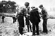
Brownsea Island Scout camp, is a historic Scout campsite on Brownsea Island in Poole Harbour in southern England, which was the site of Robert Baden-Powell's 1907 experimental camp for boys to test ideas for his book Scouting for Boys, which led to the rapid growth of the Scout movement. Boys from different social backgrounds participated from 1 to 8 August 1907 in activities around camping, observation, woodcraft, chivalry, lifesaving and patriotism.
Boy Scout camped on the island until the early 1930s. In 1963, a formal 50-acre (20 ha) Scout campsite was created after the island became a nature conservation area owned by the National Trust. In 1973, a Scout Jamboree with six hundred Scouts was held on the island. On 1 August 2007, a centenary of Scouting event, including four Scout camps and a Sunrise Ceremony, took place at the Brownsea Island Scout camp on the 100th anniversary of the start of the experimental encampment. (Full article...)
Selected article 52
Portal:Islands/Selected article/52
Barren Island is a peninsula and former island on the southeast shore of Brooklyn in New York City. Located on Jamaica Bay, it was geographically part of the Outer Barrier island group on the South Shore of Long Island. The island was occupied by the Lenape Native Americans prior to the arrival of Dutch settlers in the 17th century. Its name is a corruption of Beeren Eylandt, the Dutch-language term for "Bears' Island".
Barren Island remained sparsely inhabited before the 19th century, mainly because of its relative isolation from the rest of the city. Starting in the 1850s, the island was developed as an industrial complex with fish rendering plants and other industries, and also as an ethnically diverse community of up to 1,500 residents. Between the mid-19th century and 1934, the island housed industrial plants that processed the carcasses of the city's dead horses, converting them into a variety of industrial products. This activity led to the still-extant waterbody on the island's western shore becoming nicknamed "Dead Horse Bay". A garbage incinerator, which became the subject of numerous complaints because of its odor, operated on the island from the 1890s to 1921. (Full article...)
Selected article 53
Portal:Islands/Selected article/53
Caroline Island (also known as Caroline Atoll or Millennium Island) is the easternmost of several uninhabited coral atolls comprising the southern Line Islands in the central Pacific Ocean nation of Kiribati.
The atoll was first sighted by Europeans in 1606 and was claimed by the United Kingdom of Great Britain and Ireland in 1868. It has been part of the Republic of Kiribati since the island nation's independence in 1979. Caroline Island has remained relatively untouched and is one of the world's most pristine tropical islands, despite guano mining, copra (coconut meat) harvesting, and human habitation in the 19th and 20th centuries. It is home to one of the world's largest populations of the coconut crab and is an important breeding site for seabirds, most notably the sooty tern. (Full article...)
Selected article 54
Portal:Islands/Selected article/54

The Falkland Islands (/ˈfɔː(l)klənd, ˈfɒlk-/ FAW(L)K-lənd, FOLK-; Spanish: Islas Malvinas [ˈislas malˈβinas]) is an archipelago in the South Atlantic Ocean on the Patagonian Shelf. The principal islands are about 300 mi (480 km) east of South America's southern Patagonian coast and about 752 mi (1,210 km) from Cape Dubouzet at the northern tip of the Antarctic Peninsula, at a latitude of about 52°S. The archipelago, with an area of 4,700 sq mi (12,000 km2), comprises East Falkland, West Falkland, and 776 smaller islands. As a British overseas territory, the Falklands have internal self-governance, but the United Kingdom takes responsibility for their defence and foreign affairs. The capital and largest settlement is Stanley on East Falkland.
The islands are believed to have been uninhabited prior to European discovery in the 17th century. Controversy exists over the Falklands' discovery and subsequent colonisation by Europeans. At various times, the islands have had French, British, Spanish, and Argentine settlements. Britain reasserted its rule in 1833, but Argentina maintains its claim to the islands. In April 1982, Argentine military forces invaded the islands. British administration was restored two months later at the end of the Falklands War. In a 2013 sovereignty referendum, almost all Falklanders voted in favour of remaining a UK overseas territory. The territory's sovereignty status is part of an ongoing dispute between Argentina and the UK. (Full article...)
Selected article 55
Portal:Islands/Selected article/55
Mackinac Island (/ˈmækənɔː/ MAK-ə-naw, locally /ˈmækənə/ MAK-ə-nə; French: Île Mackinac; Ojibwe: Mishimikinaak ᒥᔑᒥᑭᓈᒃ; Ottawa: Michilimackinac) is an island and resort area, covering 4.35 square miles (11.3 km2) in land area, in the U.S. state of Michigan. The name of the island in Odawa is Michilimackinac and "Mitchimakinak" in Ojibwemowin, meaning "Great Turtle". It is located in Lake Huron, at the eastern end of the Straits of Mackinac, between the state's Upper and Lower Peninsulas. The island was long home to an Odawa settlement and previous indigenous cultures before European colonization began in the 17th century. It was a strategic center of the fur trade around the Great Lakes. Based on a former trading post, Fort Mackinac was constructed on the island by the British during the American Revolutionary War. It was the site of two battles during the War of 1812 before the northern border was settled and the US gained this island in its territory.
In the late 19th century, Mackinac Island became a popular tourist attraction and summer colony. Many of the structures on the island have undergone extensive historical preservation and restoration. Because of its historic significance, the entire island is listed as a National Historic Landmark. It is well known for numerous cultural events; a wide variety of architectural styles, including the Victorian Grand Hotel; and its ban on almost all motor vehicles, with exceptions only for city emergency vehicles (ambulance, police cars and fire trucks), city service vehicles and snowmobiles in winter. More than 80 percent of the island is preserved as Mackinac Island State Park. (Full article...)
Selected article 56
Portal:Islands/Selected article/56
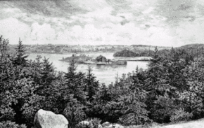
Melville Island is a small peninsula in Nova Scotia, Canada, located in the Northwest Arm of Halifax Harbour, west of Deadman's Island. It is part of the Halifax Regional Municipality.
The site was discovered by Europeans in the 17th century, though it was likely earlier explored by Indigenous peoples. The land is rocky, with thin, acidic soil, but supports a limited woodland habitat. It was initially used for storehouses before being purchased by the British, who built a prisoner-of-war camp to hold captives from the Napoleonic Wars and later the War of 1812. The burial ground for prisoners was on the adjacent Deadman's Island. (Full article...)
Selected article 57
Portal:Islands/Selected article/57
North Island is the northernmost island in the Houtman Abrolhos, a coral reef archipelago in the Indian Ocean off the coast of Mid West Western Australia. Located about 14 km (9 mi) from the nearest island group, it is one of the largest islands in the Houtman Abrolhos, and one of the few to support dune systems. It has relatively diverse flora dominated by chenopod shrubs and fauna that includes the introduced tammar wallaby, around seven species of reptile, and about 15 resident bird species.
First recorded and surveyed in 1840, North Island has been a seasonal camp for western rock lobster fishermen since the beginning of the 20th century, and this remains the principal focus of human activity on the island. There is also a small amount of tourism, though for the most part it is reserved as conservation habitat for vegetation communities and rare birds. (Full article...)
Selected article 58
Portal:Islands/Selected article/58
The Admiralty Islands campaign (Operation Brewer) was a series of battles in the New Guinea campaign of World War II in which the United States Army's 1st Cavalry Division took the Japanese-held Admiralty Islands.
Acting on reports from airmen that there were no signs of enemy activity and the islands might have been evacuated, General Douglas MacArthur accelerated his timetable for capturing the Admiralties and ordered an immediate reconnaissance in force. The campaign began on 29 February 1944 when a force landed on Los Negros, the third-largest island in the group. By using a small, isolated beach where the Japanese had not anticipated an assault, the force achieved tactical surprise, but the islands proved to be far from unoccupied. A furious battle over the islands ensued. (Full article...)
Selected article 59
Portal:Islands/Selected article/59
The Battle of Goodenough Island (22–27 October 1942), also known as Operation Drake, was a battle of the Pacific campaign of World War II. The Allies landed on Goodenough Island, Papua, and clashed with a Japanese Kaigun Rikusentai (Special Naval Landing Force). The Japanese troops had been stranded on the island during the Battle of Milne Bay in late August 1942. "Drake Force", consisting of the Australian 2/12th Battalion and attachments, landed on the southern tip of Goodenough Island at Mud Bay and Taleba Bay on 22 October, tasked with denying the Japanese use of the island prior to the Buna campaign. Following a short but intense fight, the Japanese forces withdrew to Fergusson Island on 27 October. After the battle, Goodenough Island was developed into a major Allied base for operations later in the war. (Full article...)
Selected article 60
Portal:Islands/Selected article/60
The Battle of Goodenough Island (22–27 October 1942), also known as Operation Drake, was a battle of the Pacific campaign of World War II. The Allies landed on Goodenough Island, Papua, and clashed with a Japanese Kaigun Rikusentai (Special Naval Landing Force). The Japanese troops had been stranded on the island during the Battle of Milne Bay in late August 1942. "Drake Force", consisting of the Australian 2/12th Battalion and attachments, landed on the southern tip of Goodenough Island at Mud Bay and Taleba Bay on 22 October, tasked with denying the Japanese use of the island prior to the Buna campaign. Following a short but intense fight, the Japanese forces withdrew to Fergusson Island on 27 October. After the battle, Goodenough Island was developed into a major Allied base for operations later in the war. (Full article...)
Selected article 61
Portal:Islands/Selected article/61
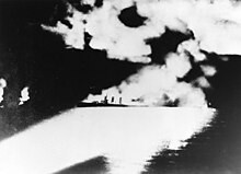
The Battle of Savo Island, also known as the First Battle of Savo Island and in Japanese sources as the First Battle of the Solomon Sea (第一次ソロモン海戦, Dai-ichi-ji Soromon Kaisen), and colloquially among Allied Guadalcanal veterans as the Battle of the Five Sitting Ducks, was a naval battle of the Solomon Islands campaign of the Pacific War of World War II between the Imperial Japanese Navy and Allied naval forces. The battle took place on 8–9 August 1942 and was the first major naval engagement of the Guadalcanal campaign and the first of several naval battles in the straits later named Ironbottom Sound, near the island of Guadalcanal.
The Imperial Japanese Navy, in response to Allied amphibious landings in the eastern Solomon Islands, mobilized a task force of seven cruisers and one destroyer under the command of Vice Admiral Gunichi Mikawa. The task forces sailed from Japanese bases in New Britain and New Ireland down New Georgia Sound (also known as "The Slot") with the intention of interrupting the Allied landings by attacking the supporting amphibious fleet and its screening force. The Allied screen consisted of eight cruisers and fifteen destroyers under Rear Admiral Victor Crutchley, but only five cruisers and seven destroyers were involved in the battle. In a night action, Mikawa thoroughly surprised and routed the Allied force, sinking one Australian and three American cruisers, while suffering only light damage in return. Rear Admiral Samuel J. Cox, director of the Naval History and Heritage Command, considers this battle and the Battle of Tassafaronga to be two of the worst defeats in U.S. naval history, with only the attack on Pearl Harbor being worse. (Full article...)
Selected article 62
Portal:Islands/Selected article/62
The Battle of the Santa Cruz Islands, fought during 25–27 October 1942, sometimes referred to as the Battle of Santa Cruz or Third Battle of Solomon Sea, in Japan as the Battle of the South Pacific (Japanese: 南太平洋海戦 Minamitaiheiyō kaisen), was the fourth aircraft carrier battle of the Pacific campaign of World War II. It was also the fourth major naval engagement fought between the United States Navy and the Imperial Japanese Navy during the lengthy and strategically important Guadalcanal campaign. As in the battles of the Coral Sea, Midway, and the Eastern Solomons, the ships of the two adversaries were rarely in sight or gun range of each other. Instead, almost all attacks by both sides were mounted by carrier- or land-based aircraft.
In an attempt to drive Allied forces from Guadalcanal and nearby islands and end the stalemate that had existed since September 1942, the Imperial Japanese Army planned a major ground offensive on Guadalcanal for 20–25 October 1942. In support of this offensive, and with the hope of engaging Allied naval forces, Japanese carriers and other large warships moved into a position near the southern Solomon Islands. From this location, the Japanese naval forces hoped to engage and decisively defeat any Allied (primarily U.S.) naval forces, especially carrier forces, that responded to the ground offensive. Allied naval forces also hoped to meet the Japanese naval forces in battle, with the same objectives of breaking the stalemate and decisively defeating their adversary. (Full article...)
Selected article 63
Portal:Islands/Selected article/63
The Battle of Valcour Island, also known as the Battle of Valcour Bay, was a naval engagement that took place on October 11, 1776, on Lake Champlain. The main action took place in Valcour Bay, a narrow strait between the New York mainland and Valcour Island. The battle is generally regarded as one of the first naval battles of the American Revolutionary War, and one of the first fought by the United States Navy. Most of the ships in the American fleet under the command of Benedict Arnold were captured or destroyed by a British force under the overall direction of General Guy Carleton. However, the American defense of Lake Champlain stalled British plans to reach the upper Hudson River valley.
The Continental Army had retreated from Quebec to Fort Ticonderoga and Fort Crown Point in June 1776 after British forces were massively reinforced. They spent the summer of 1776 fortifying those forts and building additional ships to augment the small American fleet already on the lake. General Carleton had a 9,000 man army at Fort Saint-Jean, but needed to build a fleet to carry it on the lake. The Americans, during their retreat, had either taken or destroyed most of the ships on the lake. By early October, the British fleet, which significantly outgunned the American fleet, was ready for launch. (Full article...)
Selected article 64
Portal:Islands/Selected article/64
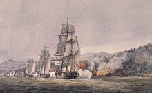
The Battle of Tory Island (sometimes called the Battle of Donegal, Battle of Lough Swilly or Warren's Action) was a naval action of the French Revolutionary Wars, fought on 12 October 1798 between French and British squadrons off the northwest coast of County Donegal, then in the Kingdom of Ireland. The last action of the Irish Rebellion of 1798, the Battle of Tory Island ended the final attempt by the French Navy to land substantial numbers of soldiers in Ireland during the war.
The Society of United Irishmen, led by Wolfe Tone, launched an uprising against British rule in Ireland in May 1798. At the request of the rebels, a small French force under General Humbert was landed at Killala, County Mayo, but by early September both this expedition and the rebellion had been defeated. Unaware of Humbert's surrender, the French despatched reinforcements on 16 September. Having missed one invasion force, the Royal Navy was on alert for another, and when the squadron carrying the reinforcements left Brest they were soon spotted. After a long chase, the French were brought to battle in a bay off the rugged County Donegal coast in the west of Ulster, very close to Tory Island. During the action the outnumbered French attempted to escape, but were run down and defeated piecemeal, with the British capturing four ships and scattering the survivors. Over the next fortnight, British frigate patrols scoured the passage back to Brest, capturing three more ships. Of the ten ships in the original French squadron, only two frigates and a schooner reached safety. British losses in the campaign were minimal. (Full article...)
Selected article 65
Portal:Islands/Selected article/65
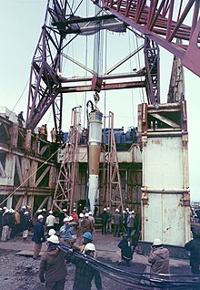
Amchitka (/æmˈtʃɪtkə/; Aleut: Amchixtax̂;[page needed]) is a volcanic, tectonically unstable and uninhabited island in the Rat Islands group of the Aleutian Islands in southwest Alaska. It is part of the Alaska Maritime National Wildlife Refuge. The island, with a land area of roughly 116 square miles (300 km2), is about 42 miles (68 km) long and 1 to 4 miles (1.6 to 6.4 km) wide. The area has a maritime climate, with many storms, and mostly overcast skies.
Amchitka was populated for more than 2,500 years by the Aleut people, but has had no permanent population since 1832. The island has been part of the United States since the Alaska Purchase of 1867. During World War II, it was used as an airfield by US forces in the Aleutian Islands Campaign. (Full article...)
Selected article 66
Portal:Islands/Selected article/66
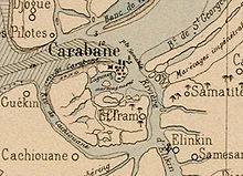
Carabane, also known as Karabane, is an island and a village located in the extreme south-west of Senegal, in the mouth of the Casamance River. This relatively recent geological formation consists of a shoal and alluvium to which soil is added by accumulation in the branches and roots of the mangrove trees which cover most of the island. Along with the rest of Ziguinchor Region, Carabane has a tropical climate, cycling between a dry season and a wet season. The island was once considered an arid location where no useful plants were likely to grow, but it now supports several types of fruit tree, the most common of which are mangos and oranges. Although the nearby Basse Casamance National Park and Kalissaye Avifaunal Reserve have been closed for years because of the Casamance Conflict, Carabane has continued to attract ornithologists interested in its wide variety of birds. Various species of fish are plentiful around the island, but there are very few mammals.
The earliest known inhabitants of the island were the Jola, the ethnic group which is still the most populous on the island. The Portuguese were active in the region from the 16th century onwards; however, they did not linger on "Mosquito Island", the mosquitoes and black flies convincing them to establish their trading post in the town of Ziguinchor instead in 1645. On January 22, 1836, the island was ceded to France by the village leader of Kagnout in return for an annual payment of 196 francs. A series of treaties between the French and the leaders of the local peoples ensued; however, the inhabitants of Carabane did not recognize the authority of the treaties imposed upon them, resulting in lootings and abductions among French rice farmers by the Karoninka people. In 1869, Carabane became autonomous, but it merged with Sédhiou in 1886. Since World War II, the population of the island has gradually declined for a variety of reasons including periods of drought, the Casamance Conflict and, more recently, the sinking of the ferry Joola in 2002. Much of the village's ability to trade and receive tourists was lost until 2014, when MV Aline Sitoe Diatta resumed ferry services to the island. (Full article...)
Selected article 67
Portal:Islands/Selected article/67
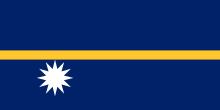
Nauru (/nɑːˈuːruː/ nah-OO-roo or /ˈnaʊruː/ NOW-roo; Nauruan: Naoero), officially the Republic of Nauru (Nauruan: Repubrikin Naoero) and formerly known as Pleasant Island, is an island country and microstate in Micronesia, part of the Oceania region in the Central Pacific. Its nearest neighbour is Banaba of Kiribati about 300 km (190 mi) to the east.
It lies northwest of Tuvalu, 1,300 km (810 mi) northeast of the Solomon Islands, east-northeast of Papua New Guinea, southeast of the Federated States of Micronesia and south of the Marshall Islands. With an area of only 21 km2 (8.1 sq mi), Nauru is the third-smallest country in the world, larger than only Vatican City and Monaco, making it the smallest republic and island nation, as well as the smallest member state of the Commonwealth of Nations by area. Its population of about 10,800 is the world's third-smallest (not including colonies or overseas territories). Nauru is a member of the United Nations, the Commonwealth of Nations, and the Organisation of African, Caribbean and Pacific States. (Full article...)
Selected article 68
Portal:Islands/Selected article/68
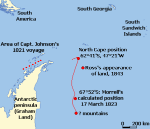
New South Greenland, sometimes known as Morrell's Land, was an appearance of land recorded by the American captain Benjamin Morrell of the schooner Wasp in March 1823, during a sealing and exploration voyage in the Weddell Sea area of Antarctica. Morrell provided precise coordinates and a description of a coastline which he claimed to have sailed along for more than 300 miles (500 km). Because the Weddell Sea area was so little visited and hard to navigate due to ice conditions, the alleged land was never properly investigated before its existence was emphatically disproven during Antarctic expeditions in the early 20th century.
At the time of Morrell's voyage, the geography of the then-unnamed Weddell Sea and its surrounding coasts was almost entirely unknown, making the claimed sighting initially plausible. However, obvious errors in Morrell's voyage account and his general reputation as a fabulist created scepticism about the existence of this new land. In June 1912, the German explorer Wilhelm Filchner searched for but found no traces of land after his ship Deutschland became icebound in the Weddell Sea and drifted into the locality of Morrell's observation. A line sounding of the sea bottom revealed more than 5,000 feet (1,500 m) of water, indicating no land in near proximity. Three years later, trapped in the same waters with his ship Endurance, Ernest Shackleton was able by similar means to confirm the land's implausibility. (Full article...)
Selected article 69
Portal:Islands/Selected article/69
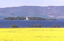
The freshwater islands in Scotland include those within freshwater lochs and rivers – including tidal areas, so the islands may not always be surrounded by freshwater. It has been estimated that there are at least 31,460 freshwater lochs in Scotland and that 1.9 per cent of the land surface is covered by freshwater. The distribution has a north-west to south-east gradient, with the highest concentrations occurring on the islands of the Outer Hebrides.
The more notable freshwater islands include Lochindorb Castle Island, Loch Leven Castle Island, St Serf's Inch and Inchmahome, each of which have had a role to play in Scottish history. Inchmurrin, the largest freshwater island in the British Isles, is in Loch Lomond, which contains thirty or more other islands. (Full article...)
Selected article 70
Portal:Islands/Selected article/70 In the Croatian part of the Adriatic Sea, there are 718 islands, 389 islets and 78 reefs, making the Croatian archipelago the largest in the Adriatic Sea and the second largest in the Mediterranean Sea, after the Greek archipelago.
Of the 718 islands, only 47 are inhabited in the sense that at least one person resides on that island. Some sources indicate that Croatia has 67 inhabited islands, counting those that have a settlement, but 20 of those have lost all of their permanent population as a result of the population decline occurring throughout the Croatian islands due to insufficient economic activity.
| # | Island | County | Population (as of 31 Mar 2011) |
Area | Highest point | Population density |
|---|---|---|---|---|---|---|
| 1 | Krk | Primorje-Gorski Kotar | 19,383 | 405.78 km2 (100,270 acres) | 568 m (1,864 ft) | 47.8/km2 (0.193/acre) |
| 2 | Korčula | Dubrovnik-Neretva | 15,522 | 276.03 km2 (68,210 acres) | 569 m (1,867 ft) | 56.2/km2 (0.227/acre) |
| 3 | Brač | Split-Dalmatia | 13,956 | 394.57 km2 (97,500 acres) | 780 m (2,560 ft) | 35.4/km2 (0.143/acre) |
| 4 | Hvar | Split-Dalmatia | 11,077 | 299.66 km2 (74,050 acres) | 628 m (2,060 ft) | 37.0/km2 (0.150/acre) |
| 5 | Rab | Primorje-Gorski Kotar | 9,328 | 90.84 km2 (22,450 acres) | 410 m (1,350 ft) | 102.7/km2 (0.416/acre) |
Selected article 71
Portal:Islands/Selected article/71
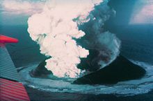
Surtsey ("Surtr's island" in Icelandic, Icelandic pronunciation: [ˈsʏr̥(t)sˌeiː] ) is an uninhabited volcanic island located in the Vestmannaeyjar archipelago off the southern coast of Iceland. At Surtsey is the southernmost point of Iceland. It was formed in a volcanic eruption which began 130 metres (430 feet) below sea level, and reached the surface on 14 November 1963. The eruption lasted until 5 June 1967, when the island reached its maximum size of 2.7 km2 (1.0 sq mi). Since then, wave erosion has caused the island to steadily diminish in size: as of 2012[update], its surface area was 1.3 km2 (0.50 sq mi). The most recent survey (2007) shows the island's maximum elevation at 155 m (509 ft) above sea level.
The new island was named after Surtr, a fire jötunn or giant from Norse mythology. It was intensively studied by volcanologists during its eruption, and afterwards by botanists and other biologists as life forms gradually colonised the originally barren island. The undersea vents that produced Surtsey are part of the Vestmannaeyjar submarine volcanic system, part of the fissure of the sea floor called the Mid-Atlantic Ridge. Vestmannaeyjar also produced the famous eruption of Eldfell on the island of Heimaey in 1973. The eruption that created Surtsey also created a few other small islands along this volcanic chain, such as Jólnir and other, unnamed peaks. Most of these eroded away fairly quickly. It is estimated that Surtsey will remain above sea level until at least the year 2100. (Full article...)
Selected article 72
Portal:Islands/Selected article/72
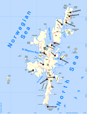
This is a list of Shetland islands in Scotland. The Shetland archipelago is located 100 kilometres (62 mi) north of mainland Scotland and the capital Lerwick is almost equidistant from Bergen in Norway and Aberdeen in Scotland. The Shetland archipelago comprises about 300 islands and skerries, of which 16 are inhabited. In addition to the Shetland Mainland the larger islands are Unst, Yell and Fetlar.
The definition of an island used in this list is that it is land that is surrounded by seawater on a daily basis, but not necessarily at all stages of the tide, excluding human devices such as bridges and causeways. There are four islands joined to the Shetland Mainland by bridges, East Burra, West Burra, Trondra, and Muckle Roe. There is also a bridge from Housay to Bruray. Nowhere in Shetland is more than three miles (5 km) from the sea. Mavis Grind (Old Norse for "gate of the narrow isthmus") is a narrow neck of land little more than 100 metres (328 feet) wide separating St. Magnus Bay and the Atlantic in the west from Sullom Voe and the North Sea in the east. (Full article...)
Selected article 73
Portal:Islands/Selected article/73

This list of Inner Hebrides summarises a chain of islands and skerries located off the west coast of mainland Scotland. There are 36 inhabited islands in this archipelago, of which Islay, Mull and Skye are the largest and most populous.
The islands of Scotland's west coast are known collectively as the Hebrides; the Inner Hebrides are separated from the Outer Hebrides by The Minch to the north and the Sea of the Hebrides to the south. The Inner Hebrides that lie respectively north and south of Ardnamurchan are administered by two separate local authorities as part of larger territories. The northern Inner Hebrides, including Skye, the Small Isles and the Summer Isles, are part of the Highland unitary council region. The southern group, including Islay, Jura, the Slate Islands and Gigha are part of the Argyll and Bute council region. (Full article...)
Selected article 74
Portal:Islands/Selected article/74
Shapinsay (/ˈʃæpɪnziː/, Scots: Shapinsee) is one of the Orkney Islands off the north coast of mainland Scotland. With an area of 29.5 square kilometres (11.4 sq mi), it is the eighth largest island in the Orkney archipelago. It is low-lying and, with a bedrock formed from Old Red Sandstone overlain by boulder clay, fertile, causing most of the area to be used for farming. Shapinsay has two nature reserves and is notable for its bird life. Balfour Castle, built in the Scottish Baronial style, is one of the island's most prominent features, a reminder of the Balfour family's domination of Shapinsay during the 18th and 19th centuries; the Balfours transformed life on the island by introducing new agricultural techniques. Other landmarks include a standing stone, an Iron Age broch, a souterrain and a salt-water shower.
There is one village on the island, Balfour, from which roll-on/roll-off car ferries sail to Kirkwall on the Orkney Mainland. At the 2011 census, Shapinsay had a population of 307. The economy of the island is primarily based on agriculture with the exception of a few small businesses that are largely tourism-related. A community-owned wind turbine was constructed in 2011. The island has a primary school but, in part due to improving transport links with mainland Orkney, no longer has a secondary school. Shapinsay's long history has given rise to various folk tales. (Full article...)
Selected article 75
Portal:Islands/Selected article/75

The Isle of Skye, or simply Skye (/skaɪ/; Scottish Gaelic: An t-Eilean Sgitheanach or Eilean a' Cheò), is the largest and northernmost of the major islands in the Inner Hebrides of Scotland. The island's peninsulas radiate from a mountainous hub dominated by the Cuillin, the rocky slopes of which provide some of the most dramatic mountain scenery in the country. Although Sgitheanach has been suggested to describe a winged shape, no definitive agreement exists as to the name's origin. (Full article...)
Selected article 76
Portal:Islands/Selected article/76 The Spratly Islands (Filipino: Kapuluan ng Kalayaan; Mandarin Chinese: 南沙群島/南沙群岛; pinyin: Nánshā Qúndǎo; Malay: Kepulauan Spratly; Vietnamese: Quần đảo Trường Sa) are a disputed archipelago in the South China Sea. Composed of islands, islets, cays, and more than 100 reefs, sometimes grouped in submerged old atolls, the archipelago lies off the coasts of the Philippines, Malaysia, and southern Vietnam. Named after the 19th-century British whaling captain Richard Spratly who sighted Spratly Island in 1843, the islands contain less than 200 ha (2 km2) of naturally occurring land area that is spread over hundreds of square km of the South China Sea.
The Spratly Islands are one of the major archipelagos in the South China Sea which complicate governance and economics in this part of Southeast Asia due to their location in strategic shipping lanes. The islands are largely uninhabited, but offer rich fishing grounds and may contain significant oil and natural gas reserves, and as such are important to the claimants in their attempts to establish international boundaries. Some of the islands have civilian settlements, but of the approximately 45 islands, cays, reefs and shoals that are occupied, all contain structures that are occupied by military forces from Malaysia, China (PRC), Taiwan (ROC), the Philippines, and Vietnam. Additionally, Brunei has claimed an exclusive economic zone in the southeastern part of the Spratly Islands, which includes the uninhabited Louisa Reef. (Full article...)
Selected article 77
Portal:Islands/Selected article/77

Jersey (/ˈdʒɜːrzi/ JUR-zee; Jèrriais: Jèrri [ʒɛri]), officially the Bailiwick of Jersey, is an island country in Northwestern Europe and a self-governing British Crown Dependency near the coast of north-west France. It is the largest of the Channel Islands and is 14 miles (23 km) from the Cotentin Peninsula in Normandy. The Bailiwick consists of the main island of Jersey and some surrounding uninhabited islands and rocks including Les Dirouilles, Les Écréhous, Les Minquiers, and Les Pierres de Lecq.
Jersey was part of the Duchy of Normandy, whose dukes became kings of England from 1066. After Normandy was lost by the kings of England in the 13th century, and the ducal title surrendered to France, Jersey remained loyal to the English Crown, though it never became part of the Kingdom of England. At the end of the Napoleonic Wars, Jersey was at the frontline of Anglo-French Wars and was invaded a number of times, leading to the construction of fortifications such as Mont Orgueil Castle and a thriving smuggling industry. During the Second World War, the island was invaded and occupied for five years by Nazi Germany. The island was liberated on 9 May 1945, which is now celebrated as the island's national day. (Full article...)
Selected article 78
Portal:Islands/Selected article/78
Dame Sandra Prunella Mason FB GCMG DA SC (born 17 January 1949) is a Barbadian politician, lawyer, and diplomat who is serving as the first president of Barbados since 2021. She was previously the eighth and final governor-general of Barbados from 2018 to 2021, the second woman to hold the office. On 20 October 2021, Mason was elected by the Parliament of Barbados to become the country's first president, and took office on 30 November 2021, when Barbados ceased to be a constitutional monarchy and became a republic.
Mason was a practicing attorney-at-law who has served as a High Court judge in Saint Lucia and a Court of Appeal judge in Barbados, and was the first woman admitted to the bar in Barbados. She served as chair of the CARICOM commission to evaluate regional integration, was the first magistrate appointed an ambassador from Barbados, and was the first woman to serve on the country's Supreme Court. She was the first appointee from Barbados to the Commonwealth Secretariat Arbitral Tribunal. In 2017, she was appointed the 8th governor-general of Barbados, with a term beginning on 8 January 2018. Simultaneously with her appointment, Mason was awarded the Dame Grand Cross in the Order of Saint Michael and Saint George. On assumption of the office of Governor-General, she became the Chancellor of the Order of National Heroes, Order of Barbados and the Order of Freedom. (Full article...)
Selected article 79
Portal:Islands/Selected article/79
The Frisian Islands, also known as the Wadden Islands or the Wadden Sea Islands, form an archipelago at the eastern edge of the North Sea in northwestern Europe, stretching from the northwest of the Netherlands through Germany to the west of Denmark. The islands shield the mudflat region of the Wadden Sea (large parts of which fall dry during low tide) from the North Sea.
The Frisian Islands, along with the mainland coast in the German Bight, form the region of Frisia (German and Dutch: Friesland), homeland of the Frisian people. Generally, the term Frisian Islands is used for the islands where Frisian is spoken and the population is ethnically Frisian. In contrast, the term Wadden Islands applies to the entire archipelago, including the Dutch-speaking westernmost islands of Texel and Vlieland, Danish-speaking Danish Wadden Sea Islands further north off the west coast of Jutland and the Islands of Trischen and Neuwerk. (Full article...)
Selected article 80
Portal:Islands/Selected article/80
Wake Island (Marshallese: Ānen Kio, lit. 'island of the kio flower'), also known as Wake Atoll, is a coral atoll in the Micronesia subregion of the Pacific Ocean. The atoll is composed of three islets – Wake, Wilkes, and Peale Islands – surrounding a lagoon encircled by a coral reef. The nearest inhabited island is Utirik Atoll in the Marshall Islands, located 592 miles (953 kilometers) to the southeast.
The island may have been found by prehistoric Austronesian mariners before its first recorded discovery by Álvaro de Mendaña de Neira in 1568. Ships continued visiting the area in the following centuries, but the island remained undeveloped until the United States claimed it in 1899. Significant development of the island didn't begin until 1935 when Pan American Airways constructed an airfield and hotel, establishing Wake Island as a stopover for trans-Pacific flying boat routes. In December 1941 at the opening of the Pacific Theatre of World War II Japan seized the island where it remained under Japanese occupation until the end of the war in September 1945. In 1972, Pan American Airways ceased using the island for trans-Pacific layovers due to the adoption of the Boeing 747 into their fleet. With the withdrawal of Pan American Airways, the island's administration was taken over by the United States Air Force, which later used the atoll as a processing location for Vietnamese refugees during Operation New Life in 1975. (Full article...)
Selected article 81
Portal:Islands/Selected article/81
Powder House Island (also known as Dynamite Island) is an artificial island on the lower Detroit River in southeast Michigan, directly adjacent to the Canada–United States border. It was constructed in the late 1880s by the Dunbar & Sullivan Company to store explosives during their dredging of the Livingstone Channel, with the purpose of circumventing an 1880 court order forbidding the company to store explosives on nearby Fox Island.
Powder House Island was the location of dynamite storage sheds, as well as a dynamite factory and several ice houses. During this time, it was the site of a series of accidents, including fires in 1895 and 1919 (which both burned the island "to the water's edge"). Twenty short tons (18,000 kg) of the island's dynamite exploded in 1906 after two men "had been shooting with a revolver" near it; while there were no deaths (and only minor injuries to the two men), windows were shattered 3 mi (4.8 km) away and the explosion was clearly audible from 85 mi (137 km) away. (Full article...)
Selected article 82
Portal:Islands/Selected article/82
Devon Island (Inuktitut: ᑕᓪᓗᕈᑎᑦ, Tallurutit) is an island in Canada and the largest uninhabited island (no permanent residents) in the world. It is located in Baffin Bay, Qikiqtaaluk Region, Nunavut, Canada. It is one of the largest members of the Arctic Archipelago, the second-largest of the Queen Elizabeth Islands, Canada's sixth-largest island, and the 27th-largest island in the world. It has an area of 55,247 km2 (21,331 sq mi) (slightly smaller than Croatia). The bedrock is Precambrian gneiss and Paleozoic siltstones and shales. The highest point is the Devon Ice Cap at 1,920 m (6,300 ft) which is part of the Arctic Cordillera. Devon Island contains several small mountain ranges, such as the Treuter Mountains, Haddington Range and the Cunningham Mountains. The notable similarity of its surface to that of Mars has attracted interest from scientists. (Full article...)


