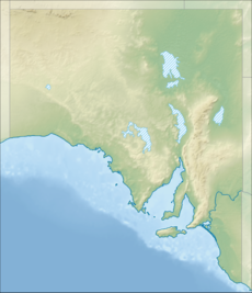
The Pinkawillinie Conservation Park is 60 kilometres (37 mi) west of Kimba on the inland side of Eyre Peninsula in South Australia.
| Pinkawillinie Conservation Park South Australia | |
|---|---|
IUCN category VI (protected area with sustainable use of natural resources)[1] | |
| Nearest town or city | Kimba |
| Coordinates | 33°00′S 135°48′E / 33.0°S 135.8°E |
| Established | 1970[2] |
| Area | 1,301.51 km2 (502.5 sq mi)[3] |
| Region | Eyre Peninsula |
| Managing authorities | Department for Environment and Water |
| See also | Protected areas of South Australia |
The park encompasses 130 000 hectares and abuts the Gawler Ranges National Park to the north west. There is limited 2wd access to the park and no facilities.[2]
The conservation park is categorised as an IUCN Category VI protected area.[1] In 1980, it was listed on the now-defunct Register of the National Estate.[4]
See also
editReferences
edit- ^ a b "Terrestrial Protected Areas of South Australia (refer 'DETAIL' tab )". CAPAD 2016. Australian Government, Department of the Environment (DoE). 2016. Retrieved 21 February 2018.
- ^ a b "Pinkawillinie Conservation Park" (PDF). Department of Environment and Natural Resources, Government of South Australia. October 2010. Retrieved 13 November 2015.
- ^ "Protected Areas Information System - reserve list" (PDF). Department of Environment Water and Natural Resources. 16 July 2015. Retrieved 13 November 2015.
- ^ "Pinkawillinie Conservation Park, Eyre Hwy, Kimba (sic), SA, Australia - listing on the now-defunct Register of the National Estate (Place ID 6732)". Australian Heritage Database. Australian Government. 21 October 1980. Retrieved 10 February 2020.
