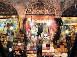
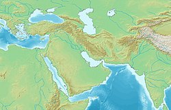
The old city of Damascus (Arabic: دِمَشْق ٱلْقَدِيمَة, romanized: Dimašq al-Qadīmah) is the historic city centre of Damascus, Syria. The old city, which is one of the oldest continuously inhabited cities in the world,[1] contains numerous archaeological sites, including some historical churches and mosques. Many cultures have left their mark, especially Hellenistic, Roman, Byzantine and Islamic. In 1979, the historical center of the city, surrounded by walls of Roman era, was declared a World Heritage Site by UNESCO. In June 2013, UNESCO included all Syrian sites on the list of World Heritage in Danger to warn of the risks to which they are exposed because of the Syrian Civil War.[2]
| UNESCO World Heritage Site | |
|---|---|
| Location | Damascus, Syria |
| Includes | Umayyad Mosque, Azm Palace, Citadel of Damascus |
| Criteria | Cultural: (i), (ii), (iii), (iv), (vi) |
| Reference | 20bis |
| Inscription | 1979 (3rd Session) |
| Extensions | 2011 |
| Endangered | 2013–2018 |
| Area | 86.12 ha (0.3325 sq mi) |
| Buffer zone | 42.60 ha (0.1645 sq mi) |
| Coordinates | 33°30′41″N 36°18′23″E / 33.51139°N 36.30639°E |

Origins and founding
editLying on the south bank of Barada River, the ancient city was founded in the 3rd millennium B.C. The horizontal diameter of the oval is about 1.5 km (0.9 mi) which is known as Damascus Straight Street, while the vertical diameter (Latin: Cardus Maximus) is about 1 km (0.6 mi). With an approximate area of 86.12 hectares (212.8 acres; 0.86 km2), the ancient city was enclosed within a historic wall of 4.5 km (2.8 mi) in circuit that was mainly built by the Romans, then fortified by the Ayyubids and Mamluks.[2]
The first mentioning of Damascus was as "Ta-ms-qu" in the second millennium BC, it was situated in an Amorite region in the middle of a conflict zone between the Hittites and Egyptians. The city was tributary to these powers until the emergence of the Sea Peoples in 1200 BC whose raids helped in weakening the arch rivals. Consequently, the Semitic Arameans managed to establish the independent state of Aram-Damascus (11th century – 733 BC), naming the main city as ‘Dimashqu’ or ‘Darmeseq’.[3]
Historical timeline
editThroughout its history, Damascus has been part of the following states:
|
|
Main sights
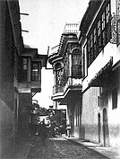
editDamascus has a wealth of historical sites dating back to many different periods of the city's history. Since the city has been built up with every passing occupation, it has become almost impossible to excavate all the ruins of Damascus that lie up to 2.4 m (8 ft) below the modern level. The Citadel of Damascus is located in the northwest corner of the Old City. The Damascus Straight Street (referred to in the conversion of St. Paul in Acts 9:11), also known as the Via Recta, was the decumanus (east–west main street) of Roman Damascus, and extended for over 1,500 m (4,900 ft). Today, it consists of the street of Bab Sharqi and the Souk Medhat Pasha, a covered market. The Bab Sharqi street is filled with small shops and leads to the old Christian quarter of Bab Tuma (St. Thomas's Gate). Medhat Pasha Souq is also a main market in Damascus and was named after Midhat Pasha, the Ottoman governor of Syria who renovated the Souk. At the end of the Bab Sharqi street, one reaches the House of Ananias, an underground chapel that was the cellar of Ananias's house. The Umayyad Mosque, also known as the Grand Mosque of Damascus, is one of the largest mosques in the world and also one of the oldest sites of continuous prayer since the rise of Islam. A shrine in the mosque is said to contain the body of St. John the Baptist. The mausoleum where Saladin was buried is located in the gardens just outside the mosque. Sayyidah Ruqayya Mosque, the shrine of the youngest daughter of Husayn ibn Ali, can also be found near the Umayyad Mosque. The ancient district of Amara is also within a walking distance from these sites. Another heavily visited site is Sayyidah Zaynab Mosque, where the tomb of Zaynab bint Ali is believed to be located.
Souqs and Khans
edit- Al-Hamidiyah Souq, built (1780–1884) during the reign of Sultan Abdul Hamid I,[4] the largest and the central souk in Syria, located inside the old walled city of Damascus next to the Citadel. The souq is about 600 meters long[4][5] and 15 meters wide,[4] and is covered by a 10 meter tall metal arch.[4]
- Midhat Pasha Souq, named after the then Ottoman governor of Syria (and later Grand Vizier) Midhat Pasha.
- Al-Buzuriyah Souq, 152 m (499 ft) in length.
- Khan al-Harir, completed in 1574.
- Khan Jaqmaq, completed in 1420.
- Khan As'ad Pasha, completed in 1752, covering an area of 2,500 square metres (27,000 sq ft). Situated along Al-Buzuriyah Souq, it was built and named after As'ad Pasha al-Azm.
- Khan Sulayman Pasha, completed in 1736, named after Sulayman Pasha al-Azm.
Historic buildings
edit- Temple of Jupiter, built by the Romans, beginning during the rule of Augustus[6] and completed during the rule of Constantius II,[7] previously a temple dedicated to Hadad-Ramman, the god of thunderstorms and rain.
- Damascus Straight Street (Latin: Via Recta), a Roman street (Decumanus Maximus) which runs from east to west in the old city, 1,500 metres in length.
- Citadel of Damascus, built (1076–1078) and (1203–1216) by Turkmen warlord Atsiz ibn Uvaq, and Al-Adil I.
- Nur al-Din Bimaristan, a large medieval bimaristan ("hospital"), built and named after the Zengid Sultan Nur ad-Din in 1154.
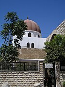
- Mausoleum of Saladin, built in 1196, the resting place and grave of the medieval Muslim Ayyubid Sultan Saladin.
- Azm Palace, built in 1750 as a residence for the Ottoman governor of Damascus As'ad Pasha al-Azm.
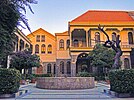
- Maktab Anbar, a mid 19th-century Jewish private mansion, restored by the Ministry of Culture in 1976 to serve as a library, exhibition centre, museum and craft workshops.[8]
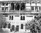
- Beit al-Mamlouka, a 17th-century Damascene house, serving as a luxury boutique hotel within the old city since 2005.
Madrasas
edit- Al-Adiliyah Madrasa, a 13th-century madrasah.
- Al-Fathiyah Madrasa, built in 1743 by an Ottoman official named Fethi Al-Defterdar.
- Al-Mujahidiyah Madrasa, built in 1141 by Burid governor Mujahid al-Din bin Bazan bin Yammin al-Kurdu.
- Al-Qilijiyah Madrasa, established in 1254.
- Al-Salimiyah Madrasa, a 16th-century madrasah.
- Al-Sibaiyah Madrasa, established in 1515.
- Al-Zahiriyah Library, established in 1277, taking its name from its founder Sultan Baibars.
- Nur al-Din Madrasa, built in 1167 by Nūr ad-Dīn Zangī.
Places of worship
editMosques
edit- Sayyidah Ruqayya Mosque contains the grave of Sukayna bint Husayn, also known as Ruqayyah, the young daughter of Al-Husayn ibn ‘Alī.[9]
- Sulaymaniyya Takiyya, the western part of which, comprising a mosque and an imaret, was commissioned by Suleiman the Magnificent and built between 1554 and 1559 to a design by Mimar Sinan;[10] the Salimiyya Madrasa was built adjoining it in 1566 (named after Suleiman's son Selim II but possibly commissioned by Suleiman himself before his death)[10]
- Umayyad Mosque, a mosque built on the site of Temple of Jupiter, and a Christian basilica which was dedicated to John the Baptist (Yahya).
- Nabi Habeel Mosque
- Sinan Pasha Mosque
- Darwish Pasha Mosque
- Aqsab Mosque
- Yalbugha Mosque
- Hanabila Mosque
- Sayyidah Zaynab Mosque
Churches
edit- House of Saint Ananias, an ancient underground structure in Damascus, Syria, that is alleged to be the remains of the home of Ananias of Damascus, where Ananias baptized Saul (who became Paul the Apostle).[11]
- Cathedral of the Dormition of Our Lady, also called "Greek-Melkite Patriarchal Cathedral of the Dormition of Our Lady", the Catholic cathedral of Melkite Greek Church.[12]
- Mariamite Cathedral of Damascus, the seat of the Greek Orthodox Church of Antioch. After the Muslim conquest of Damascus the church was closed until 706 AD when al-Walid ordered to return it to the Christians as a compensation for the Church of John the Baptist which was turned into the Umayyad Mosque.
- Chapel of Saint Paul
- Cathedral of Saint George
- Syriac Catholic Cathedral of Saint Paul
Gates
editThe old part of the city is surrounded with 4.5-kilometre-long (2.8-mile) thick walls,[13] pierced by the seven historical gates, the eighth gate was added later by Muslims. These are, clockwise from the north-east side:
- Bab Tuma (Gate of Thomas), dedicated to Venus.
- Bab Sharqi (The Eastern Gate), dedicated to the Sun.
- Bab Kisan (Kisan Gate), dedicated to Saturn.
- Bab al-Saghir (also called "Goristan-e-Ghariban"), dedicated to Jupiter.
- Bab al-Jabiyah (Gate of the Water Trough), dedicated to Mars.
- Bab al-Faradis (The Gate of the Paradise), dedicated to Mercury.
- Bab al-Salam (The Gate of Peace), dedicated to the Moon.
- Bab al-Faraj (The Gate of Deliverance), a gate which was built completely after the Muslim conquest of the Levant.
Hammams
editThe presence of public baths (ḥammāms) in Damascus started during the Umayyad era, while some historians date them back to the Roman era. The Damascene baths were mentioned by a number of Damascus historians, such as Ibn 'Asakir (1106–1175 AD) in his famous book "The History of Damascus". In his book, Ibn 'Asakir named 77 of baths working at that time within the city. The historian Ibn Shaddad counted 114 baths located in Damascus in 1250 AD.
The number of these baths increased to 365 during the Ottoman era, then decreased drastically to reach 60 baths in the late nineteenth century AD. Today, however, the number of baths in full operation is barely 20, the most famous of them is the "Nour al-Din al-Shahid" bath in the Al-Buzuriyah Souq.[14]
Districts and subdivisions
edit- Al-Qaymariyya
- Al-Amarah Al-Jouwaniyah
- Al-Amin
- Bab Tuma
- Al-Jourah
- Al-Hariqa
- Ma'azanat ash-Shahm
- Shaghour al-Juwani
Preservation of the ancient city
editThreats to the future of the old City
editDue to the rapid decline of the population of Old Damascus (between 1995 and 2009 about 30,000 people moved out of the old city for more modern accommodation),[15] a growing number of buildings are being abandoned or are falling into disrepair. In March 2007, the local government announced that it would be demolishing Old City buildings along a 1,400 m (4,600 ft) stretch of rampart walls as part of a redevelopment scheme. These factors resulted in the Old City being placed by the World Monuments Fund on its 2008 Watch List of the 100 Most Endangered Sites in the world.[16][17]
Current state of old Damascus
editIn spite of the recommendations of the UNESCO World Heritage Center:[18]
- Souq al-Atiq, a protected buffer zone, was destroyed in three days in November 2006;
- King Faysal Street, a traditional hand-craft region in a protected buffer zone near the walls of Old Damascus between the Citadel and Bab Touma, is threatened by a proposed motorway.
- In 2007, the Old City of Damascus and notably the district of Bab Tuma have been recognized by The World Monument Fund as one of the most endangered sites in the world.[19]
In October 2010, Global Heritage Fund named Damascus one of 12 cultural heritage sites most "on the verge" of irreparable loss and destruction.[20]
The old city outside of the walls of the Roman era, is also considered part of the old Damascus, however, it hasn't been given the same historical priority. During the French mandate, Michel Écochard, the French architect, planned an urban scheme for the city, that advised to only reserve the parts of the old city inside the Roman walls. This approach has been adopted later by the ruling governments of Syria, which contributed to demolishing parts of its old neighborhoods. Old houses in Sarouja, Al Midan, and Shagour Barrani was replaced by new buildings for trade mainly.[21][22]
See also
edit- Tourism in Syria
- Timeline of Damascus history
- List of rulers of Damascus
- World Heritage Sites in Danger
References
edit- ^ Eldredge, Niles and Horenstein, Sidney (2014). Concrete Jungle: New York City and Our Last Best Hope for a Sustainable Future. Berkeley, California: University of California Press. p. 21. ISBN 978-0-520-27015-2.
- ^ a b "Ancient City of Damascus". UNESCO. Retrieved 29 October 2017.
- ^ Ross Burns (2005). Damascus: A History. Routledge. pp. 4–8. ISBN 0-203-93995-6.
- ^ a b c d سوق الحميدية - اكتشف سورية
- ^ Al-Hamidiyah Souk, main Damascus shopping centre - The Arab Weekly
- ^ Burns, 2005, p. 61.
- ^ Finegan, 1981, pp. 58–60.
- ^ Archnet, Maktab Anbar Restoration
- ^ "Syria". Mailviruskid.tripod.com. Retrieved 2016-10-14.
- ^ a b Rihawi, Abd al-Qadir al-; Ouéchek, Émilie E. (1975). "Les deux takiyya de Damas". Bulletin d'études orientales. Vol. 28. Institut Francais du Proche-Orient. pp. 217–225. JSTOR 41604595.
- ^ "Saint Ananias Chapel". Archived from the original on 2008-10-11. Retrieved 2017-11-04.
- ^ Correspondent, a Times Special (2013-09-09). "Damascus residents fear a U.S. strike will bring rebel onslaught". Los Angeles Times. ISSN 0458-3035. Retrieved 2016-11-24.
{{cite news}}:|last=has generic name (help) - ^ "سور دمشق وأبوابها السبعة استخدمت في السابق لصد الغزاة ولاستقبال ضيوف الخلفاء والأمراء وتستثمر حاليا سياحيا حيث تجذب السياح والمهتمين بالآثار". الشرق الأوسط (in Arabic). 23 February 2003.
- ^ "Hammams of Old Damascus: Back from the Dead". Huffington Post. 11 January 2016.
- ^ Hendawi, Hamza (2009-02-01). "Old Damascus struggles to cope in the new Syria". The San Diego Union-Tribune. The Associated Press. Retrieved 13 August 2017.
- ^ World Monuments Fund. "2008 World Monuments Watch List Of 100 Most Endangered Sites" (PDF). World Monuments Fund. World Monuments Fund. Archived from the original (PDF) on 20 March 2013. Retrieved 27 July 2015.
- ^ "2008 Panelists Bios" (PDF). World Monuments Fund. Archived from the original (PDF) on May 13, 2008. Retrieved 3 September 2009.
- ^ "The British Syrian Society". The British Syrian Society. Archived from the original on 2007-06-23. Retrieved 29 May 2009.
- ^ "Worldmonuments.org". Worldmonuments.org. Archived from the original on 30 September 2002. Retrieved 6 November 2011.
- ^ "GHF". Global Heritage Fund. Archived from the original on 15 May 2011. Retrieved 1 June 2011.
- ^ "Archnet".
- ^ "No Damascus like home".
Bibliography
edit- Burns, Ross (2005). Damascus: A History. Routledge. ISBN 978-0-415-27105-9.
- Finegan, Jack (1981). The archeology of the New Testament:the Mediterranean world of the early Christian Apostles. Taylor & Francis. ISBN 9780709910060.

