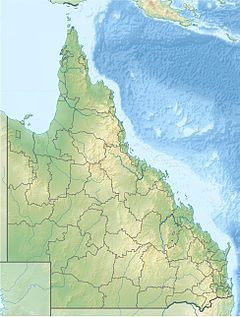
The O'Connell River is a river in North Queensland, Australia.[4][5]
| O'Connell | |
|---|---|
Location of O'Connell river mouth in Queensland | |
| Location | |
| Country | Australia |
| State | Queensland |
| Region | North Queensland |
| Physical characteristics | |
| Source | |
| • location | Clarke Range (Yalboroo) |
| • coordinates | 20°56′31″S 148°39′00″E / 20.94181°S 148.65003°E |
| • elevation | 410 m (1,350 ft) |
| Mouth | Coral Sea |
• location | Lethebrook, Whitsunday Region / Bloomsbury, Mackay Region |
• coordinates | 20°34′06″S 148°40′00″E / 20.56833°S 148.66667°E |
• elevation | 0 m (0 ft) |
| Length | 34.2 km (21.3 mi)[1] |
| Basin size | 886.5 km2 (342.3 sq mi)[2] |
| Discharge | |
| • location | Near mouth |
| • average | 15.75 m3/s (497 GL/a)[2] |
| Basin features | |
| Tributaries | |
| • left | Ceadar Creek, Boundary Creek, Dingo Creek, Andromache |
| • right | Horse Creek, Plantain Creek, Gibson Creek, Dinner Creek |
| [3] | |
The headwaters of the river rise in the Clarke Range, just north of the Eungella National Park. It flows north parallel with the Bruce Highway, then discharges into the Repulse Fish Habitat area near Covering Beach and onto the Coral Sea.[5]
The river has a catchment area of 2,388 square kilometres (922 sq mi), of which 128 km2 (49 sq mi) is composed of estuarine wetlands.[6]
See also
editReferences
edit- ^ "Map of O'Connell River, QLD".
- ^ a b "East Coastal Watersheds".
- ^ "Map of O'Connell River". Bonzle Digital Atlas of Australia. Retrieved 31 July 2015.
- ^ "O'Connell River – watercourse in the Whitsunday Region (entry 24954)". Queensland Place Names. Queensland Government. Retrieved 26 December 2024.
- ^ a b "Layers: Locality; Mountains and ranges; Contours; Watercourses; Road and rail". Queensland Globe. Queensland Government. Retrieved 26 December 2024.
- ^ "O'Connell River drainage basin". WetlandInfo. Queensland Government. Retrieved 31 July 2015.
