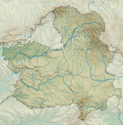
Montiel is a municipality of Spain located in the province of Ciudad Real, Castilla–La Mancha.[2] The municipality spans across a total area of 271.22 km2 and, as of 1 January 2020, it has a registered population of 1,294.[2]
Montiel | |
|---|---|
 | |
| Coordinates: 38°42′N 2°52′W / 38.700°N 2.867°W | |
| Country | Spain |
| Autonomous community | Castilla–La Mancha |
| Province | Ciudad Real |
| Area | |
• Total | 271.22 km2 (104.72 sq mi) |
| Elevation | 900 m (3,000 ft) |
| Population (2018)[1] | |
• Total | 1,330 |
| • Density | 4.9/km2 (13/sq mi) |
| Demonym | Montieleños |
| Postal code | 13326 |
| Website | Official website |
History
editOn 5 March 1227, Ferdinand III donated the Estrella Castle to Pedro González, Grand Master of the Order of Santiago, so Montiel eventually became the head of the Campo de Montiel lands.[3] In 1243, Montiel was granted a fuero (a copy of Cuenca's) and a number of privileges by Grand Master Paio Peres Correia.[4]
The Battle of Montiel occurred at the town. It was also the place where Peter of Castile was killed by Henry of Trastamara.[5]
Historically, Montiel was home to a Jewish community in the Middle Ages, up until the 1492 expulsion of the Jews.[6]
References
edit- Citations
- ^ Municipal Register of Spain 2018. National Statistics Institute.
- ^ a b "Datos del Registro de Entidades Locales". Ministerio de Asuntos Económicos y Transformación Digital. Retrieved 18 May 2021.
- ^ Madrid Medina 2015, p. 69.
- ^ Madrid y Medina 1989, p. 206.
- ^ "Un sarcófago hallado en Montiel data de 1396". Castilla la Mancha (in Spanish). Europa Press (news agency). 21 October 2014. Retrieved 6 April 2015.
- ^ "Montiel". Jewish Virtual Library. Retrieved 1 July 2024.
- Bibliography
- Madrid y Medina, Ángela (1989). "Alfonso X el Sabio y La Mancha santiaguista" (PDF). Espacio Tiempo y Forma. Serie III, Historia Medieval. 2. Madrid: Universidad Nacional de Educación a Distancia: 205–218.
- Madrid Medina, Ángela (2015). "Los orígenes de la presencia de la Orden de Santiago en el Campo de Montiel". Revista de Estudios del Campo de Montiel (1). Almedina: Centro de Estudios del Campo de Montiel: 55–73. ISSN 2172-2633.


