McLean (2021 population: 392) is a village in the Canadian province of Saskatchewan within the Rural Municipality of South Qu'Appelle No. 157 and Census Division No. 6. It is on Highway 1 between Qu'Appelle and Balgonie. The village of McLean is located in South Central Saskatchewan on the Trans-Canada Highway and is the highest point on the Canadian Pacific Railway mainline east of the Rockies. It is about 37 kilometres (23 mi) east of the Regina.
Village of Mclean | |
|---|---|
Village | |
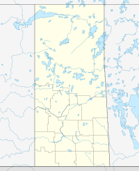
Location of Mclean in Saskatchewan | |
| Coordinates: 50°31′01″N 104°04′01″W / 50.517°N 104.067°W | |
| Country | Canada |
| Province | Saskatchewan |
| Region | Saskatchewan |
| Census division | 6 |
| Rural Municipality | South Qu'appelle |
| Post office Founded | N/A |
| Incorporated (Village) | N/A |
| Incorporated (Town) | N/A |
| Government | |
| • Mayor | Shawn McIntosh |
| • Administrator | Melody Temrick |
| Area | |
| • Land | 1.32 km2 (0.51 sq mi) |
| Population (2021) | |
• Total | 392 |
| • Density | 297.0/km2 (769.1/sq mi) |
| Time zone | CST |
| Postal code | S0G 3E0 |
| Area code | 306 |
| Highways | Highway 1 & SK 620 |
| [1][2][3][4] | |
History
editMcLean incorporated as a village on September 1, 1966.[5]
Demographics
editIn the 2021 Census of Population conducted by Statistics Canada, McLean had a population of 392 living in 148 of its 156 total private dwellings, a change of -3.2% from its 2016 population of 405. With a land area of 1.32 km2 (0.51 sq mi), it had a population density of 297.0/km2 (769.1/sq mi) in 2021.[10]
In the 2016 Census of Population, the Village of McLean recorded a population of 405 living in 144 of its 158 total private dwellings, a 24.9% change from its 2011 population of 304. With a land area of 1.33 km2 (0.51 sq mi), it had a population density of 304.5/km2 (788.7/sq mi) in 2016.[11]
Transportation
editMcLean is situated 20 minutes east of Saskatchewan's capital city Regina, on the Trans-Canada Highway and the Canadian Pacific Railway (CPR) mainline, between Balgonie and Qu'Appelle. This village is the highest point on the CPR east of the Rockies.
See also
editReferences
edit- ^ National Archives, Archivia Net, Post Offices and Postmasters, archived from the original on October 6, 2006
- ^ Government of Saskatchewan, MRD Home, Municipal Directory System, archived from the original on November 21, 2008
- ^ Canadian Textiles Institute. (2005), CTI Determine your provincial constituency, archived from the original on 2007-09-11
- ^ Commissioner of Canada Elections, Chief Electoral Officer of Canada (2005), Elections Canada On-line, archived from the original on April 21, 2007
- ^ "Urban Municipality Incorporations". Saskatchewan Ministry of Government Relations. Archived from the original on October 15, 2014. Retrieved June 1, 2020.
- ^ "Census of Saskatchewan 1936" (PDF). Government of Canada. p. 105. Retrieved October 26, 2024.
- ^ "1976 Census of Canada" (PDF). Government of Canada. Retrieved October 26, 2024.
- ^ "Saskatchewan Census Population" (PDF). Saskatchewan Bureau of Statistics. Archived from the original (PDF) on September 24, 2015. Retrieved May 31, 2020.
- ^ "Saskatchewan Census Population". Saskatchewan Bureau of Statistics. Retrieved May 31, 2020.
- ^ "Population and dwelling counts: Canada, provinces and territories, census divisions and census subdivisions (municipalities), Saskatchewan". Statistics Canada. February 9, 2022. Retrieved April 1, 2022.
- ^ "Population and dwelling counts, for Canada, provinces and territories, and census subdivisions (municipalities), 2016 and 2011 censuses – 100% data (Saskatchewan)". Statistics Canada. February 8, 2017. Retrieved May 30, 2020.

