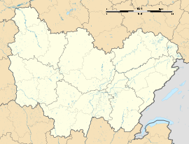
Maxilly-sur-Saône is a commune in the Côte-d'Or department in the Bourgogne-Franche-Comté region in eastern France. The inhabitants are called Maximilliens and Maximilliennes.
Maxilly-sur-Saône | |
|---|---|
 The Saône Canal at Maxilly-sur-Saône | |
| Coordinates: 47°20′05″N 5°25′42″E / 47.3347°N 5.4283°E | |
| Country | France |
| Region | Bourgogne-Franche-Comté |
| Department | Côte-d'Or |
| Arrondissement | Dijon |
| Canton | Auxonne |
| Government | |
| • Mayor (2020–2026) | Alain Dunet[1] |
Area 1 | 7.87 km2 (3.04 sq mi) |
| Population (2021)[2] | 366 |
| • Density | 47/km2 (120/sq mi) |
| Time zone | UTC+01:00 (CET) |
| • Summer (DST) | UTC+02:00 (CEST) |
| INSEE/Postal code | 21398 /21270 |
| Elevation | 183–236 m (600–774 ft) (avg. 186 m or 610 ft) |
| 1 French Land Register data, which excludes lakes, ponds, glaciers > 1 km2 (0.386 sq mi or 247 acres) and river estuaries. | |
Geography
editLocated a few kilometers from the Haute-Saône, Maxilly-sur-Saône is crossed by a canal which connects the River Marne to the Saône.
Bordering municipalities
editTown planning
editTypology
editMaxilly-sur-Saône is classified as a rural municipality, because it is part of the a category of municipalities with a low or very low population density, as defined by the municipal density grid of the Institut national de la statistique et des études économiques.[3][4][5]
In addition, Maxilly-sur-Saôn is part of the attraction area of Dijon, of which it is a municipality in the crown. This area, which includes 333 municipalities, is categorized in areas of 200,000 to less than 700,000 inhabitants.[6][7]
The zoning of the municipality, as reflected in the database European occupation biophysical soil Corine Land Cover (CLC), is marked by the importance of the agricultural land (59.6% in 2018), a proportion roughly equivalent to that of 1990 (59.1%). The detailed breakdown in 2018 is as follows:[8]
- forests (30.7%)
- meadows (29%)
- arable land (18.2%)
- heterogeneous agricultural areas (12.4%)
- urbanized areas (7.1%)
- inland waters (2.3%)
- industrial or commercial zones and communication networks (0.5%).
The Institut national de l'information géographique et forestière also provides an online tool to compare the evolution over time of land use in the municipality (or in territories at different scales). Several eras are accessible as aerial maps or photos: the Cassini map (18th century), the map of Staff (1820-1866) and the current period (1950 to present).[9]
Points of interest
editMaxilly-sur-Saône is home to a Lock where the canal from the Marne to the Saône ends (or begins). Saint-Martin Parish church can also be found in the commune.
-
Lock at Tremblant in Maxilly sur Saône
-
Saint-Martin Parish church
Population
edit| Year | Pop. | ±% p.a. |
|---|---|---|
| 1968 | 296 | — |
| 1975 | 340 | +2.00% |
| 1982 | 298 | −1.87% |
| 1990 | 300 | +0.08% |
| 1999 | 301 | +0.04% |
| 2007 | 301 | +0.00% |
| 2012 | 347 | +2.89% |
| 2017 | 348 | +0.06% |
| Source: INSEE[10] | ||
See also
editReferences
edit- ^ "Répertoire national des élus: les maires". data.gouv.fr, Plateforme ouverte des données publiques françaises (in French). 9 August 2021.
- ^ "Populations légales 2021" (in French). The National Institute of Statistics and Economic Studies. 28 December 2023.
- ^ "Typologie urbain / rural | L'Observatoire des Territoires". www.observatoire-des-territoires.gouv.fr. Retrieved 1 July 2021.
- ^ "Définition - Commune rurale | Insee". www.insee.fr. Retrieved 1 July 2021.
- ^ "Comprendre la grille de densité | L'Observatoire des Territoires". www.observatoire-des-territoires.gouv.fr. Retrieved 1 July 2021.
- ^ "Base des aires d'attraction des villes 2020 | Insee". www.insee.fr. Retrieved 1 July 2021.
- ^ "En France, neuf personnes sur dix vivent dans l'aire d'attraction d'une ville - Insee Focus - 211". www.insee.fr. Retrieved 1 July 2021.
- ^ "CORINE Land Cover | Données et études statistiques". archive.wikiwix.com. Archived from the original on 21 March 2019. Retrieved 1 July 2021.
- ^ "Remonter le temps". remonterletemps.ign.fr. Retrieved 1 July 2021.
- ^ Population en historique depuis 1968, INSEE


