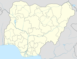
Machina (also known as Matsena) is a Local Government Area in Yobe State, Nigeria. Its headquarters are in the town of Machina at 13°08′11″N 10°02′57″E / 13.13639°N 10.04917°E. It shares a border in the north with The Republic of Niger.
Machina | |
|---|---|
LGA and town | |
| Coordinates: 13°06′N 10°00′E / 13.100°N 10.000°E | |
| Country | |
| State | Yobe State |
| Government | |
| • Local Government Chairman | Bukar A. Bukar (APC) |
| Area | |
• Total | 1,213 km2 (468 sq mi) |
| Population (2006 census) | |
• Total | 61,606 |
| Time zone | UTC+1 (WAT) |
| 3-digit postal code prefix | 630 |
| ISO 3166 code | NG.YO.MA |
 | |
It has an area of 1,213 km2 and a population of 61,606 at the 2006 census.
The postal code of the area is 630.[1]
Climate
editTemperatures in Machina range from 59°F to 105°F, rarely dropping below 54°F or rising above 109°F, and there are hot, miserable, mainly gloomy rainy seasons and blistering, windy dry seasons.[2][3]
With an average daily high temperature of 101°F, the hot season lasts for 2.5 months, from March 26 to June 12. May, with an average high of 104°F and low of 82°F, is the hottest month of the year in Machina.
With an average daily high temperature below 89°F, the cool season lasts for 1.8 months, from December 9 to February 2. In Machina, January is the coldest month of the year, with an average low of 60°F and high of 86°F.[4]
See also
editReferences
edit- ^ "Post Offices- with map of LGA". NIPOST. Archived from the original on 2012-11-26. Retrieved 2009-10-20.
- ^ "Machina Climate, Weather By Month, Average Temperature (Nigeria) - Weather Spark". weatherspark.com. Retrieved 2023-08-28.
- ^ "Weather Forecast Machina - Nigeria (Yobe) : free 15 day weather forecasts". La Chaîne Météo (in French). Retrieved 2023-08-28.
- ^ "Climate & Weather Averages in Ga Machina, Nigeria". www.timeanddate.com. Retrieved 2023-09-29.
