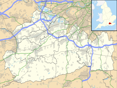
This is a list of settlements in Surrey by population based on the results of the 2011 census. The next United Kingdom census will take place in 2021. In 2011, there were 36 built-up area subdivisions with 5,000 or more inhabitants in Surrey, shown in the table below.
Administrative boundaries
editPopulation ranking
edit| # | Settlement | Population[1][2] | Outlying areas in detail | |
|---|---|---|---|---|
| 2001 | 2011 | |||
| 1 | Woking | 96,420 | 105,367 | |
| 2 | Guildford | 70,000 | 77,057 | |
| 3 | Walton-on-Thames | 62,540 | 66,566 | |
| 4 | Ewell | 49,180 | 51,727 | |
| 5 | Esher | 47,340 | 50,904 | |
| 6 | Camberley | 34,340 | 38,038 | |
| 7 | Redhill | 29,590 | 34,498 | |
| 8 | Leatherhead | 30,150 | 32,522 | |
| 9 | Epsom | 26,260 | 31,474 | |
| 10 | Weybridge | 26,863 | 29,837 | |
| 11 | Ashford | 26,320 | 28,036 | |
| 12 | Egham | 25,920 | 25,996 | |
| 13 | Staines | 24,730 | 25,736 | |
| 14 | Farnham | 23,602 | 25,604 | |
| 15 | Horley | 21,730 | 22,693 | |
| 16 | Godalming | 21,840 | 22,689 | |
| 17 | Reigate | 20,826 | 22,123 | |
| 18 | Caterham | 19,870 | 21,437 | |
| 19 | Frimley | 18,766 | 19,094 | |
| 20 | Cobham | 16,360 | 17,273 | |
| 21 | Dorking | 16,071 | 17,098 | |
| 22 | Addlestone | 15,025 | 15,883 | |
| 23 | Ashtead | 13,210 | 13,901 | |
| 24 | Chertsey | 12,220 | 13,753 | |
| 25 | Oxted | 13,010 | 13,452 | |
| 26 | Haslemere | 12,055 | 13,122 | |
| 27 | Banstead | 10,120 | 10,653 | |
| 28 | Cranleigh | 9,670 | 9,905 | |
| 29 | Warlingham | 8,979 | 9,092 | |
| 30 | Lightwater | 6,691 | 6,791 | |
| 31 | Hindhead | 6,120 | 6,668 | Includes Grayshott from Hampshire |
| 32 | Witley | 6,084 | 6,437 | |
| 33 | Virginia Water | 5,895 | 5,940 | Ward count[3][4] |
| 34 | East Horsley | 5,661 | 5,866 | |
| 35 | Bagshot | 5,247 | 5,430 | |
| 36 | West Clandon/Send | 5,232 | 5,422 | |
| 37 | Whitebushes/South Earlswood | 4,435 | 4,450 | |
See also
editReferences
edit- ^ "Surrey (County, South East England, United Kingdom) - Population Statistics and Location in Maps and Charts". www.citypopulation.de. Retrieved 15 November 2016.
- ^ 2011 census table: ONS
- ^ Sillitoe, Neighbourhood Statistics - Neil (14 April 2008). "Detect browser settings". www.neighbourhood.statistics.gov.uk. Retrieved 20 November 2016.
- ^ Sillitoe, Neighbourhood Statistics - Neil (14 April 2008). "Detect browser settings". www.neighbourhood.statistics.gov.uk. Retrieved 20 November 2016.
