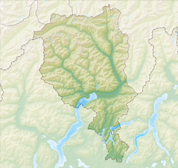
Lago di Robièi is a lake in Ticino, Switzerland. The reservoir has a volume of 6,700,000 cubic metres (5,400 acre⋅ft) and a surface area of 24 ha (59 acres). It is located at an elevation of 1,940 metres (6,360 ft) near Lago dei Cavagnöö and Lago del Zött.
| Lago di Robièi | |
|---|---|
| Location | Ticino |
| Coordinates | 46°26′44″N 8°31′1″E / 46.44556°N 8.51694°E |
| Type | reservoir |
| Catchment area | 1.52 km2 (0.59 sq mi) |
| Basin countries | Switzerland |
| Surface area | 0.24 km2 (0.093 sq mi) |
| Max. depth | 50 m (160 ft) |
| Surface elevation | 1,940 m (6,360 ft) |
 | |
The reservoir can be reached by following the road through the Maggia Valley to Bignasco and proceeding to San Carlo. From San Carlo, an aerial tramway leads to the dam 900 metres (3,000 ft) above.
The dam was completed in 1967.
Climate
edit| Climate data for Robièi (1898m a.s.l., Reference Period 1991–2020) | |||||||||||||
|---|---|---|---|---|---|---|---|---|---|---|---|---|---|
| Month | Jan | Feb | Mar | Apr | May | Jun | Jul | Aug | Sep | Oct | Nov | Dec | Year |
| Mean daily maximum °C (°F) | −0.5 (31.1) |
−0.5 (31.1) |
1.8 (35.2) |
4.2 (39.6) |
8.1 (46.6) |
12.9 (55.2) |
15.3 (59.5) |
15.0 (59.0) |
11.1 (52.0) |
7.2 (45.0) |
2.5 (36.5) |
0.2 (32.4) |
6.4 (43.6) |
| Daily mean °C (°F) | −3.3 (26.1) |
−3.5 (25.7) |
−1.2 (29.8) |
1.3 (34.3) |
5.2 (41.4) |
9.7 (49.5) |
12.1 (53.8) |
12.0 (53.6) |
8.2 (46.8) |
4.5 (40.1) |
0.1 (32.2) |
−2.5 (27.5) |
3.6 (38.4) |
| Mean daily minimum °C (°F) | −6.1 (21.0) |
−6.4 (20.5) |
−4.1 (24.6) |
−1.4 (29.5) |
2.5 (36.5) |
6.7 (44.1) |
9.0 (48.2) |
9.1 (48.4) |
5.5 (41.9) |
2.0 (35.6) |
−2.3 (27.9) |
−5.2 (22.6) |
0.8 (33.4) |
| Average precipitation mm (inches) | 137 (5.4) |
113 (4.4) |
152 (6.0) |
237 (9.3) |
254 (10.0) |
216 (8.5) |
163 (6.4) |
204 (8.0) |
243 (9.6) |
276 (10.9) |
279 (11.0) |
142 (5.6) |
2,416 (95.1) |
| Source: MeteoSwiss[1] | |||||||||||||
See also
editReferences
edit- ^ "Climate tables for normals per station (Reference period 1991−2020)". Swiss Federal Office of Meteorology and Climatology, MeteoSwiss. Retrieved 18 September 2023.


