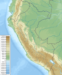
Kuntur K'uchu (Quechua kuntur condor, k'uchu corner,[2] "condor corner", Hispanicized spelling Condorcucho) is a mountain in the Wansu mountain range in the Andes of Peru, about 5,200 metres (17,060 ft) high. It is situated in the Arequipa Region, La Unión Province, Puyca District, and in the Cusco Region, Chumbivilcas Province, Santo Tomás District. It lies northwest of Qullpa and north of Pichaqani.
| Kuntur K'uchu | |
|---|---|
| Highest point | |
| Elevation | 5,200 m (17,100 ft)[1] |
| Coordinates | 14°44′25″S 72°29′12″W / 14.74028°S 72.48667°W |
| Geography | |
| Location | Peru, Arequipa Region, Cusco Region |
| Parent range | Andes, Wansu |
References
edit- ^ escale.minedu.gob.pe - UGEL map of the La Unión Province (Arequipa Region)
- ^ Teofilo Laime Ajacopa (2007). Diccionario Bilingüe: Iskay simipi yuyayk’anch: Quechua – Castellano / Castellano – Quechua (PDF). La Paz, Bolivia: futatraw.ourproject.org.
