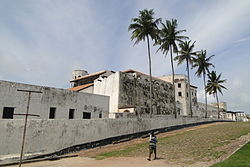
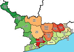
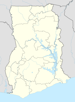
Komenda/Edina/Eguafo/Abirem Municipal District is one of the twenty-two districts in the Central Region of Ghana.[1][2] Originally created as an ordinary district assembly in 1988, when it was known as Komenda/Edina/Eguafo/Abirem District, it was created from the Cape Coast Municipal Council, until it was later elevated to municipal district assembly status on 29 February 2008, to become Komenda/Edina/Eguafo/Abirem Municipal District. The municipality is located in the southwest part of Central Region and has Elmina as its capital town.[3]
Komenda/Edina/Eguafo/Abirem Municipal District | |
|---|---|
Municipal District | |
 | |
 Districts of Central Region | |
Location of Komenda/Edina/Eguafo/Abirem Municipal District within Central | |
| Coordinates: 5°5′24.72″N 1°20′57.12″W / 5.0902000°N 1.3492000°W | |
| Country | |
| Region | |
| Capital | Elmina |
| Government | |
| • Municipal Chief Executive | George Frank Asmah |
| Area | |
• Total | 396 km2 (153 sq mi) |
| Population (2021) | |
• Total | 166,017 |
| Time zone | UTC+0 (GMT) |
| ISO 3166 code | GH-CP-KE |
| Website | Official Website |
List of settlements
edit| Settlements of Komenda/Edina/Eguafo/Abirem Municipal District | |||
| No. | Settlement | Population | Population year |
|---|---|---|---|
| 1 | Abeyee | ||
| 2 | Aboransa | ||
| 3 | Aborodeano | ||
| 4 | Abrem Agona | Abrem Ankaase | |
| 5 | Abrem Berase | ||
| 6 | Abreshia (Abrehya) | ||
| 7 | Amisano | ||
| 8 | Ampenyi | ||
| 9 | Bantoma | ||
| 10 | Besease | ||
| 11 | Bronyibima | ||
| 12 | Domenase | ||
| 13 | Dutch Komenda | ||
| 14 | Eguafo | ||
| 15 | Elmina | 32,819 | 2012 |
| 16 | Essaman Junction | ||
| 17 | Kissi | ||
| 18 | Komenda | ||
| 19 | Ntranoa | ||
Sources
editReferences
edit- ^ Eshun, Francisca (20 May 2021). "Church of Pentecost builds police station for Abrem Agona". Graphic Online. Retrieved 22 May 2021.
- ^ Yarboi-Tetteh, David O. (31 October 2019). "Ghana: Floods Cause Havoc in 8 Districts in Central Region ... Ucc Suspends Lectures". allAfrica. Retrieved 26 May 2022.
- ^ "Ghana Districts: A repository of all Local Assemblies in Ghana". www.ghanadistricts.com. Retrieved 2024-11-26.

