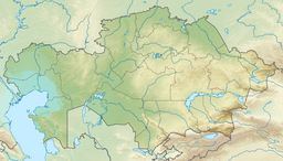
Karasor (Kazakh: Қарасор; Russian: Карасор) is a salt lake in the Ekibastuz City Administration, Pavlodar Region, Kazakhstan.[1][2]
| Karasor | |
|---|---|
| Қарасор | |
 Sentinel-2 image of the lake. The white spot are ashes from the nearby power plants. | |
| Location | Ekibastuz City Administration |
| Coordinates | 51°57′58″N 75°41′44″E / 51.96611°N 75.69556°E |
| Type | endorheic |
| Primary inflows | Bala tunnik |
| Catchment area | 8,750 square kilometers (3,380 sq mi) |
| Basin countries | Kazakhstan |
| Max. length | 17.2 kilometers (10.7 mi) |
| Max. width | 7.5 kilometers (4.7 mi) |
| Surface area | 44.3 square kilometers (17.1 sq mi) |
| Max. depth | 5 meters (16 ft) |
| Residence time | UTC+6 |
| Shore length1 | 78.7 kilometers (48.9 mi) |
| Surface elevation | 70 meters (230 ft) |
| 1 Shore length is not a well-defined measure. | |
Karasor is the largest of the lakes in the area surrounding Ekibastuz. It is located 25 kilometers (16 mi) to the northeast of the city and 15 kilometers (9.3 mi) to the west of Kalkaman.[3]
Geography
editKarasor is an endorheic lake in the Irtysh Basin. It stretches from southeast to northwest for roughly 17 kilometers (11 mi) and is about 7.5 kilometers (4.7 mi) wide. Smaller lake Shandaksor, with the Ekibastuz GRES-2 Power Station rising by its eastern shore, lies 8 kilometers (5.0 mi) to the west of the northwestern corner, and Zhyngyldy, with the Ekibastuz GRES-1 Power Station by its northern shore, lies 17 kilometers (11 mi) to the WSW of the southwestern lakeshore. Other lakes in the vicinity are Tuzdysor, located 9 kilometers (5.6 mi) to the northwest, Kudaikol 12 kilometers (7.5 mi) to the southeast, Atygay 15 kilometers (9.3 mi) to the SSW, and Shureksor 17 kilometers (11 mi) to the north.[3]
The Bala Tundik river flows into Karasor. The lake is fed by snow and rain. Karasor usually freezes in November and thaws in April. The lakeshores are flat and the surrounding area is used for local livestock grazing. There are also some cultivated fields.[1][2]
Ash dumping
editLarge quantities of ash are dumped into lake Karasor by the two neighboring power plants. The accumulation of dumped ashes in the southern part of the lake forms an island or peninsula with an average diameter of 2.5 kilometers (1.6 mi). The ashes are collected by people of the neighboring villages in order to sell them to be recycled for the industrial production of aluminosilicate microparticles.[3][4]
See also
editReferences
edit- ^ a b "M-43 Topographic Chart (in Russian)". Retrieved 20 February 2024.
- ^ a b Nature of Kazakhstan Encyclopedia / General editor. B. O. Jacob. - Almaty: "Kazakh Encyclopedia" LLP, 2011. T.Z. - 304 pages. ISBN 9965-893-64-0 (T.Z.), ISBN 9965-893-19-5
- ^ a b c Google Earth
- ^ Война за золу: в Экибастузе назревает конфликт из-за столичной компании
External links
edit- Media related to Karasor (lake, Ekibastuz) at Wikimedia Commons
- Озеро «Карасор». Почему вокруг этого водоема назревает скандал? «ЕСТЬ ВОПРОСЫ» "The scandal of lake Karasor" (in Russian)
