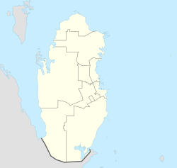
Izghawa (Arabic: ازغوى) is a district on the border between the two municipalities of Umm Salal and Al Rayyan in Qatar. Consequently, its administration is split, with its western portion (Izghawa 71) being controlled by Umm Salal and the east (Izghawa 51) under Al Rayyan's management.[4]
Izghawa
ازغوى | |
|---|---|
District | |
 Wadi Al Mashrab Street in Izghawa 71 | |
| Coordinates: 25°21′40″N 51°25′12″E / 25.361149°N 51.420091°E[1] | |
| Country | |
| Municipality | Umm Salal / Al Rayyan |
| Zone | Zone 71 (Umm Salal) / Zone 51 (Al Rayyan) |
| District no. | 48 |
| Area | |
• Total | 11.8 km2 (4.6 sq mi) |
| Elevation | 25 m (82 ft) |
Geography
editThe majority of urban settlement is based in the east, in Izghawa 51, some of which is situated in a rawda (depression). In the western portion, or Izghawa 71, there is a large undeveloped tract of land, some farms and a wadi named Wadi Izghawa Al Gharbi.[1]
Landmarks
editOne of the settlement's defining landmarks is the Izghawa Park. Occupying an area of over 14,000 square meters, the park was opened in 2006 to provide a green space for residents. In addition to its numerous trees and ornamentals, the parks facilities include a mosque, a children's play area, a volleyball court, and a basketball court.[5] In April 2018, the second-ever branch of The Center for the Empowerment and Care of Older Persons was constructed within the park. The center provides a range of services and facilities to those over 60 years of age.[6]
Transport
editCurrently, the elevated Izghawa Metro Station is under construction, having been launched during Phase 2A. Once completed, it will be part of Doha Metro's Green Line.[7]
Education
editThe following schools are located in Izghawa:
| Name of School | Curriculum | Grade | Genders | Official Website | Ref |
|---|---|---|---|---|---|
| Awfaz Global school – Izghawa Branch | British | Kindergarten – Secondary | Both | Official website | [8] |
| Al Manar International School Althemaid Branch | American/IB | Kindergarten – Secondary | Both | Official website | [9] |
References
edit- ^ a b "Geographic Information System". Ministry of Municipality and Environment. Archived from the original on 18 November 2018. Retrieved 17 March 2019.
- ^ "District Area Map". Ministry of Development Planning and Statistics. Retrieved 12 February 2019.
- ^ "Izghawa 51, Zone 51, Qatar on the Elevation Map". elevationmap.net. Retrieved 3 January 2019.
- ^ "2015 Population census" (PDF). Ministry of Development Planning and Statistics. April 2015. Archived from the original (PDF) on 17 July 2016. Retrieved 20 May 2018.
- ^ "حديقة ازغوى" (in Arabic). Ministry of Municipality and Environment. Retrieved 20 May 2018.
- ^ ""إحسان" يفتتح نادي جديد بحديقة أزغوى للعائلات" (in Arabic). Al Arab. 22 April 2018. Retrieved 20 May 2018.
- ^ "QAR Metro". arcgis.com. Retrieved 17 March 2019.
- ^ "Awfaz Global school – Izghawa". Schools in Qatar. Retrieved 20 May 2018.
- ^ "Al Manar International School Izghawa". dohafamily.com. Retrieved 20 May 2018.
