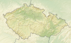
Horní Cerekev (German: Ober Zerekwe) is a town in Pelhřimov District in the Vysočina Region of the Czech Republic. It has about 1,900 inhabitants.
Horní Cerekev | |
|---|---|
 Horní Cerekev Castle | |
| Coordinates: 49°19′13″N 15°19′40″E / 49.32028°N 15.32778°E | |
| Country | |
| Region | Vysočina |
| District | Pelhřimov |
| First mentioned | 1361 |
| Government | |
| • Mayor | Milan Kunst |
| Area | |
• Total | 31.98 km2 (12.35 sq mi) |
| Elevation | 586 m (1,923 ft) |
| Population (2024-01-01)[1] | |
• Total | 1,900 |
| • Density | 59/km2 (150/sq mi) |
| Time zone | UTC+1 (CET) |
| • Summer (DST) | UTC+2 (CEST) |
| Postal code | 394 03 |
| Website | www |
Administrative parts
editThe villages of Chrástov, Hříběcí, Těšenov and Turovka are administrative parts of Horní Cerekev.
Etymology
editThe settlement was originally named Líčkovice after its founder Líček and later renamed Cierkev, i.e. 'church' in old Czech. Later the name evolved into Cerekev and the attribute Horní ('upper') was added.[2]
Geography
editHorní Cerekev is located about 14 kilometres (9 mi) southeast of Pelhřimov and 19 km (12 mi) southwest of Jihlava. The Jihlava River flows through the town. The municipal territory lies mostly in the Křemešník Highlands, only the area on the left bank of the Jihlava River extends into the Křižanov Highlands. The highest point is at 713 m (2,339 ft) above sea level.
History
editThe first written mention of Horní Cerekev is from 1361. The most notable owners of the village was the Léskovec family, which ruled it from 1411 to 1655. The last noble owners, who held Horní Cerekev until 1945, was the House of Hohenzollern.[2]
In 2000, the municipality was promoted to a town.[2]
Demographics
edit
|
|
| ||||||||||||||||||||||||||||||||||||||||||||||||||||||
| Source: Censuses[3][4] | ||||||||||||||||||||||||||||||||||||||||||||||||||||||||
Transport
editHorní Cerekev is located on the railway lines Brno–Plzeň and Jihlava–Tábor.[5]
Sights
editThe Church of the Annunciation dates from 1384. The original wooden church gave the town its name and was later replaced by a stone one. It was extended and remodelled in the Baroque style in 1631 and 1763. After a fire in 1821, only one of its two towers was reconstructed.[6]
A small fortress surrounded by moats was built in the 14th century. Between 1411 and 1655, it was gradually rebuilt in the Renaissance style. In 1720 and 1734, it was rebuilt into its current Baroque form.[7]
Notable people
edit- Josef Šejnost (1878–1941), sculptor
- Josef Dvořák (born 1942), actor
- Denisa Křížová (born 1994), ice hockey player
References
edit- ^ "Population of Municipalities – 1 January 2024". Czech Statistical Office. 2024-05-17.
- ^ a b c "Historie města" (in Czech). Město Horní Cerekev. Retrieved 2021-10-22.
- ^ "Historický lexikon obcí České republiky 1869–2011" (in Czech). Czech Statistical Office. 2015-12-21.
- ^ "Population Census 2021: Population by sex". Public Database. Czech Statistical Office. 2021-03-27.
- ^ "Detail stanice Horní Cerekev" (in Czech). České dráhy. Retrieved 2024-06-20.
- ^ "Kostel Zvěstování Panny Marie – Horní Cerekev" (in Czech). Atlas Česka. 10 April 2011. Retrieved 2021-10-22.
- ^ "Zámek v Horní Cerekvi" (in Czech). CzechTourism. Retrieved 2021-10-22.
External links
edit


