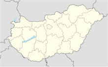
47°37′28″N 017°48′49″E / 47.62444°N 17.81361°E
Győr-Pér Airport Győr-Pér repülőtér | |||||||||||||||
|---|---|---|---|---|---|---|---|---|---|---|---|---|---|---|---|
 | |||||||||||||||
| Summary | |||||||||||||||
| Airport type | Public | ||||||||||||||
| Operator | Győr-Pér Repülőtér Kft. | ||||||||||||||
| Serves | Győr, Hungary | ||||||||||||||
| Location | Pér | ||||||||||||||
| Elevation AMSL | 424 ft / 129 m | ||||||||||||||
| Coordinates | 47°37′40″N 017°48′23″E / 47.62778°N 17.80639°E | ||||||||||||||
| Website | lhpr.hu | ||||||||||||||
| Map | |||||||||||||||
 | |||||||||||||||
| Runways | |||||||||||||||
| |||||||||||||||
Győr-Pér Airport (Hungarian: Győr-Pér repülőtér) (ICAO: LHPR) is a public commercial airport near Győr, Hungary.
Airlines and destinations
edit| Airlines | Destinations |
|---|---|
| Private Wings | Charter: Ingolstadt–Manching |
Effective December 2022, there are no regular passenger flights.
Statistics
editGraphs are unavailable due to technical issues. Updates on reimplementing the Graph extension, which will be known as the Chart extension, can be found on Phabricator and on MediaWiki.org. |
Annual passenger traffic at LHPR airport.
See Wikidata query.
| Year | Passengers[3] | Change |
|---|---|---|
| 2004 | 7 895
|
n/a
|
| 2005 | 11 134
|
+41.02% |
| 2006 | 14 463
|
+29.89% |
| 2007 | 13 405
|
−7.31% |
| 2008 | 14 177
|
+5.76% |
| 2009 | 8 770
|
−38.14% |
| 2010 | 11 112
|
+26.70% |
| 2011 | 18 976
|
+70.77% |
| 2012 | 30 314
|
+59.74% |
| 2013 | 31 274
|
+3.16% |
| 2014 | 33 817
|
+8.13% |
| 2015 | 29 437
|
−12.95% |
| 2016 | 21 454
|
−27.11% |
References
edit- ^ Airport data for Győr-Pér Airport Archived 2011-07-21 at the Wayback Machine, from official website
- ^ "Airport information for LHPR". World Aero Data. Archived from the original on 2019-03-05.
{{cite web}}: CS1 maint: unfit URL (link) Data current as of October 2006. Source: DAFIF. - ^ "Repülőterek forgalmi adatai (2004-2015)" (in Hungarian). KSH. Retrieved 2016-04-15.
External links
edit
