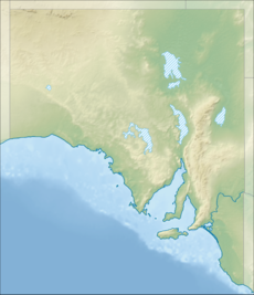
Guichen Bay Conservation Park (formerly the Guichen Bay National Park) is a protected area in the Australian state of South Australia overlooking Guichen Bay located in the gazetted locality of Mount Benson about 8 kilometres (5.0 miles) north of the town centre of Robe.[2][5]
| Guichen Bay Conservation Park South Australia | |
|---|---|
| Nearest town or city | Robe[2] |
| Coordinates | 37°5′16″S 139°46′50″E / 37.08778°S 139.78056°E[1] |
| Established | 27 July 1967[3] |
| Area | 1.27 km2 (0.5 sq mi)[4] |
| Managing authorities | Department for Environment and Water |
| See also | Protected areas of South Australia |
The conservation park consists of land in sections 360, 361, 555, 575 and 576 in the cadastral unit of the Hundred of Waterhouse.[3][6][7] Sections 360 and 361 were proclaimed on 27 July 1976 as the Guichen Bay National Park under the National Parks Act 1966.[3] On 27 April 1972, it was reconstituted as the Guichen Bay Conservation Park under the National Parks and Wildlife Act 1972.[8] Section 555 was added to the conservation park on 9 September 1976 followed by Sections 575 and 576 on 21 March 1991.[6][7] As of 2018, it covered an area of 1.27 square kilometres (0.49 sq mi).[4]
The following statements sourced respectively from the conservation park’s management plan and the now-discontinued Register of the National Estate summarises its conservation significance:[5][9]
The Park contains some of the Guichen Bay beach ridge plain; a classic example of Holocene beach ridge development of worldwide interest which records the naturalhistory of the Bay over the last 7000 years.
Because of its inaccessibility this Park is rarely visited by people. The fairly dense coastal heath provides a home for the secretive Dasyornis broadbenti (rufous bristle bird), while along the seashore dotterels and oystercatchers are common.
The conservation park is classified as an IUCN Category III protected area.[1] In 1980, it was listed on the now-defunct Register of the National Estate.[9]
See also
editReferences
edit- ^ a b c "Terrestrial Protected Areas of South Australia (refer 'DETAIL' tab )". CAPAD 2016. Australian Government, Department of the Environment (DoE). 2016. Retrieved 21 February 2018.
- ^ a b "Search results for 'Guichen Bay Conservation Park' with the following datasets selected – 'Suburbs and Localities', 'NPW and Conservation Properties', 'Hundreds', 'Roads' and 'Gazetteer'". Location SA Map Viewer. Government of South Australian. Retrieved 5 December 2018.
- ^ a b c Shard, A. J. (27 July 1967). "NATIONAL PARKS ACT, 1966: HUNDRED OF WATERHOUSE - GUICHEN BAY NATIONAL PARK" (PDF). South Australian Government Gazette. South Australian Government. p. 850. Retrieved 5 December 2018.
- ^ a b "Protected Areas Information System - reserve list (as of 17 Feb 2014)" (PDF). Department of Environment Water and Natural Resources. Retrieved 26 March 2014.
- ^ a b Small Coastal Parks of the South East Management Plan (PDF). National Parks and Wildlife Service, Department of Environment and Planning, South Australia. 1994. p. 19. Retrieved 29 July 2014.
- ^ a b Banfield, D.H. (9 September 1976). "NATIONAL PARKS AND WILDLIFE ACT, 1972-1974: HUNDRED OF WATERHOUSE—ALTERATION OF BOUNDARIES OF GUICHEN BAY CONSERVATION PARK" (PDF). South Australian Government Gazette. South Australian Government. p. 826. Retrieved 5 December 2018.
- ^ a b Blevins, F.T.. (21 March 1991). "NATIONAL PARKS AND WILDLIFE ACT 1972 SECTIONS 29 (3) AND 43 (2): GUICHEN BAY CONSERVATION PARK—ALTERATION OF BOUNDARIES" (PDF). South Australian Government Gazette. South Australian Government. p. 961. Retrieved 5 December 2018.
- ^ "No. 56 of 1972 (National Parks and Wildlife Act, 1972)". The South Australian Government Gazette. Government of South Australia: 660 & 701. 27 April 1972. Retrieved 1 December 2018.
- ^ a b "Guichen Bay Conservation Park, Robe, (sic) SA, Australia - listing on the now-defunct Register of the National Estate (Place ID 8042)". Australian Heritage Database. Australian Government. 21 October 1980. Retrieved 5 December 2018.
