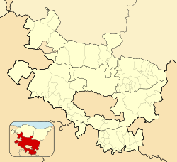
Gebara (Spanish: Guevara) is a hamlet and concejo in the municipality of Barrundia, Álava, Basque Country, Spain. It is a former municipality located on the banks of the Zadorra river.
Gebara | |
|---|---|
 The palace and ruins of the castle | |
| Coordinates: 42°53′37″N 2°30′41″W / 42.8936°N 2.5114°W | |
| Country | Spain |
| Autonomous community | Basque Country |
| Province | Álava |
| Comarca | Llanada Alavesa |
| Municipality | Barrundia |
| Area | |
• Total | 3.11 km2 (1.20 sq mi) |
| Elevation | 551 m (1,808 ft) |
| Population (2023)[2] | |
• Total | 64 |
| • Density | 21/km2 (53/sq mi) |
| Postal code | 01206 |
History
editThe origins of Gebara are uncertain. Koldo Mitxelena and Joaquín Gorrochategui have suggested that the toponyms Gébala (Γέβαλα) and Gabálaika (Γαβάλαικα) mentioned in Ptolemy's works as cities of the Varduli could correspond to modern Gebara.[3]
Records are mute during the early Middle Ages, with the first mention occurring in a document from the 11th century about the counts of Oñati.[citation needed] Gebara played an important role during the War of the Bands of the late Middle Ages as the stronghold of the Ladrón de Guevara family. It was during this time that the castle was built. Located on top of a hill, the castle was destroyed during the First Carlist War. The Tower-palace of Guevara is located at the foot of the hill, close to the Church of the Assumption.[4]
The Brotherhood of Gebara (Spanish: Hermandad de Guevara) formerly administered the village of Gebara, as well as Elgea, Etura and Urizar.[5] After the municipal reforms of the 19th century, the old brotherhood was converted into a municipality. By 1887, the municipality had been merged into Barrundia.[6]
References
edit- ^ "Divisiones Administrativas SHP Líneas". GeoAraba. Diputación Foral de Álava. 24 January 2024. Retrieved 12 May 2024.[permanent dead link]
- ^ "Nomenclátor: Núcleos". Entidades Locales de Álava (in Spanish). Diputación Foral de Álava. 1 January 2023. Retrieved 12 May 2024.
- ^ Salaberri Zaratiegi, Patxi (2015). Araba/Álava: Los nombres de nuestros pueblos (PDF) (in Spanish). Euskaltzaindia. p. 200. ISBN 978-84-944512-0-1.
- ^ Vera, Vicente (1915). Geografía general del País Vasco-Navarro. Provincia de Álava (in Spanish). pp. 405–409.
- ^ Madoz, Pascual (1847). Diccionario geográfico-estadístico-histórico de España y sus posesiones de Ultramar (in Spanish). Vol. IX. p. 75.
- ^ "Variaciones de los municipios de España desde 1842" (PDF) (in Spanish). Ministry of Public Administrations. October 2008. p. 9. Archived from the original (PDF) on 5 April 2018. Retrieved 12 May 2024.
External links
edit- Media related to Guevara-Gebara at Wikimedia Commons


