This article needs additional citations for verification. (January 2024) |
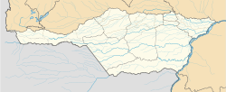
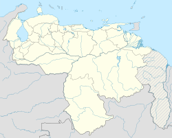
Guasdualito is a city and episcopal see in the landlocked Apure State, in southern Venezuela.
Guasdualito | |
|---|---|
 | |
| Coordinates: 07°14′48″N 70°43′45″W / 7.24667°N 70.72917°W | |
| Country | |
| State | Apure |
| Municipality | Páez Municipality |
| Founded | 1770/1 |
| Elevation | 125 m (410 ft) |
| Population | |
• Total | 105,000 |
| • Demonym | Guasdualiteño/a |
| Time zone | UTC−4 (VET) |
| Postal code | 5063 |
| Area code | 0278 |
| Climate | Aw |
Description
editThe city is the capital of Páez Municipality, in the Distrito Especial Alto Apure.
It has an important location on the border between Venezuela and the city of Arauca in Colombia for commerce, as well as being the main petroleum center in the region.
It has a population of approximately 100,000 inhabitants per 2014.
Climate
editGuasdualito has a tropical savanna climate (Köppen: Aw),[1] characterized by consistently hot temperatures and distinct wet and dry seasons. Guasdualito experiences a wet season from April to November, with the wettest months being May, June, and July. The dry season lasts from December to March. February to April are the hottest months, with average high temperatures around 34 °C (93 °F), and the coolest period is from June to August, with average highs around 30 °C (86 °F).[2]
| Climate data for Guasdualito (1991–2020) | |||||||||||||
|---|---|---|---|---|---|---|---|---|---|---|---|---|---|
| Month | Jan | Feb | Mar | Apr | May | Jun | Jul | Aug | Sep | Oct | Nov | Dec | Year |
| Record high °C (°F) | 36.9 (98.4) |
37.8 (100.0) |
39.6 (103.3) |
39.0 (102.2) |
38.4 (101.1) |
39.1 (102.4) |
36.4 (97.5) |
36.1 (97.0) |
35.6 (96.1) |
38.3 (100.9) |
38.3 (100.9) |
38.5 (101.3) |
39.6 (103.3) |
| Mean daily maximum °C (°F) | 33.3 (91.9) |
34.5 (94.1) |
34.8 (94.6) |
33.4 (92.1) |
31.8 (89.2) |
30.4 (86.7) |
30.2 (86.4) |
30.8 (87.4) |
31.5 (88.7) |
31.8 (89.2) |
31.6 (88.9) |
32.2 (90.0) |
32.2 (90.0) |
| Daily mean °C (°F) | 25.9 (78.6) |
26.9 (80.4) |
27.6 (81.7) |
27.0 (80.6) |
26.2 (79.2) |
25.5 (77.9) |
25.2 (77.4) |
25.5 (77.9) |
25.9 (78.6) |
26.1 (79.0) |
26.0 (78.8) |
25.9 (78.6) |
26.1 (79.0) |
| Mean daily minimum °C (°F) | 21.4 (70.5) |
22.3 (72.1) |
23.0 (73.4) |
23.3 (73.9) |
23.1 (73.6) |
22.6 (72.7) |
22.4 (72.3) |
22.5 (72.5) |
22.7 (72.9) |
22.9 (73.2) |
22.8 (73.0) |
22.1 (71.8) |
22.6 (72.7) |
| Record low °C (°F) | 16.8 (62.2) |
17.2 (63.0) |
18.6 (65.5) |
18.8 (65.8) |
20.5 (68.9) |
20.5 (68.9) |
20.1 (68.2) |
20.3 (68.5) |
18.2 (64.8) |
18.5 (65.3) |
18.2 (64.8) |
18.0 (64.4) |
16.8 (62.2) |
| Average precipitation mm (inches) | 14.7 (0.58) |
25.6 (1.01) |
58.4 (2.30) |
160.1 (6.30) |
270.1 (10.63) |
304.1 (11.97) |
289.8 (11.41) |
210.1 (8.27) |
177.0 (6.97) |
161.4 (6.35) |
110.0 (4.33) |
29.2 (1.15) |
1,810.5 (71.28) |
| Average precipitation days (≥ 1.0 mm) | 1.1 | 2.1 | 4.0 | 10.4 | 15.1 | 18.3 | 17.8 | 15.1 | 11.8 | 11.3 | 7.0 | 3.3 | 117.3 |
| Source: NOAA[2] | |||||||||||||
Religion
editThe Our Lady of Mount Carmel Cathedral (Catedral Nuestra Señora del Carmen) is dedicated to the Virgin of Mercy and is the cathedral episcopal see of the Roman Catholic Diocese of Guasdualito since December 2015.
References
edit- ^ "Table 1 Overview of the Köppen-Geiger climate classes including the defining criteria". Nature: Scientific Data. 23 October 2023.
- ^ a b "World Meteorological Organization Climate Normals for 1991-2020 — Guasdualito". National Oceanic and Atmospheric Administration. Retrieved January 27, 2024.

