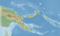
Gama Rural LLG is a local-level government (LLG) of Madang Province, Papua New Guinea.[1][2] As of the year 2011, it had a population of 10,840.[3]
Gama Rural LLG | |
|---|---|
| Coordinates: 5°17′34″S 144°43′42″E / 5.2928°S 144.728299°E | |
| Country | Papua New Guinea |
| Province | Madang Province |
| Area | |
• Total | 1,935 km2 (747 sq mi) |
| Population (2011 census) | |
• Total | 10,840 |
| • Density | 5.6/km2 (15/sq mi) |
| Time zone | UTC+10 (AEST) |
Wards
edit- 35. Aingdai /Forogo
- 36. Ambisiba
- 37. Kenaint
- 38. Kinibong
- 39. Gai
- 40. Bank
- 41. Useruk
- 43. Kwaringiri
- 44. Garisakan / Umerum
- 45. Gunts
- 46. Komaraga
- 47. Kombaku
- 48. Nimbla
References
edit- ^ "Census Figures by Wards - Momase Region". www.nso.gov.pg. 2011 National Population and Housing Census: Ward Population Profile. Port Moresby: National Statistical Office, Papua New Guinea. 2014. Archived from the original on 2019-05-19. Retrieved 2019-06-06.
- ^ "Final Figures". www.nso.gov.pg. 2011 National Population and Housing Census: Ward Population Profile. Port Moresby: National Statistical Office, Papua New Guinea. 2014. Archived from the original on 2015-09-06. Retrieved 2019-06-06.
- ^ "Gama Rural (Local-level Government, Papua New Guinea) - Population Statistics, Charts, Map and Location". www.citypopulation.de. Retrieved 20 June 2023.
- OCHA FISS (2018). "Papua New Guinea administrative level 0, 1, 2, and 3 population statistics and gazetteer". Humanitarian Data Exchange. 1.31.9.
- United Nations in Papua New Guinea (2018). "Papua New Guinea Village Coordinates Lookup". Humanitarian Data Exchange. 1.31.9.
