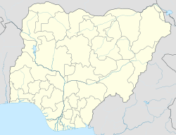
Fagge is a Local Government Area in Kano State, Nigeria, within the state metropolitan . Its headquarters are in the suburb of Waje.
Fagge | |
|---|---|
| Coordinates: 12°00′24″N 8°31′45″E / 12.0067°N 8.5292°E | |
| Country | |
| State | Kano State |
| Government | |
| • Local Government Chairman and the Head of the Local Government Council | Hon. Ibrahim Muhammad Abdullah |
| Area | |
• Total | 21 km2 (8 sq mi) |
| Population (2006 census) | |
• Total | 198,828 |
| Time zone | UTC+1 (WAT) |
| 3-digit postal code prefix | 700 |
| ISO 3166 code | NG.KN.FA |
 | |
It has an area of 21 km2 and a population of 198,828 at the 2006 census.
The postal code of the area is 700.[1]
History
editOn the 4th of December 1996.Fagge Local Government Area was created from the Nasarawa local government area.[2] Hausa and Fulani ethnic groups making up the bulk of the population. There is also a significant Igbo population. The predominant religion in the Local Government Area is Islam, and the Hausa language is widely spoken there.[2]
Religion
editThere mainly two religions practice in fagge which are Islam and Christianity.
Climate
editThe dry season in Kano is partly cloudy and hot all year round, whereas the wet season is muggy and cloudy. It rarely falls below 48°F or rises beyond 106°F throughout the year, with the average temperature fluctuating between 53°F and 102°F.[3][4][5]
Temperature
editTemperatures are rising due to climate change, and in places like Fagge, colder weather is occurring more frequently.[6][4][5]
Economy/Agriculture
editThe primary economic activity in Fagge Local Government Area is trade, as the region is home to Kano state's largest market, Sabon Gari. Another important aspect of the Fagge Local Government Area economy is agriculture, with the region well-known for growing a variety of crops, including sorghum, rice, millet, and soy beans. Pottery, hunting, and the weaving and dying of textiles are among the other significant economic activities in the region.[2]
References
edit- ^ "Post Offices- with map of LGA". NIPOST. Archived from the original on 2009-10-07. Retrieved 2009-10-20.
- ^ a b c "Fagge Local Government Area". www.manpower.com.ng. Retrieved 2024-07-30.
- ^ "Kano Climate, Weather By Month, Average Temperature (Nigeria) - Weather Spark". weatherspark.com. Retrieved 2023-07-08.
- ^ a b "Fagge, Nigeria Weather History | Weather Underground". www.wunderground.com. Retrieved 2024-07-30.
- ^ a b "Weather Forecast Fagge - Nigeria (Kano) : free 15 day weather forecasts". Weather Crave. 2024-07-30. Retrieved 2024-07-30.
- ^ "Climate Change Fagge". meteoblue. Retrieved 2023-10-21.
