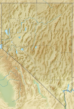
Eureka Airport (IATA: EUE[2][3], FAA LID: Ø5U) is seven miles northwest of Eureka, in Eureka County, Nevada, United States. It is owned by the County of Eureka.[1] The airport is toward the south end of the Diamond Valley.
Eureka Airport | |||||||||||
|---|---|---|---|---|---|---|---|---|---|---|---|
 | |||||||||||
| Summary | |||||||||||
| Airport type | Public | ||||||||||
| Owner | County of Eureka | ||||||||||
| Serves | Eureka, Nevada | ||||||||||
| Elevation AMSL | 5,958 ft / 1,816 m | ||||||||||
| Coordinates | 39°36′14″N 116°00′13″W / 39.60389°N 116.00361°W | ||||||||||
| Map | |||||||||||
 | |||||||||||
| Runways | |||||||||||
| |||||||||||
| Statistics (2012) | |||||||||||
| |||||||||||
It is also known as Eureka County Airport and in 2007 it was named Booth Bailey Field, honoring Booth Bailey, a Eureka native and founder of Diamond Aviation, the airport's fixed-base operator.[4][5][6]
The FAA's National Plan of Integrated Airport Systems for 2023–2027 categorizes it as a general aviation facility.[7]
Facilities
editEureka Airport covers 800 acres (324 ha) at an elevation of 5,958 feet (1,816 m). Its single runway, 18/36, is 7,300 by 60 feet (2,225 x 18 m) asphalt.[1]
In the year ending May 15, 2023 the airport had 2,304 aircraft operations, average 44 per week: 90% general aviation, 9% military, and <1% military. Six aircraft were then based at this airport, all single-engine.[1]
See also
editReferences
edit- ^ a b c d FAA Airport Form 5010 for 05U PDF. Federal Aviation Administration. Effective August 10, 2023.
- ^ "Eureka Airport, Nevada (IATA: EUE, FAA: 05U)". Great Circle Mapper. Retrieved August 7, 2010.
- ^ "IATA Airport Code Search (EUE: Eureka)". International Air Transport Association. Retrieved June 13, 2014.
- ^ "Diamond Aviation". Eureka County Economic Development. Retrieved August 7, 2010.
- ^ "Eureka County Board of Commissioners - March 20, 2007" (PDF).[permanent dead link]
- ^ "Obituary: Mr. Booth Bailey". Humboldt Sun. June 19, 2007. Archived from the original on 2010-09-20. Retrieved 2010-08-07.
- ^ National Plan of Integrated Airport Systems for 2009–2013: Appendix A: Part 4 (PDF, 1.61 MB) Archived June 6, 2011, at the Wayback Machine. Federal Aviation Administration. Updated October 15, 2008.
External links
edit- "Diagram of Eureka Airport (Ø5U)" (PDF). Archived from the original (PDF) on 2016-03-03. from Nevada DOT
- Aerial image as of June 1994 from USGS The National Map
- FAA Terminal Procedures for 05U, effective December 26, 2024
- Resources for this airport:
- FAA airport information for 05U
- AirNav airport information for 05U
- FlightAware airport information and live flight tracker
- SkyVector aeronautical chart for 05U
