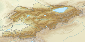
The Donguz-Too (Kyrgyz: Доңузтоо; Russian: Донуз-Тоо ) is an offshoot of Fergana Range in the West Tien Shan, Kyrgyzstan. It is located between valleys of rivers Donguz-Too and Zyndan-Suu, both right tributaries of the river Jazy (Yassy). The length of the range is approximately 28 km and the width - 6 km. The average altitude is about 2,100 - 2,200 m and the highest peak - 2,354 m. The range is mainly composed of limestone and shist of middle Paleozoic in southeast part, and sandstone, clay, and marl of Paleogene and Cretaceous in northwest part. The slopes are gentle and the terrain is mildly or moderately rugged.[1][2]
| Donguz-Too | |
|---|---|
| Highest point | |
| Elevation | 2,354 m (7,723 ft) |
| Coordinates | 40°54′23″N 73°39′20″E / 40.90639°N 73.65556°E |
| Dimensions | |
| Length | 28 km (17 mi) SE-NW |
| Width | 6 km (3.7 mi) NE-SW |
| Naming | |
| Native name | Доңузтоо (Kyrgyz) |
| Geography | |
| Country | Kyrgyzstan |
| Region | Osh Region |
| Geology | |
| Rock type(s) | Composed of limestone and shist of middle Paleozoic in southeast part, and sandstone, clay, and marl of Paleogene and Cretaceous in northwest part. |
References
edit- ^ "Доңузтоо" [Donguztoo] (PDF). Кыргызстандын Географиясы [Geography of Kyrgyzstan] (in Kyrgyz). Bishkek. 2004. p. 38. ISBN 9967-14-006-2.
{{cite encyclopedia}}: CS1 maint: location missing publisher (link) - ^ Ошская область:Энциклопедия [Encyclopedia of Osh Oblast] (in Russian). Bishkek: Chief Editorial Board of Kyrgyz Soviet Encyclopedia. 1987. p. 445.
