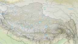
Dochen Tso (Tibetan: མདོ་ཆེན་མཚོ, Wylie: mdo chen mtsho, THL: do chen tso)[1][2] or Duoqing Cuo (Chinese: 多庆错; pinyin: duōqìng cuò) is a high-altitude lake in Yadong County in the Tibet region of China.[3]
| Dochen Tso | |
|---|---|
| Duoqing Cuo | |
| མདོ་ཆེན་མཚོ (Standard Tibetan) | |
 Sentinel-2 image (2021) | |
| Location | Yadong County, Shigatse Prefecture, Tibet, China |
| Coordinates | 28°8′57″N 89°21′37″E / 28.14917°N 89.36028°E |
| Surface area | 62.67 km2 (24.20 sq mi) |
| Surface elevation | 4,472 m (14,672 ft) |
| Frozen | Winter |
Location
editThe lake in located at 4,472 m (14,672 ft) above sea level,[4] about 240 kilometers southwest of the regional capital Lhasa. The rivers Nimu Maqu and Qionggui Zangbu are the primary sources of water for the lake, and the lake's water is discharged into Galacuo, which is located 9 km further to the north.[5][6]
References
edit- ^ Dorje, Gyurme (1999), Footprint Tibet Handbook with Bhutan (2nd ed.), Bath: Footprint Handbooks, p. 310, ISBN 0-8442-2190-2 – via archive.org
- ^ "Geographical names of Tibet AR (China): Xigazê Prefecture-Level City". KNAB Place Name Database. Institute of the Estonian Language. 2018-06-03.
- ^ "Mindat.org". www.mindat.org. Retrieved 2022-09-17.
- ^ "Duoqing Cuo lake, Tibet Autonomous Region, China". cn.geoview.info. Retrieved 2022-09-17.
- ^ 西藏统计年鉴 (in Chinese). 中国统计出版社. 2002. ISBN 978-7-5037-3773-2.
- ^ 西藏统计年鉴/2007(总第19期)/: [中英文本] (in Chinese). 中国统计出版社. 2007. ISBN 978-7-5037-5151-6.
